|
Title Page
Acknowledgment
●
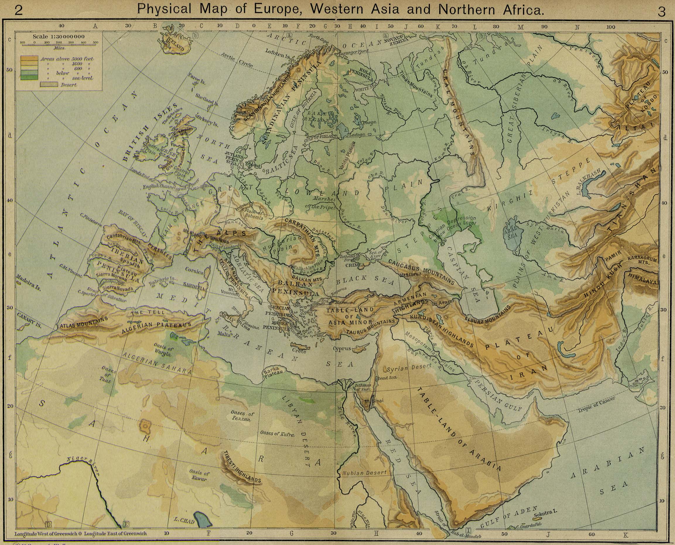
Physical Map of Europe, Western Asia and Northern Africa [p.2-3]
●
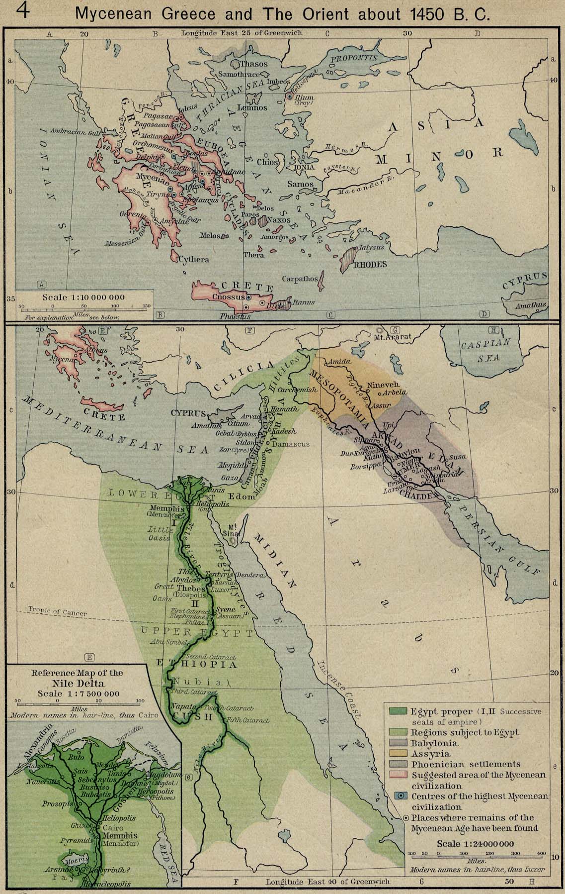
Mycenean Greece and the Orient about 1450 B.C. [p.4]
●
Mycenean Greece and the Orient about 1450 B.C. [p.4]
Inset: Reference Map
of the Nile Delta.
●
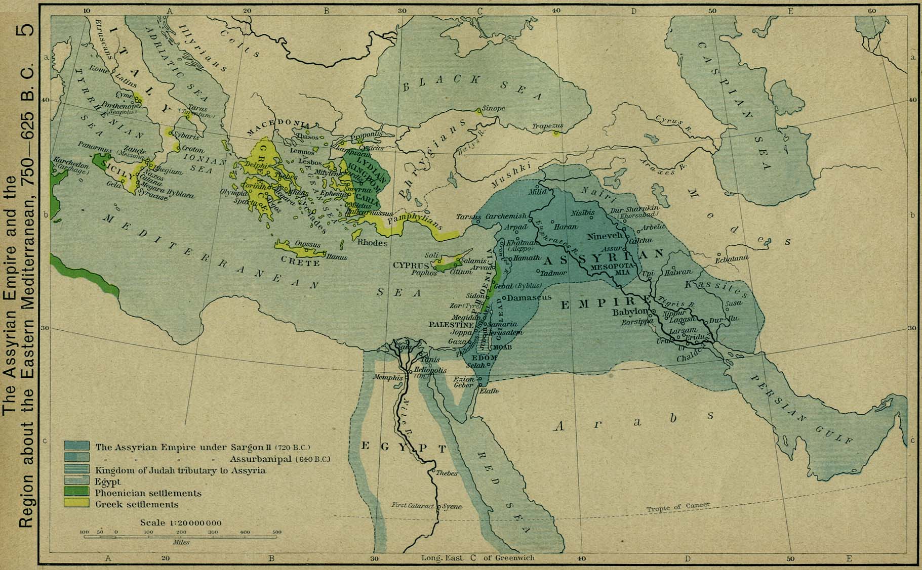
The Assyrian Empire and the Region about the Eastern Mediterranean,
750-625 B.C. [p.5]
●
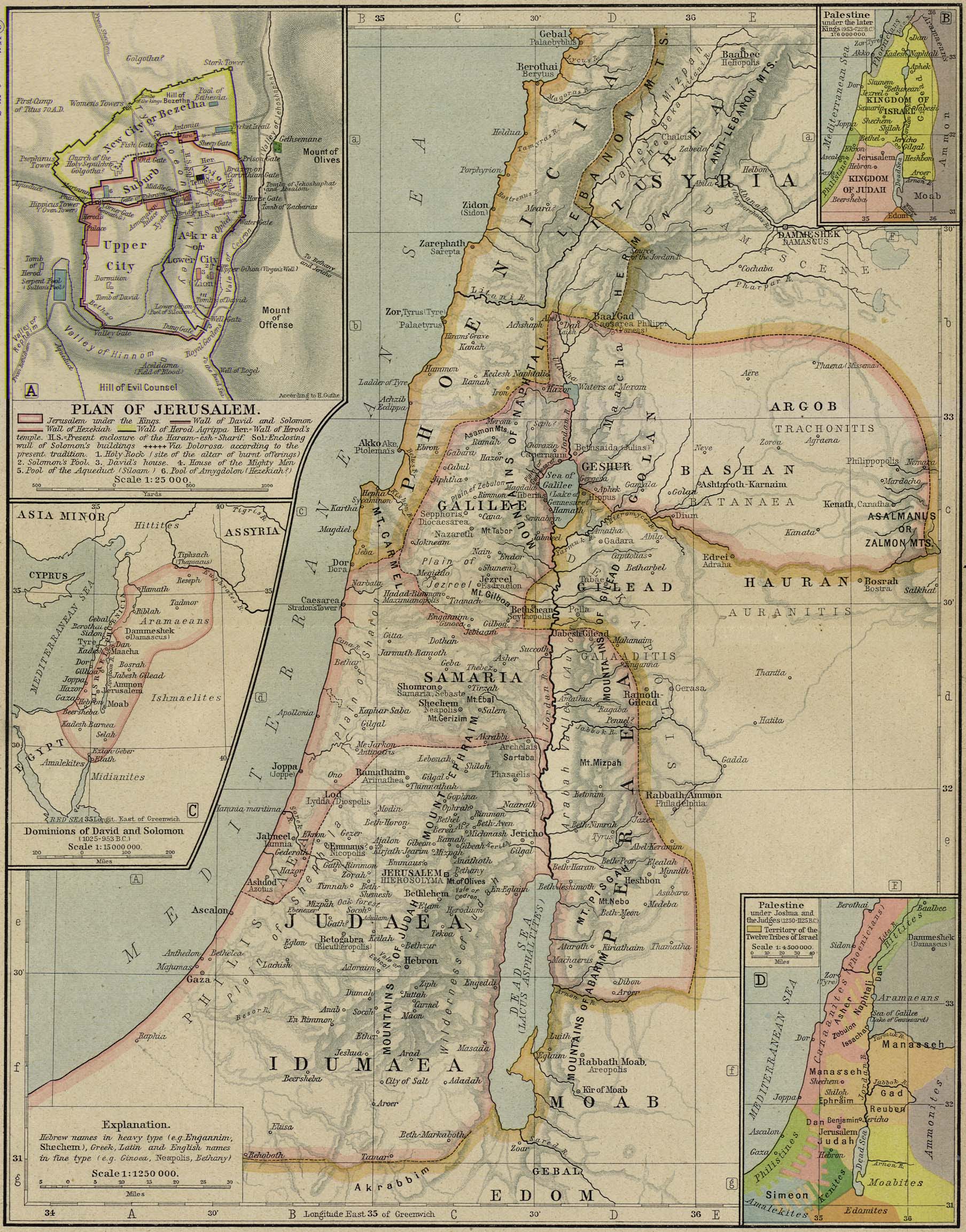
Reference Map of Ancient Palestine [p.6-7]
Insets: Plan of
Jerusalem. Dominions of David and Solomon (1025-953 B.C.).
Palestine under the later Kings (953-722 B.C.).
Palestine under Joshua and the Judges (1250-1125
B.C.).
●
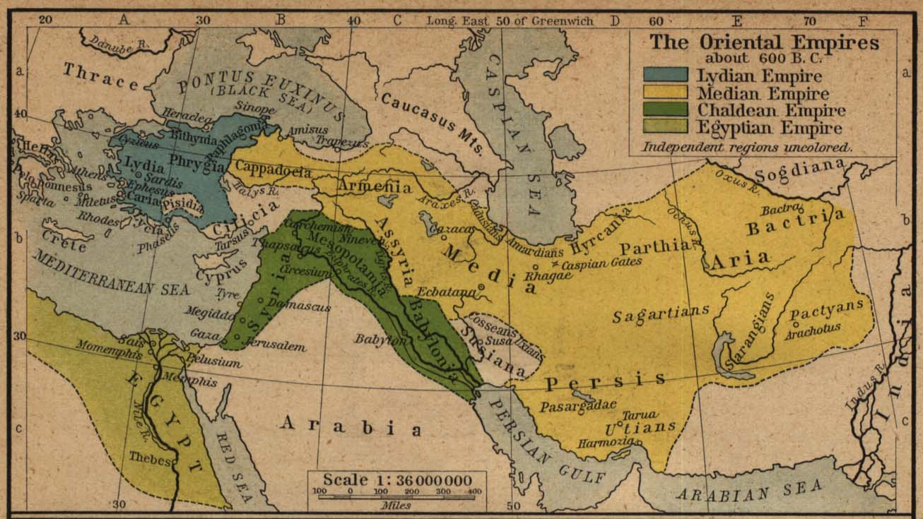
The Oriental Empires about 600 B.C. [p.8]
●
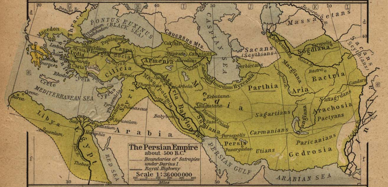
The Persian Empire about 500 B.C. [p.8]
●
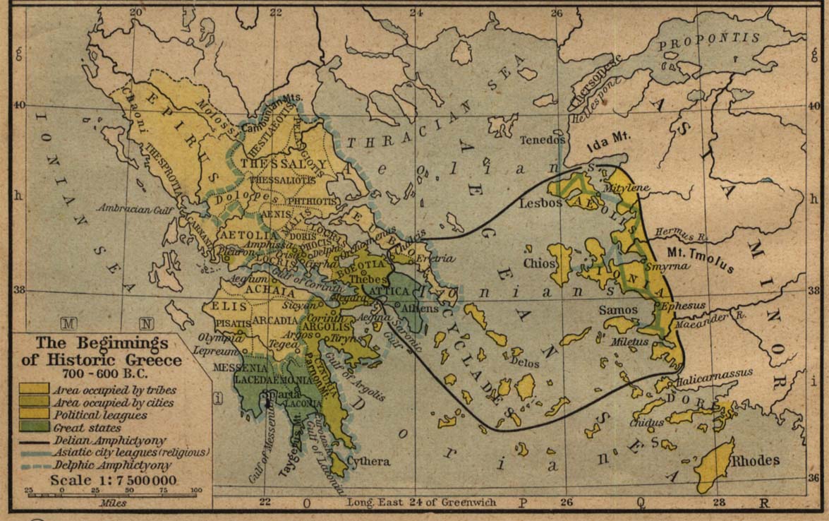
The Beginnings of Historic Greece 700 B.C.-600 B.C. [p.8]
●
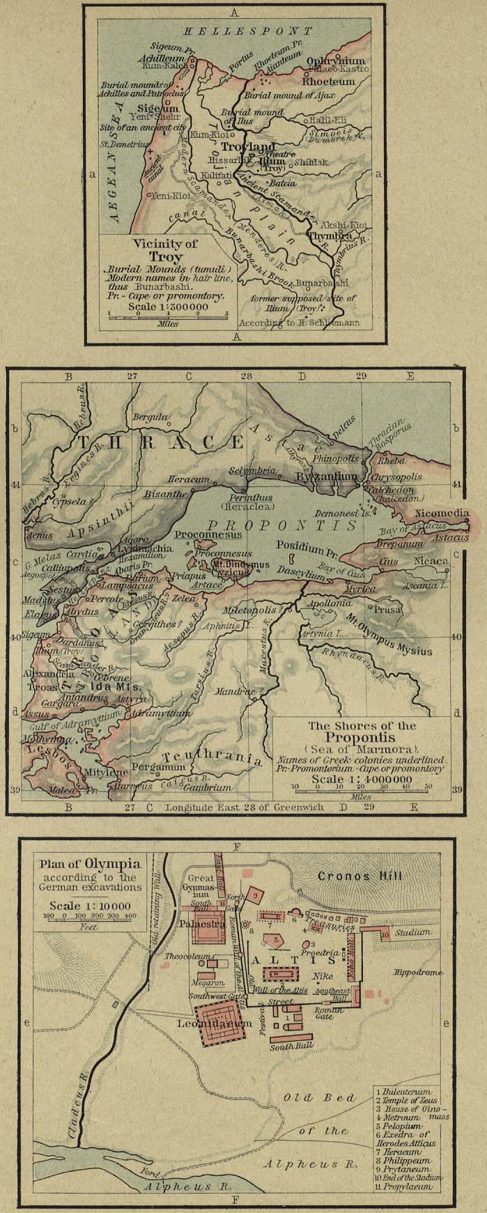
Vicinity of Troy. The Shores of the Propontis. Plan of Olympia.
[p.9]
●
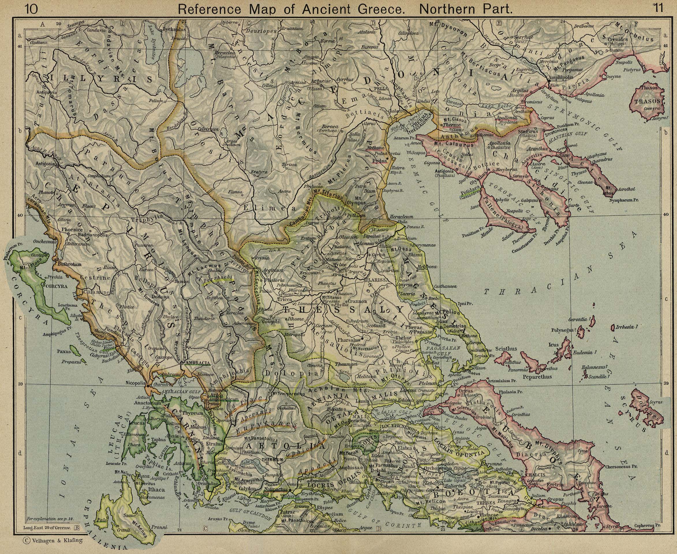
Reference Map of Ancient Greece. Northern Part. [p.10-11]
●
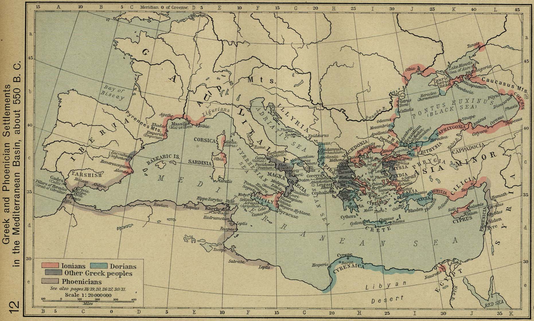
Greek and Phoenician Settlements in the Mediterranean Basin, about
550 B.C. [p.12]
●
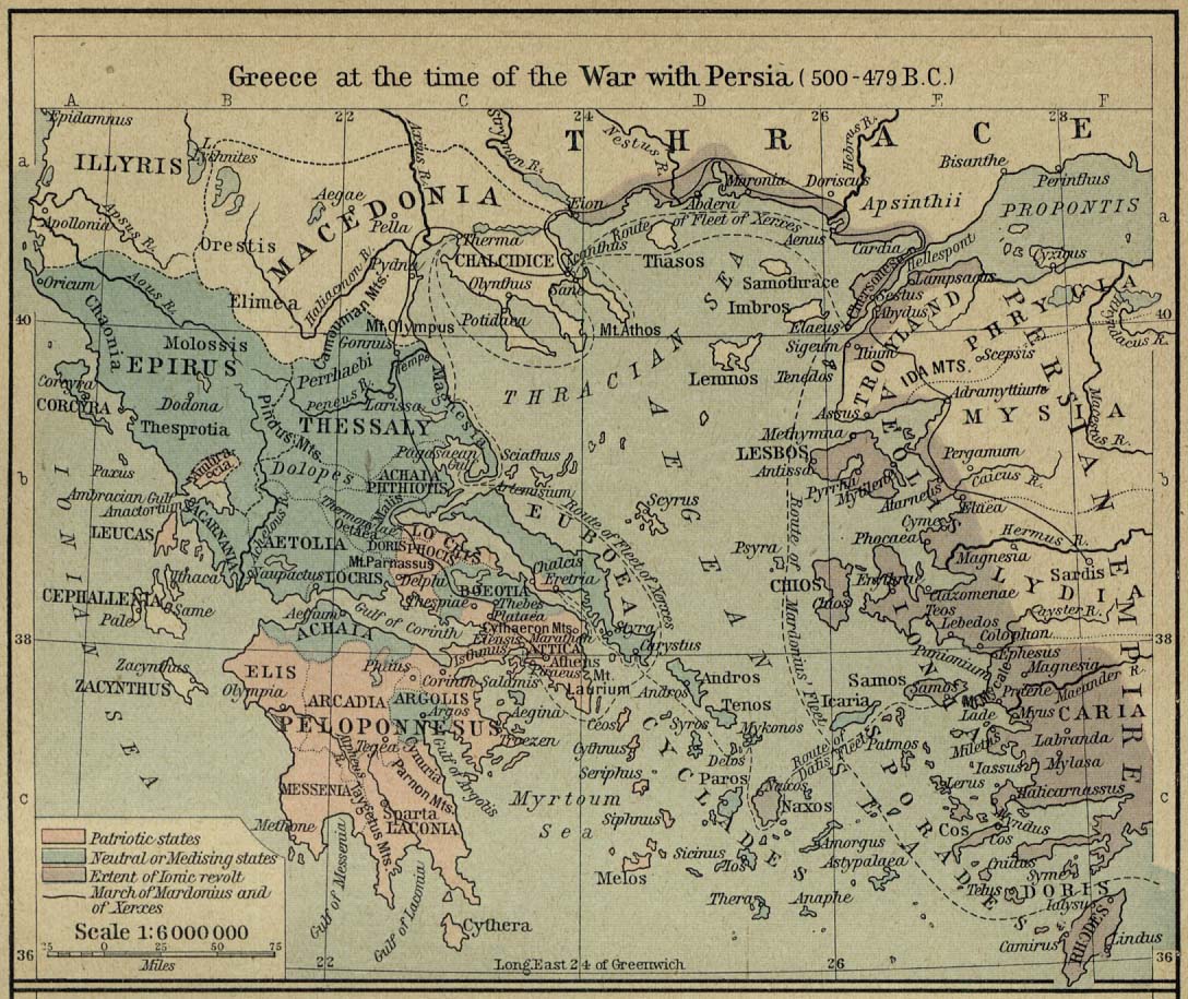
Greece at the Time of the War with Persia, 500-479 B.C. [p.13]
●
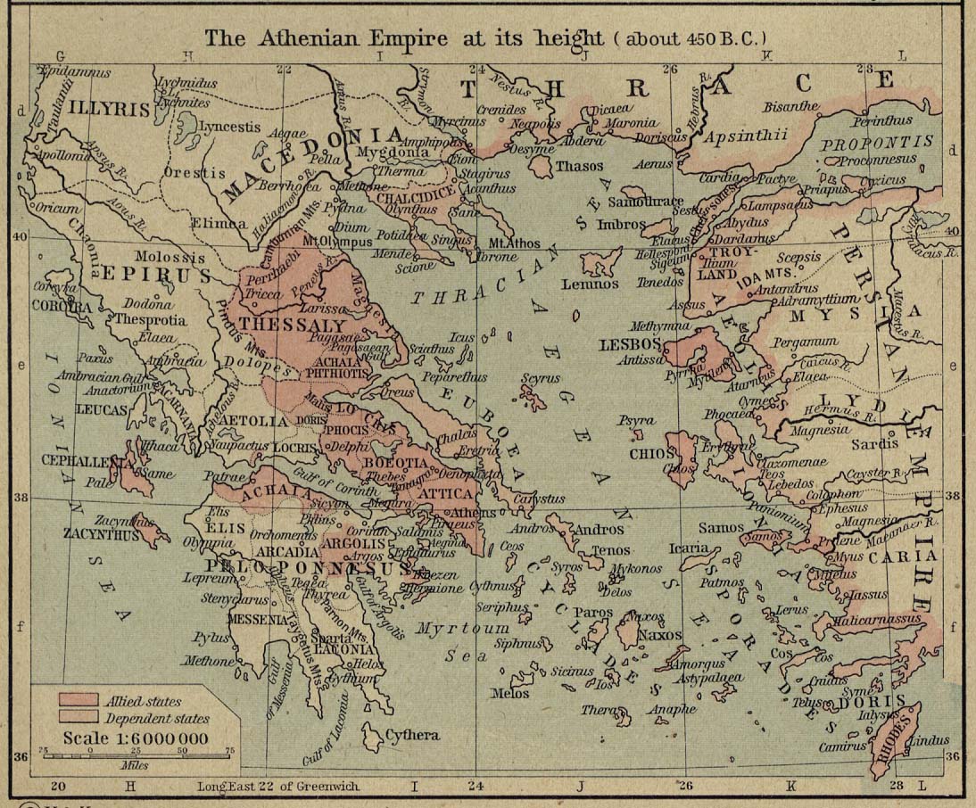
The Athenian Empire at its Height (about 450 B.C.). [p.13]
●
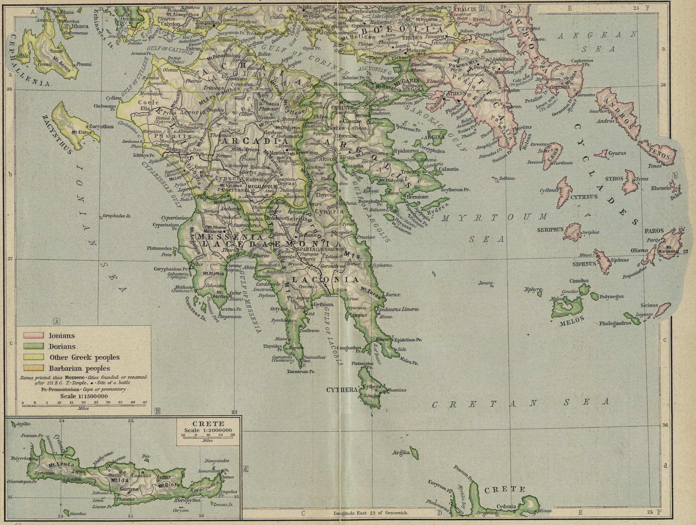
Reference Map of Ancient Greece. Southern Part. [p.14-15]
Inset: Crete.
●
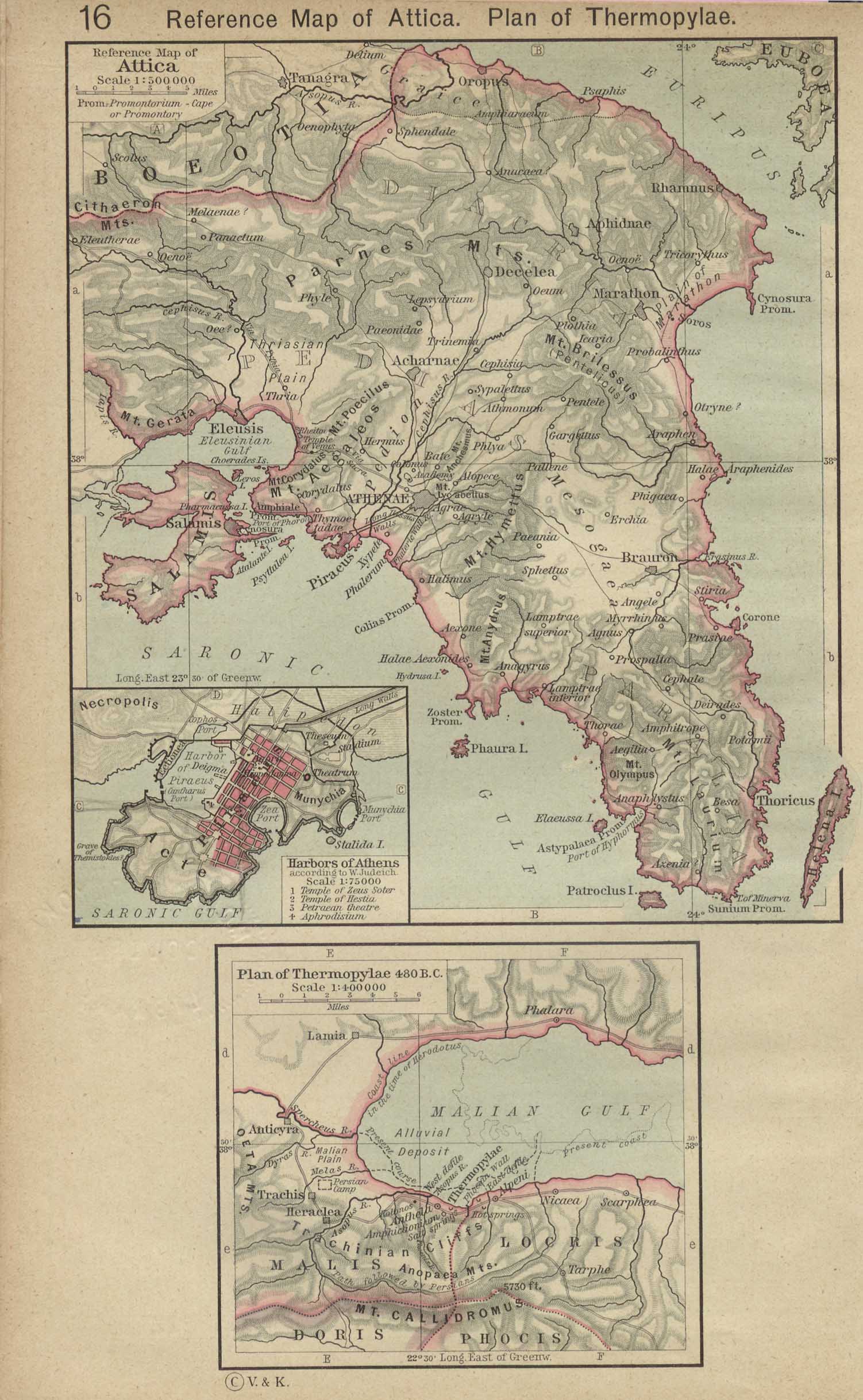
Reference Map of Attica. Plan of Thermopylae, 480 B.C. [p.16]
Inset: Harbors of
Athens
●
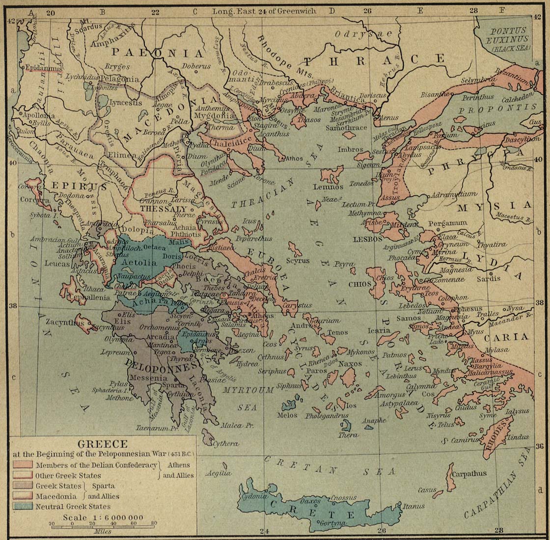
Greece at the Beginning of the Peloponnesian War (431 B.C.).
[p.17]
●
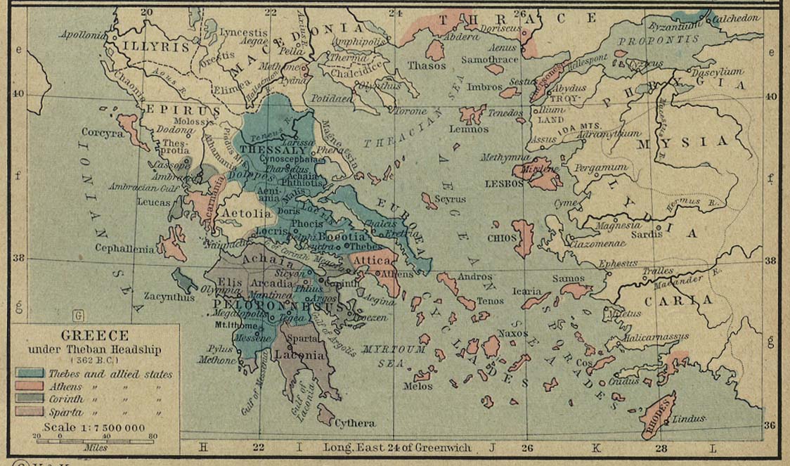
Greece under Theban Headship (362 B.C.). [p.17]
●
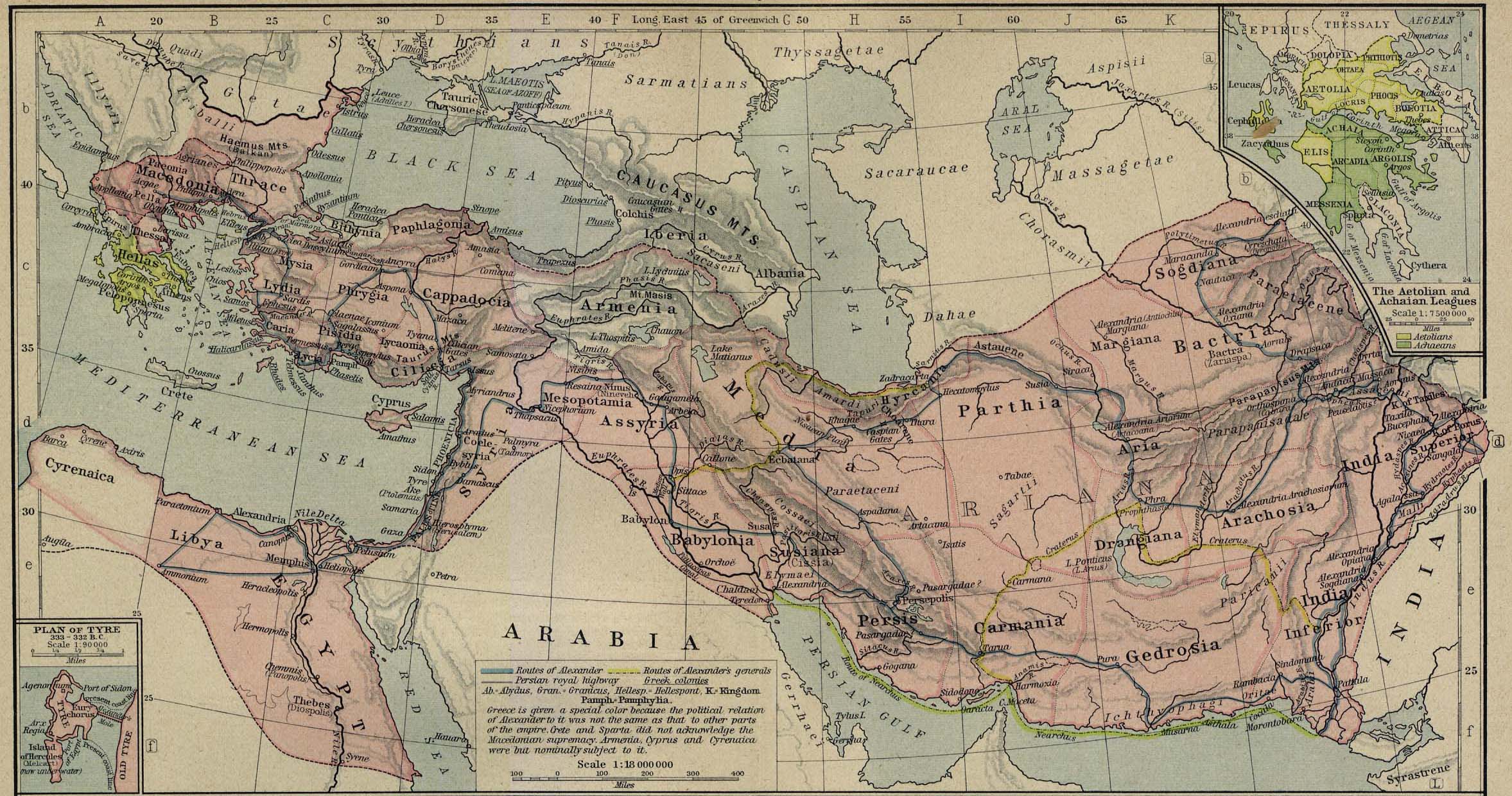
The Macedonian Empire, 336-323 B.C. [p.18-19]
Insets: The Aetolian
and Achaian Leagues.
Plan of
Tyre.
●
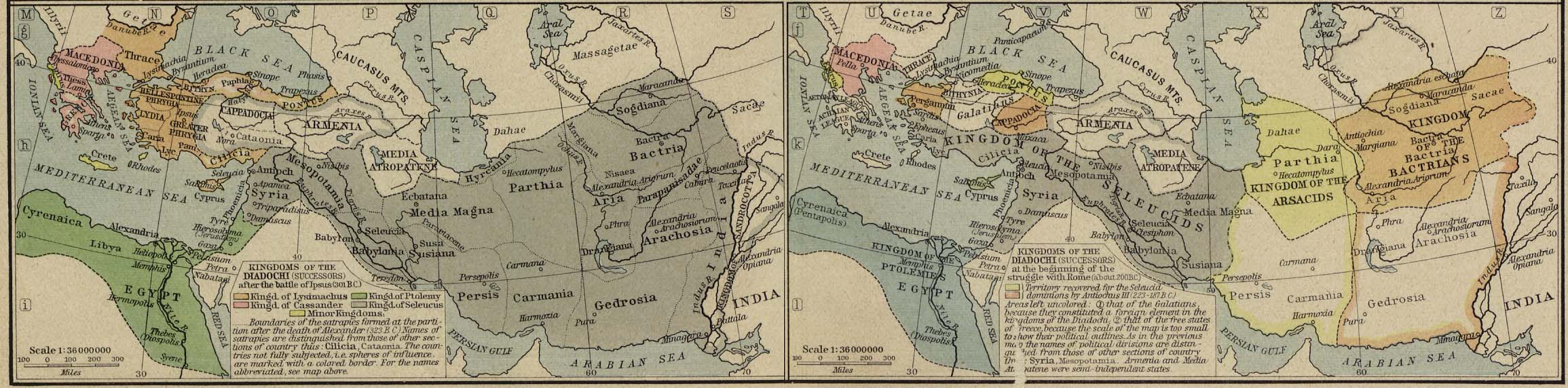
Kingdoms of the Diadochi [p.18-19]
After the
Battle of Ipsus (301 B.C.).
At the
Beginning of the Struggle with Rome (about 200 B.C.).
●
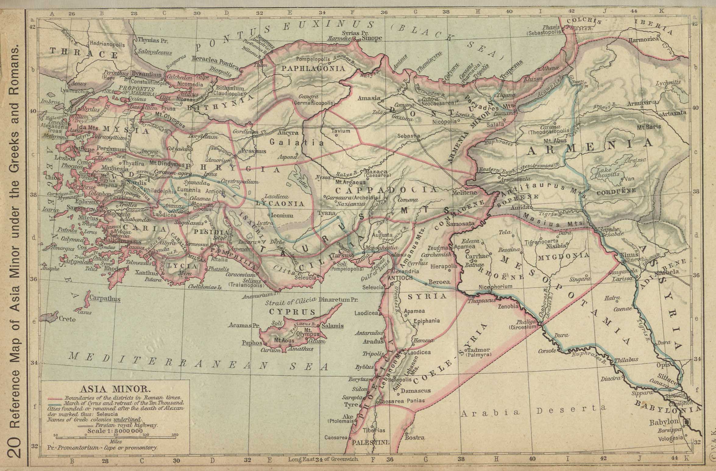
Reference Map of Asia Minor under the Greeks and Romans [p.20]
●
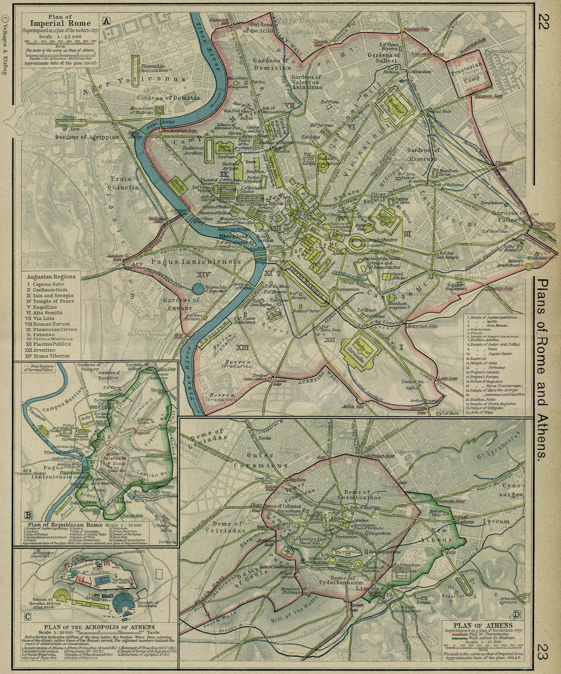
Plan of Imperial Rome [p.22-23]
●
Plan of Athens [p.23]
Inset: Plan of the
Acropolis of Athens.
●
Plan of Republican Rome [p.23]
●
Plan of the Roman Forum and its Vicinity at the Time of the Republic
[p.24]
●
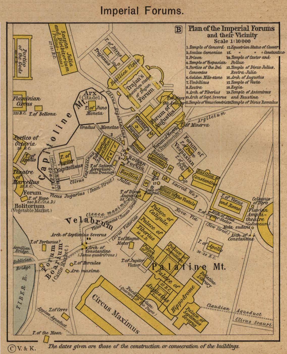
Plan of the Imperial Forums and their Vicinity [p.24]
●
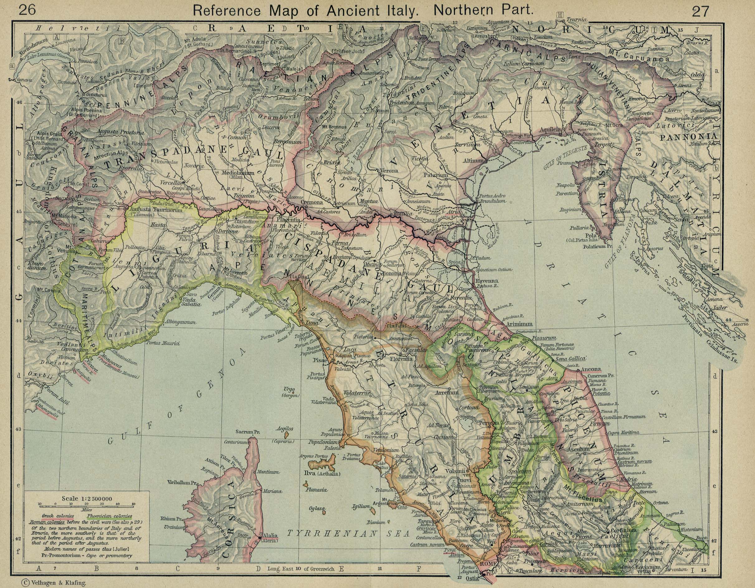
Reference Map of Ancient Italy. Northern Part. [p.26-27]
●
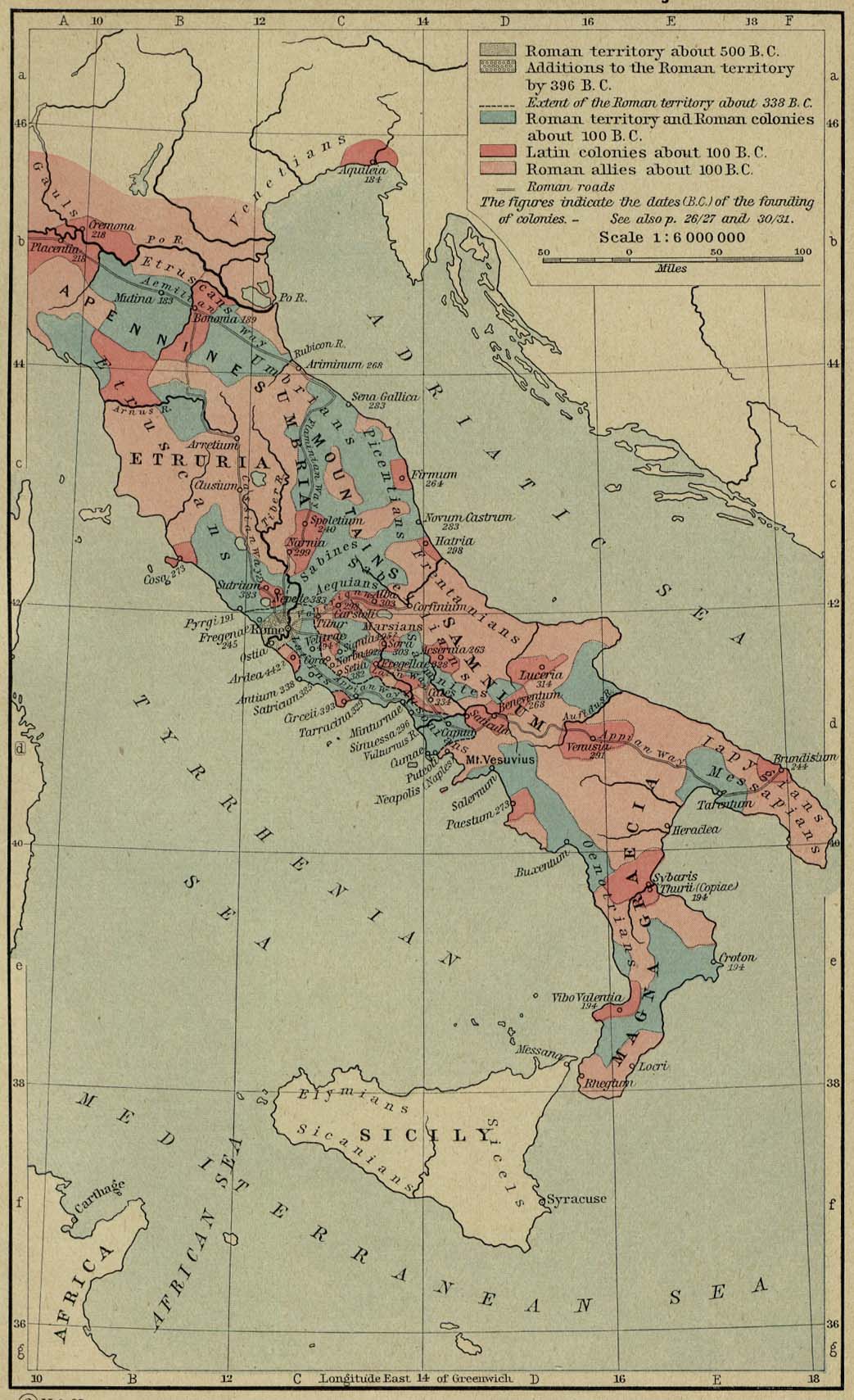
The Growth of Roman Power in Italy [p.29]
●
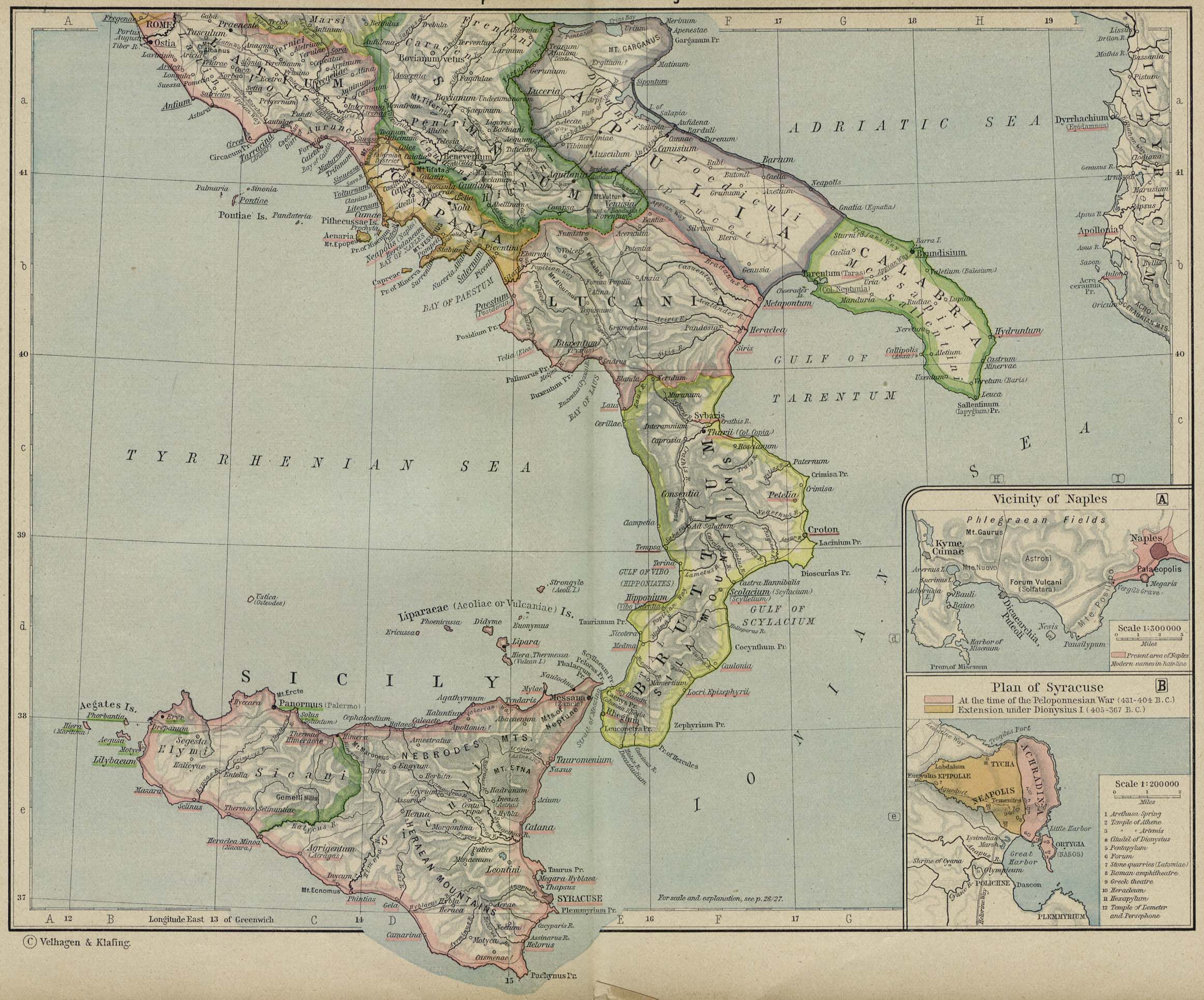
Reference Map of Ancient Italy. Southern Part [p.30-31]
Insets: Vicinity of
Naples.
Plan of
Syracuse.
●
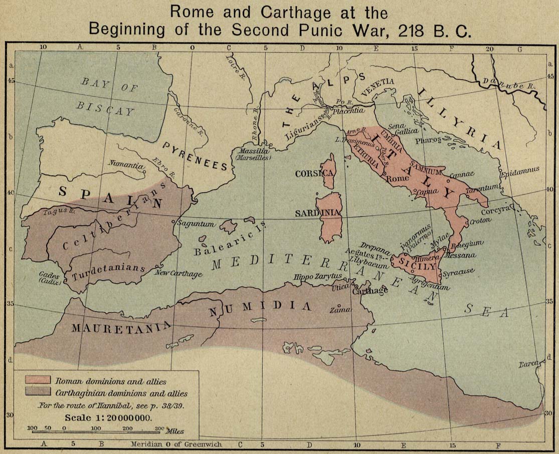
Rome and Carthage at the Beginning of the Second Punic War, 218 B.C.
[p.32]
●
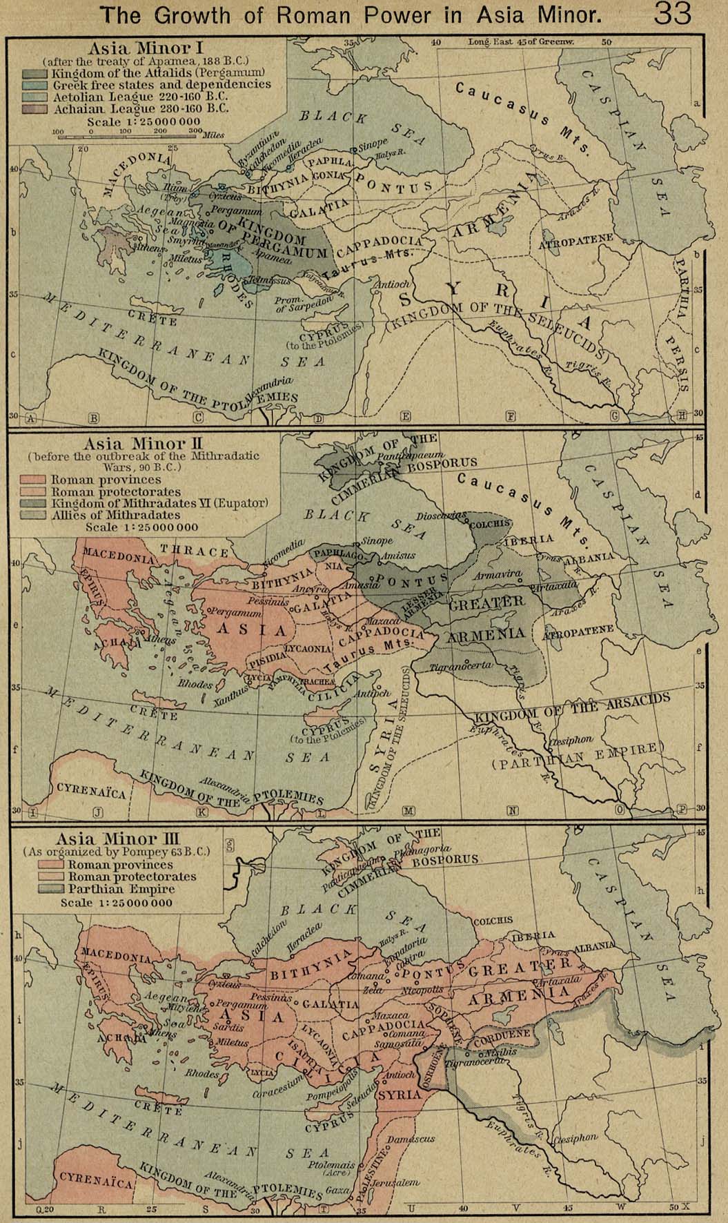
The Growth of Roman Power in Asia Minor [p.33]
I,
after the Treaty of Apamea, 188 B.C.;
II, before
the outbreak of the Mithradatic Wars, 90 B.C.;
III, as
organized by Pompey, 63 B.C.
●
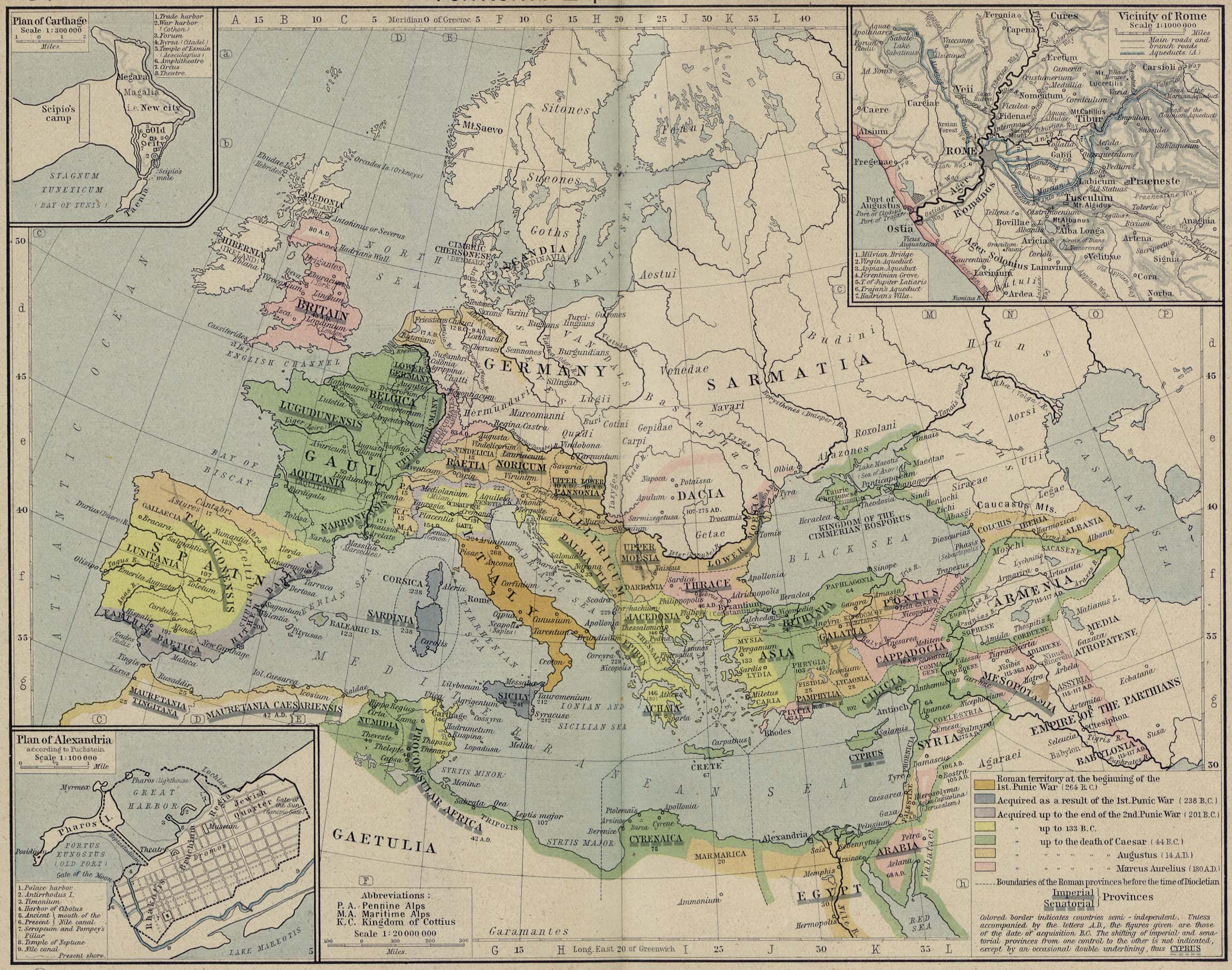
Territorial Expansion of Rome [p.34-35]
Insets: Plan of
Carthage.
Vicinity
of Rome.
Plan of
Alexandria.
●
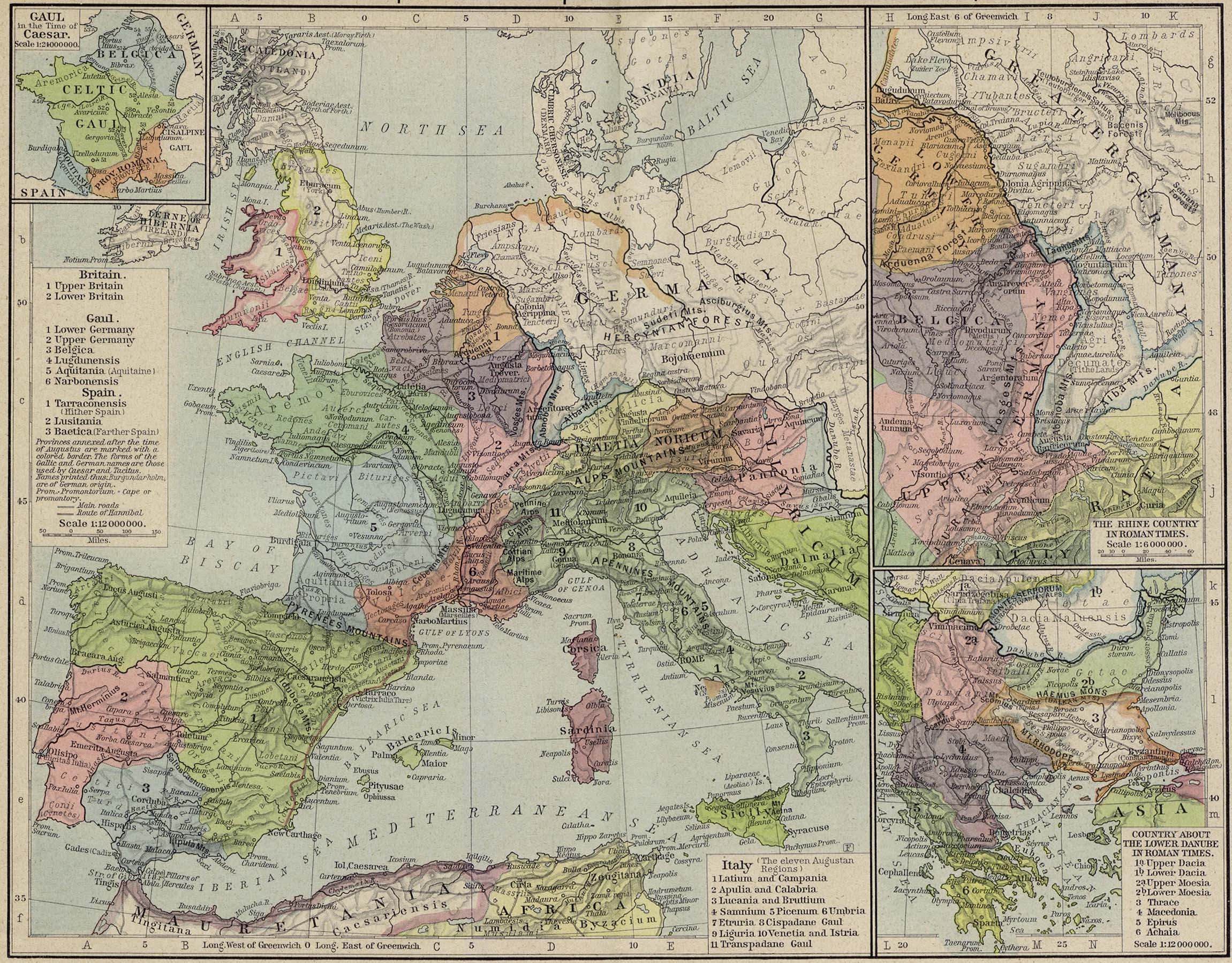
Reference Map of the European Provinces of the Roman Empire
[p.38-39]
Insets: Gaul in the
Time of Caesar.
The Rhine
Country in Roman Times.
Country
about the Lower Danube in Roman Times.
●
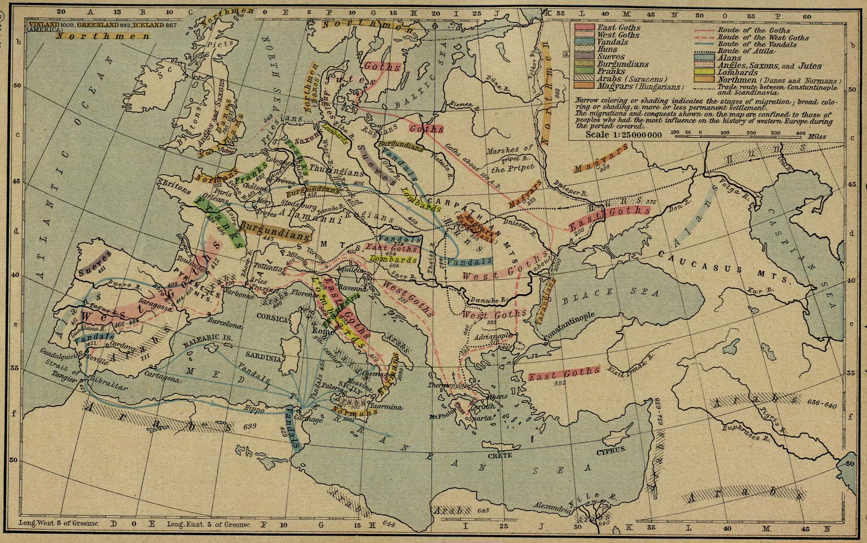
Germanic Migrations and Conquests, 150-1066 [p.45]
●
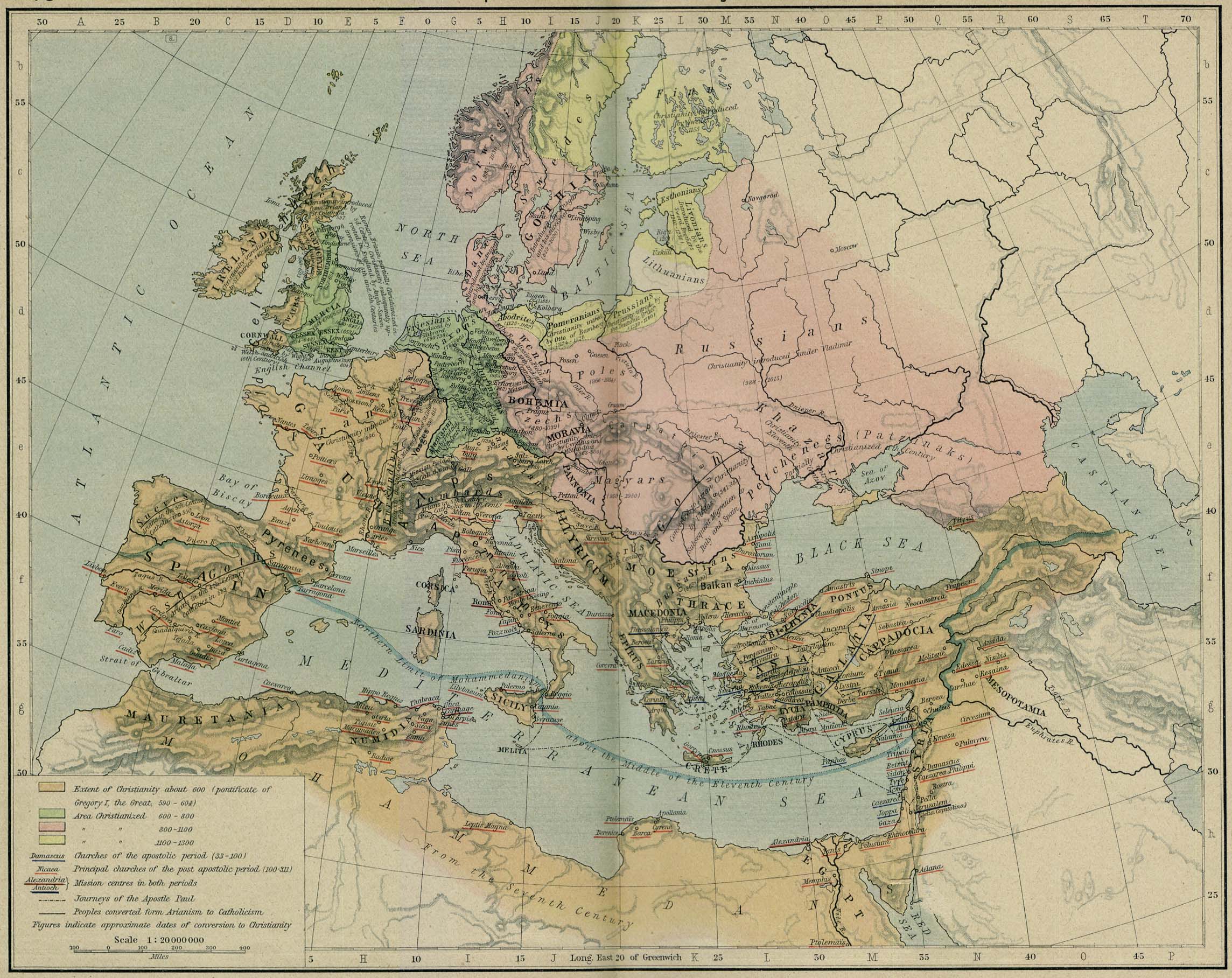
Development of Christianity to 1300 [p.46-47]
●
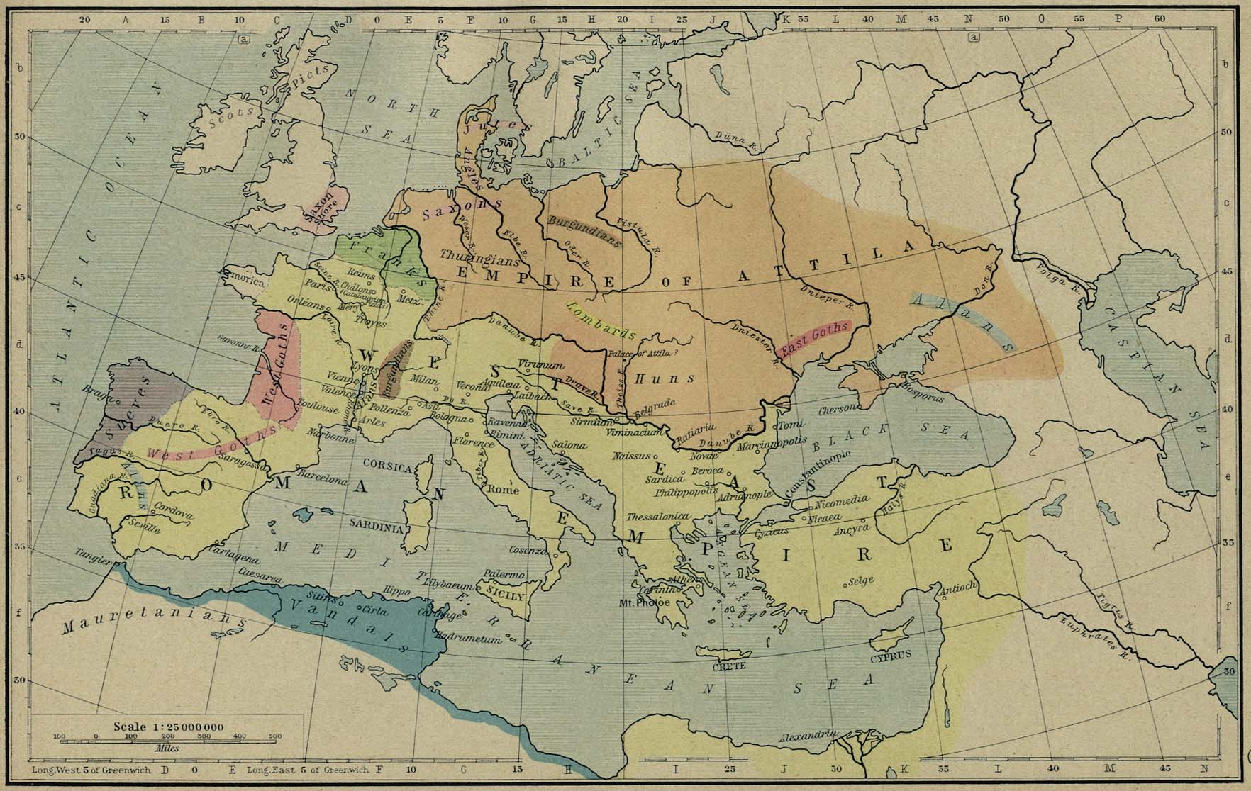
The Roman and Hunnic Empires about 450 [p.48]
●
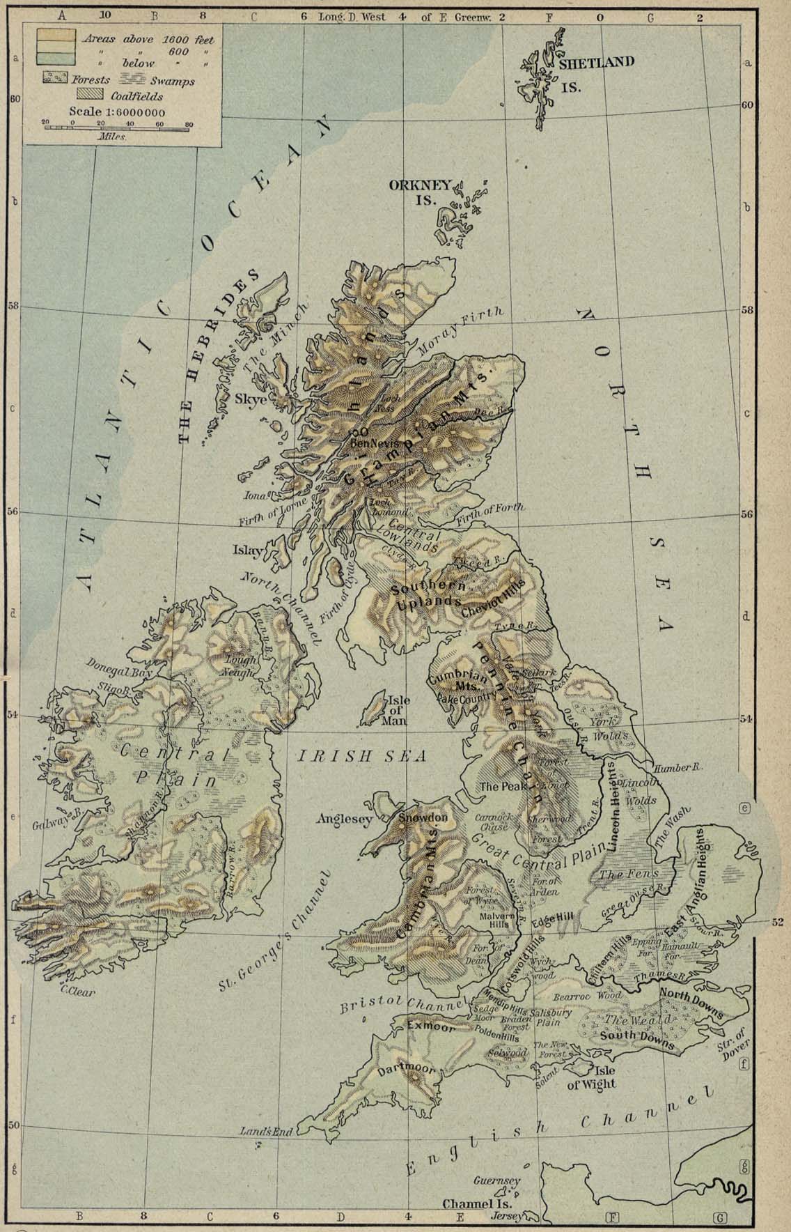
Physical Map of the British Isles [p.49]
●
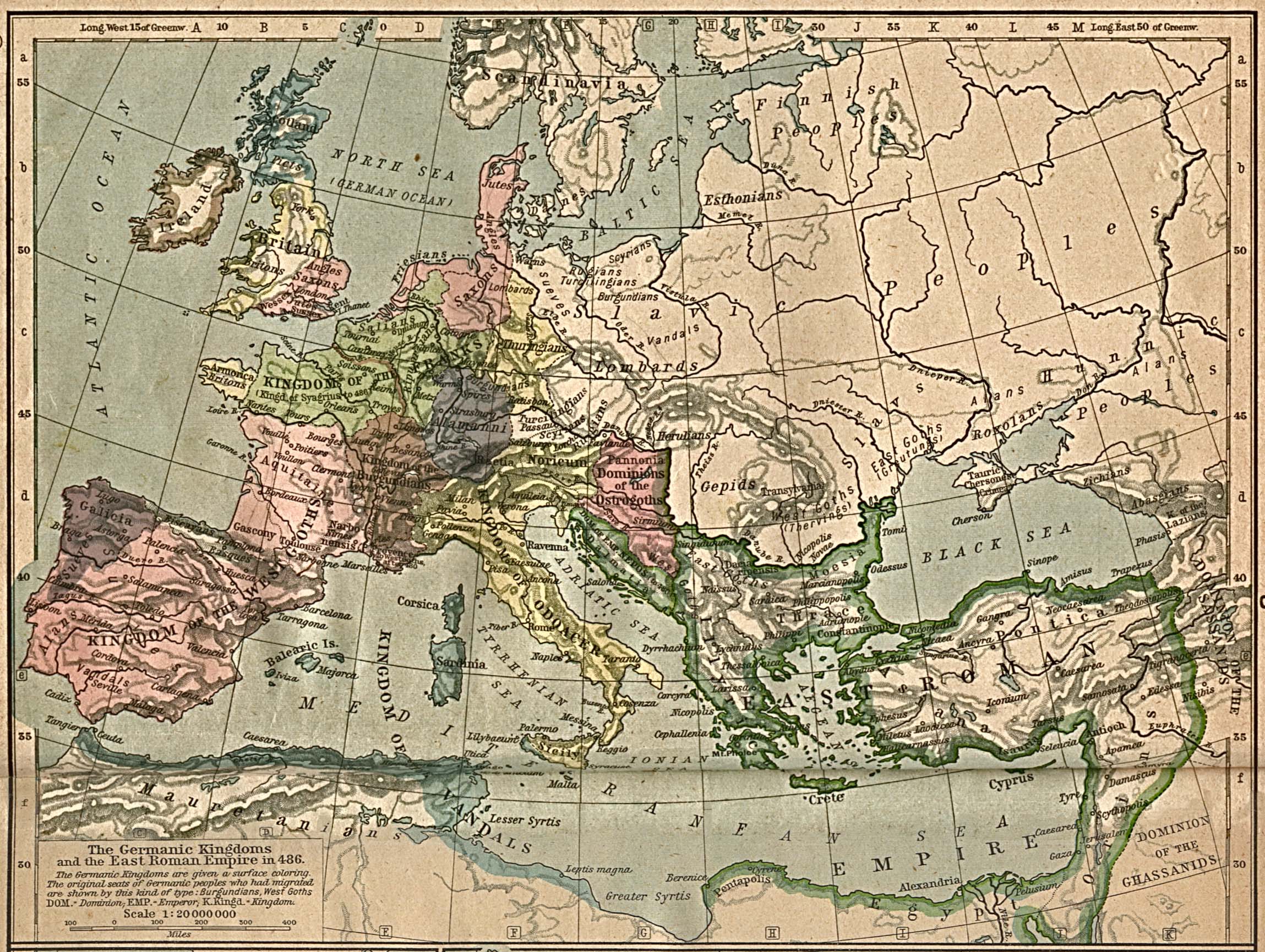
The Germanic Kingdoms and the East Roman Empire in 486 [p.50]
●
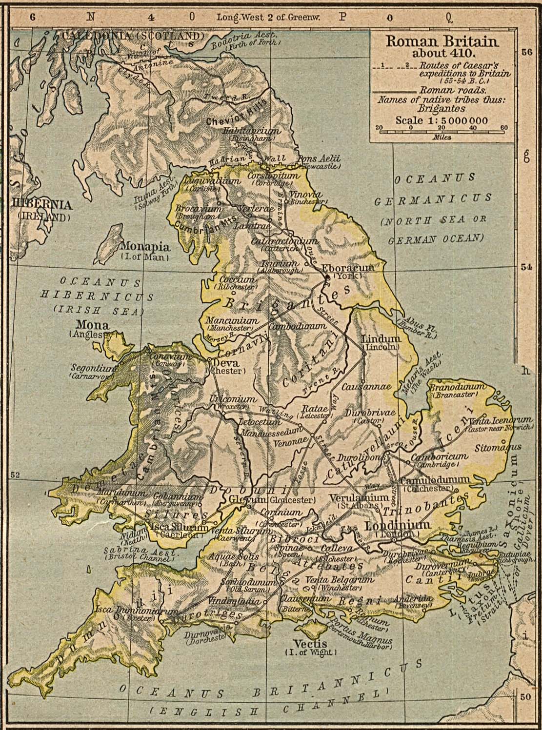
Roman Britain About 410. [p.51]
●
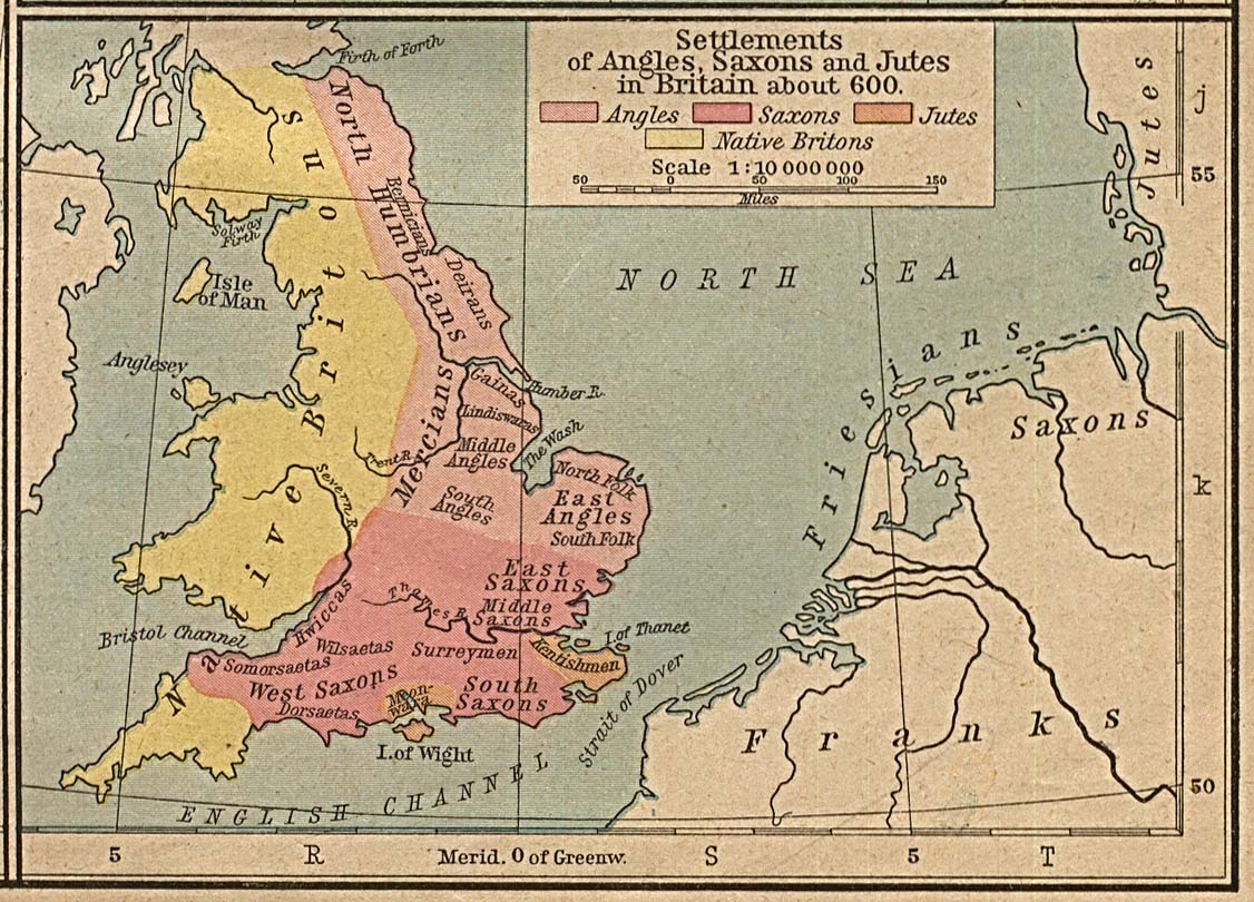
Settlements of Angles, Saxons and Jutes in Britain about 600
[p.51]
●
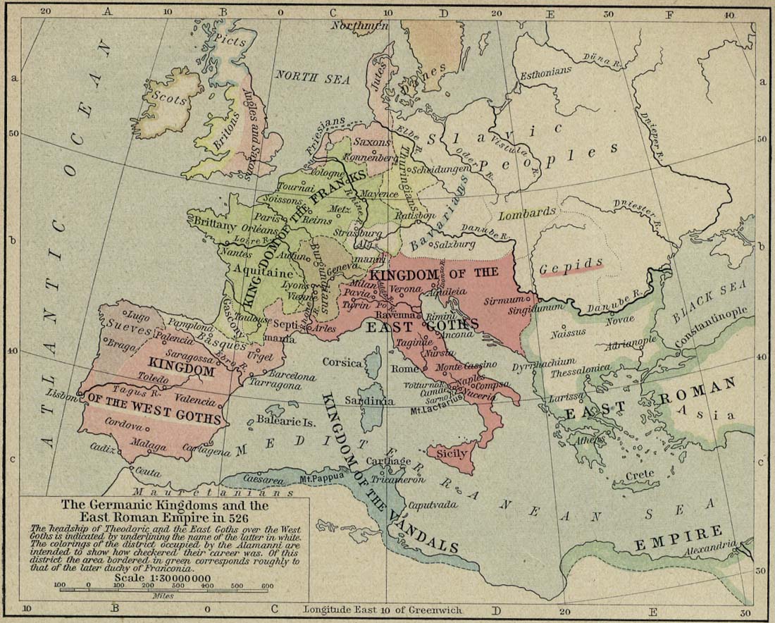
The Germanic Kingdoms and the East Roman Empire in 526 [p.52]
●
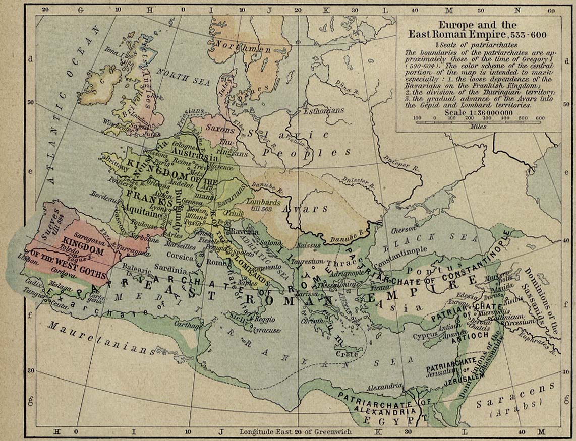
Europe and the East Roman Empire, 533-600 [p.52]
●
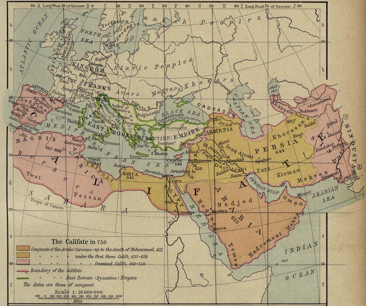
The Califate in 750 [p.53]
●
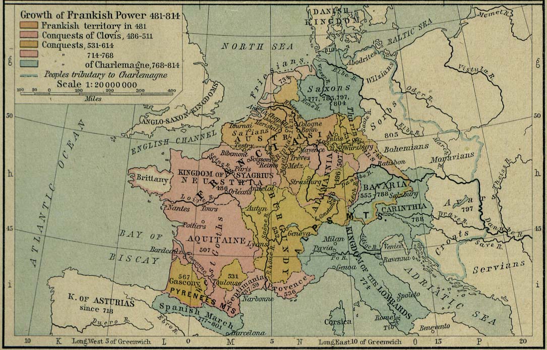
Growth of Frankish Power, 481-814 [p.53]
●
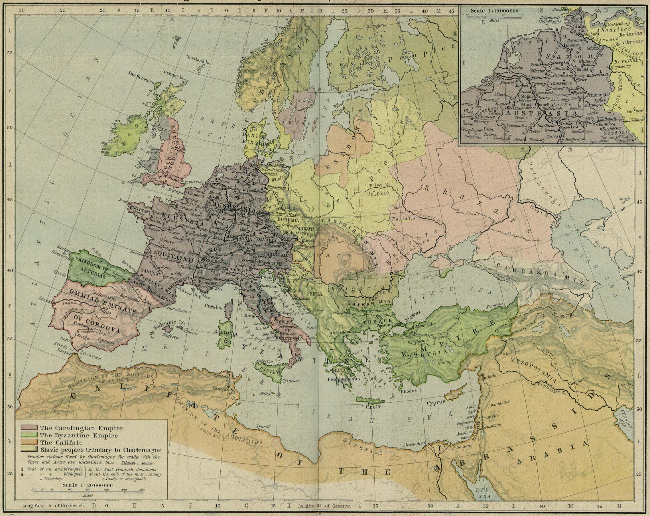
The Carolingian and Byzantine Empires and the Califate about 814
[p.54-55]
Inset: Northern
Austrasia about 814.
●
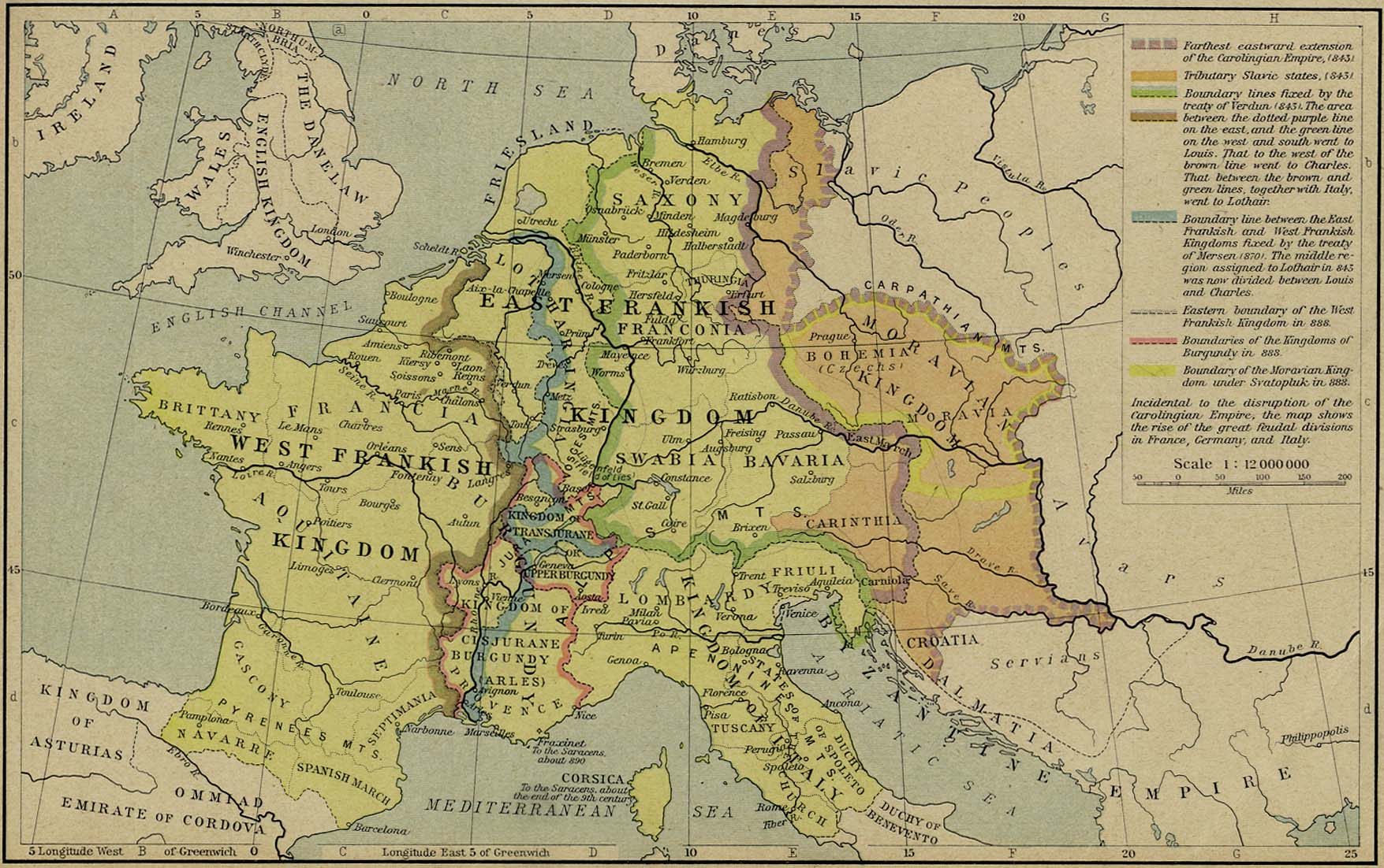
Disruption of the Carolingian Empire, 843-888 [p.56]
●
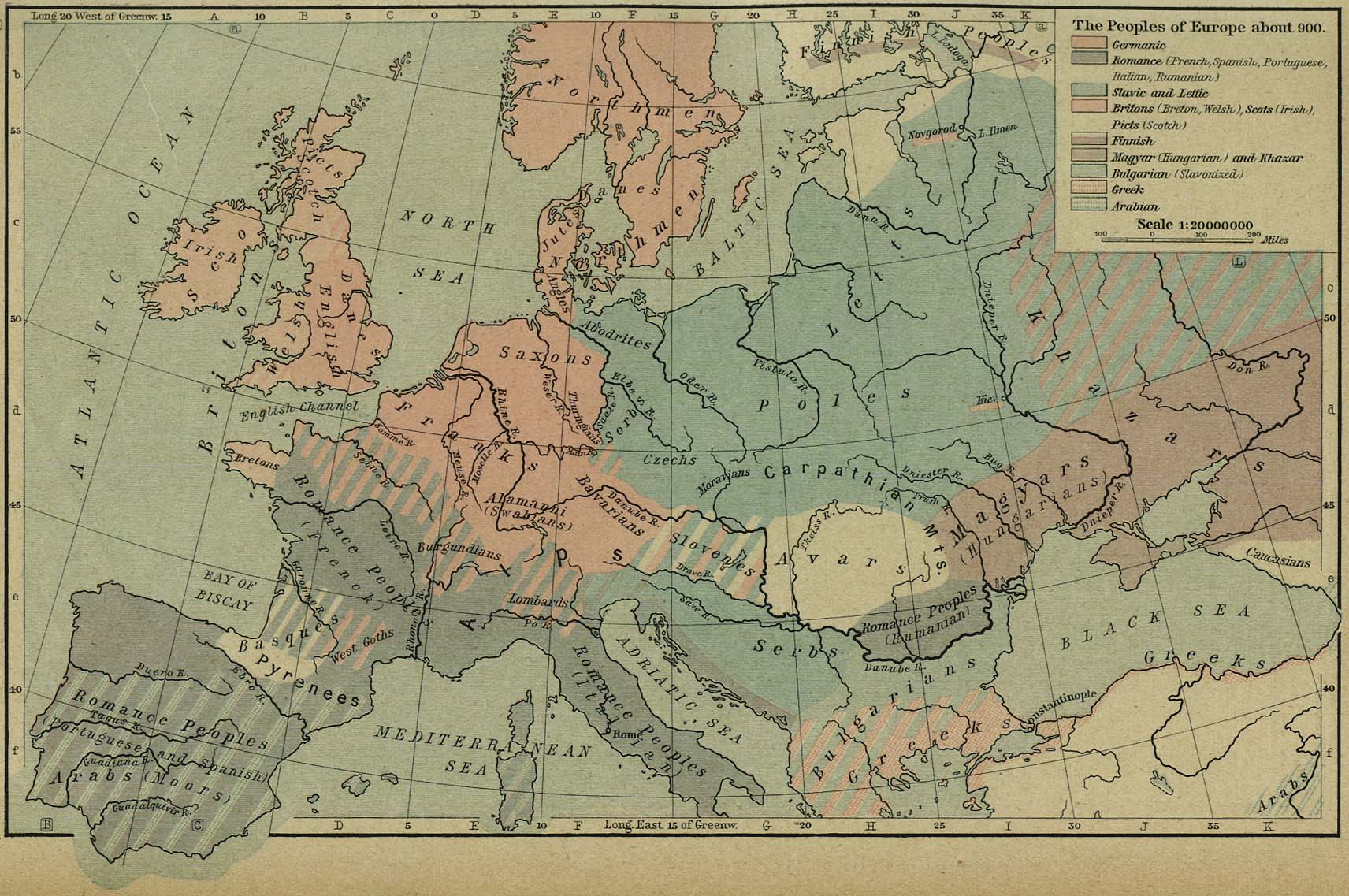
The Peoples of Europe about 900 [p.57]
●
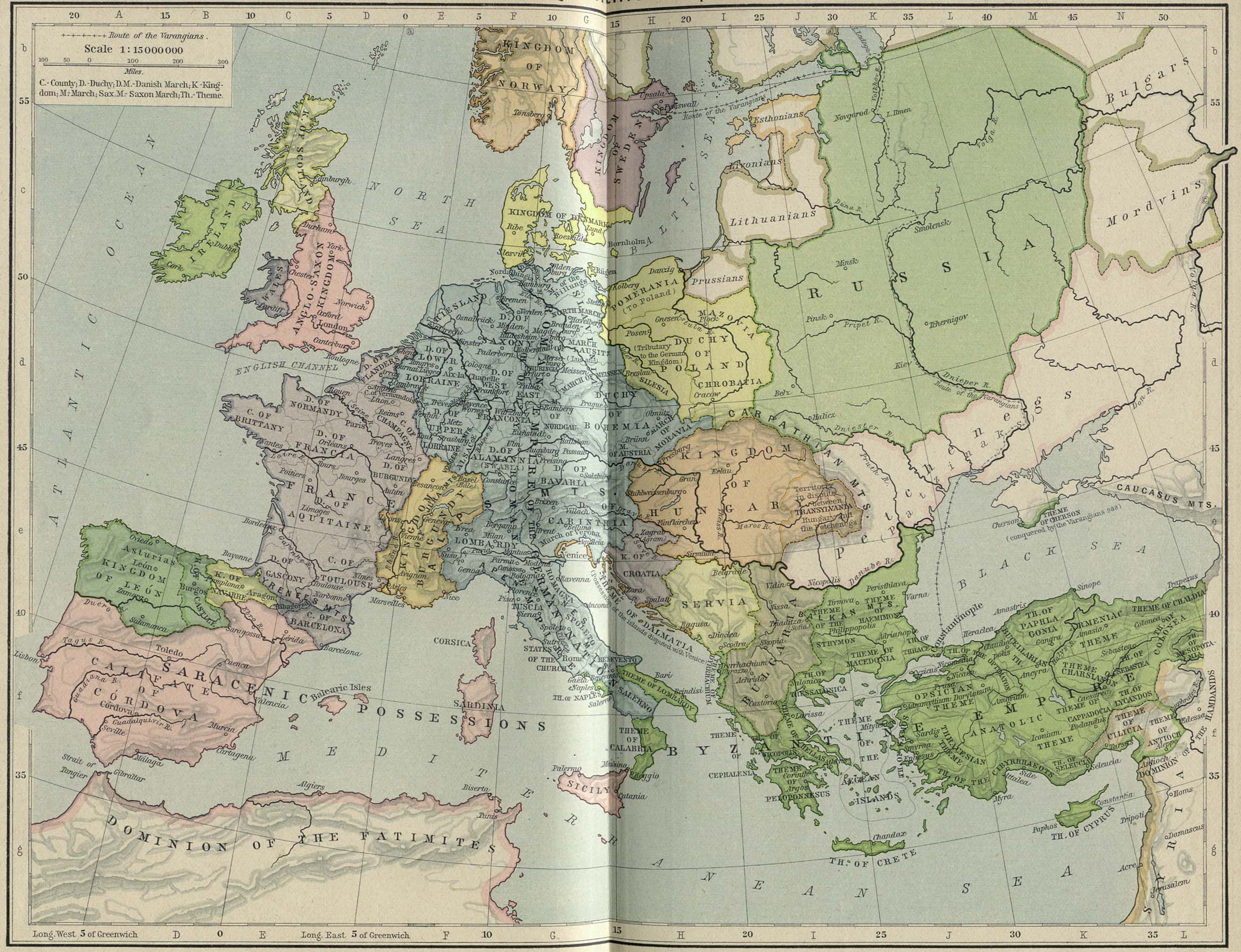
Europe and the Byzantine Empire about 1000 [p.58-59]
●
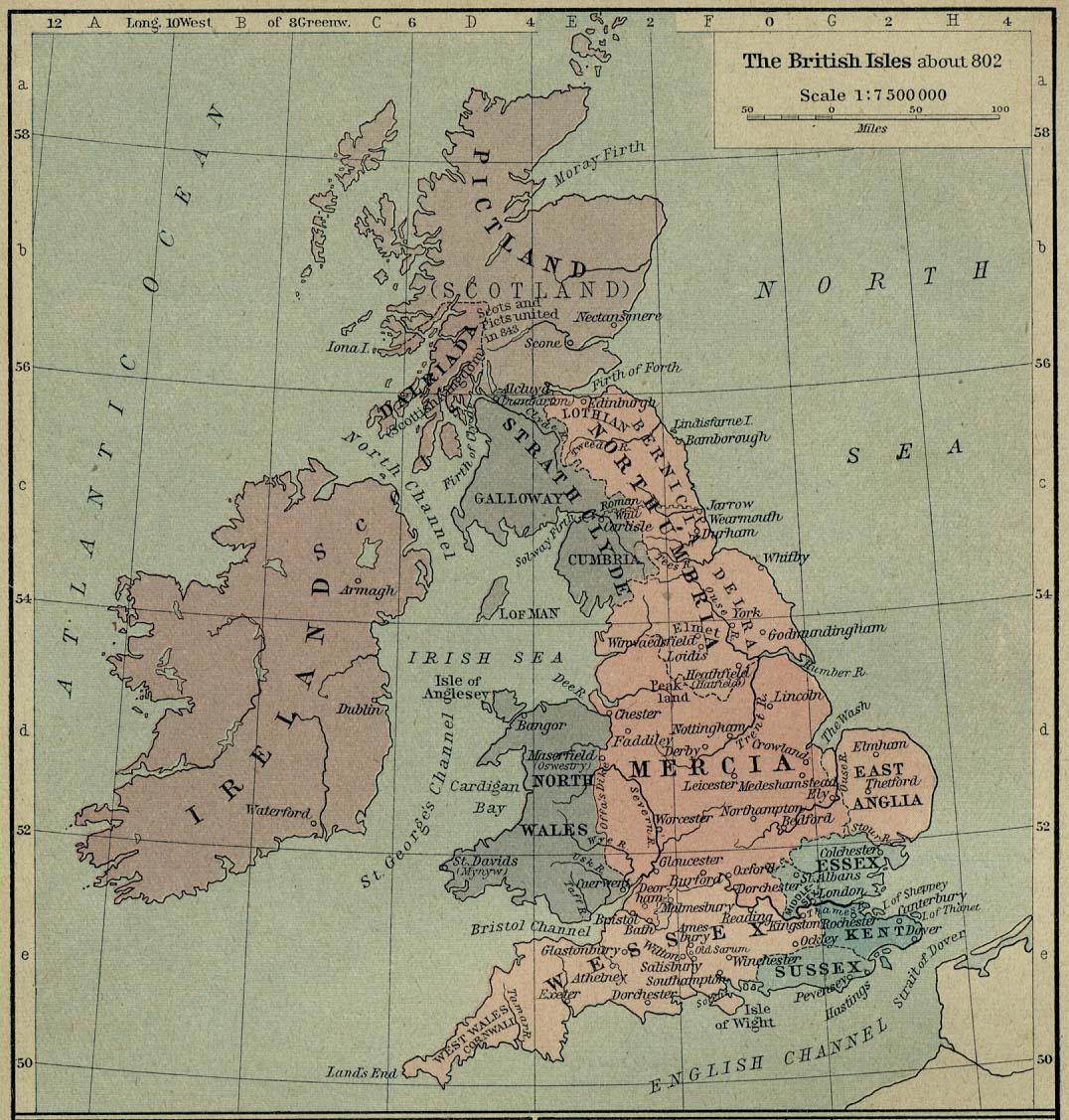
The British Isles about 802 [p.60]
●
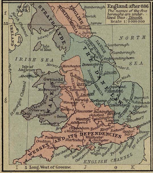
England after 886 (99K) [p.60]
●
The Shires of England in the Tenth Century (99K) [p.60]
●
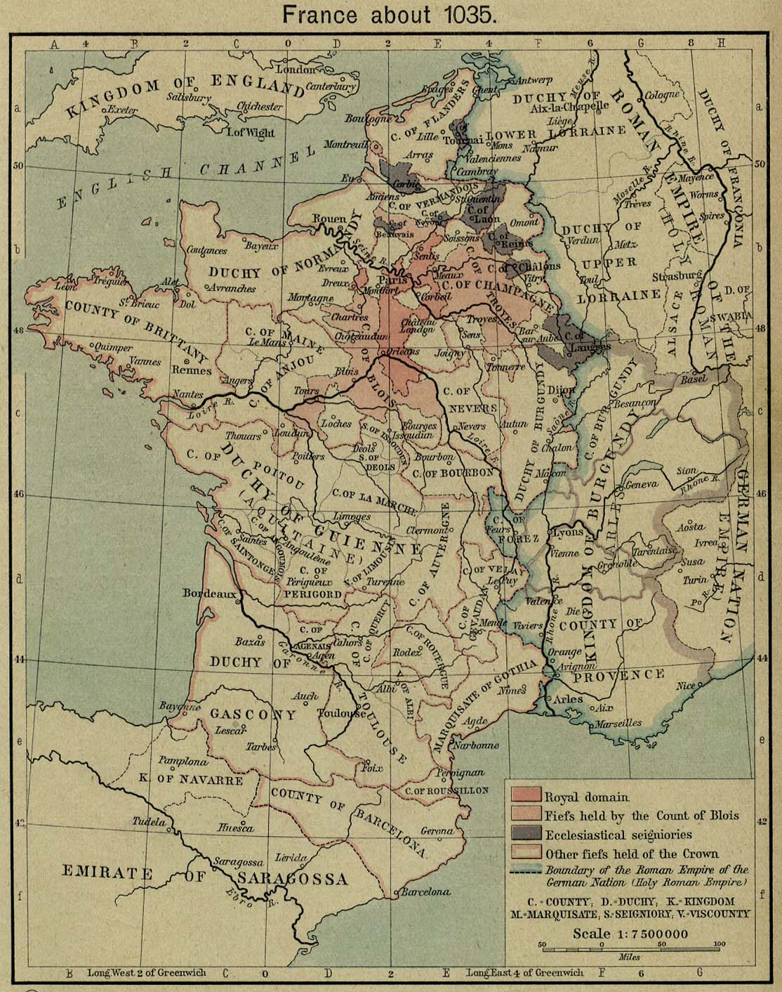
France about 1035 [p.61]
●
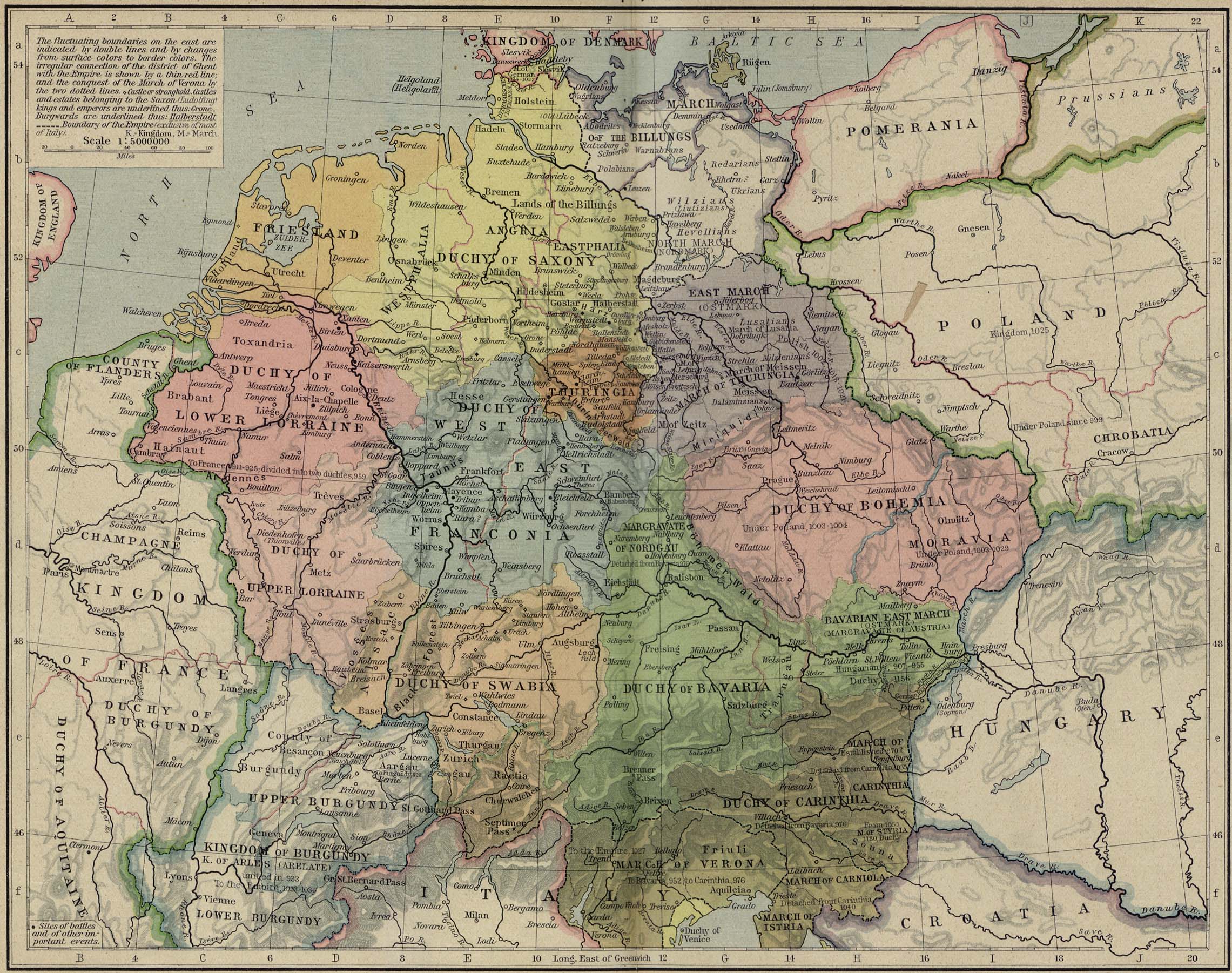
Central Europe, 919-1125 [p.62-63]
●
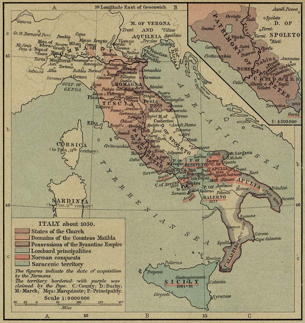
Italy about 1050 [p.64]
Inset: The Patrimony
of St. Peter.
●
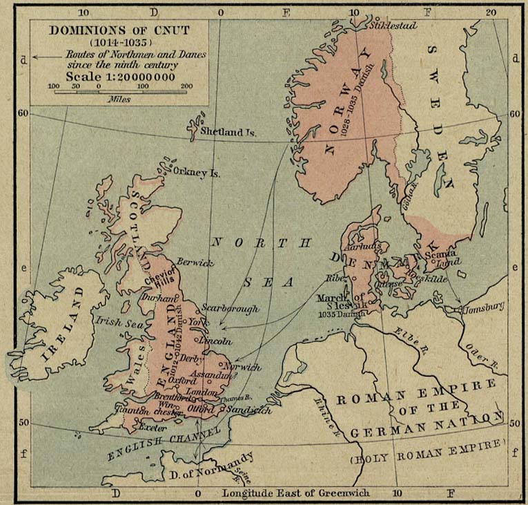
Dominions of Cnut, 1014-1035 [p.64]
●
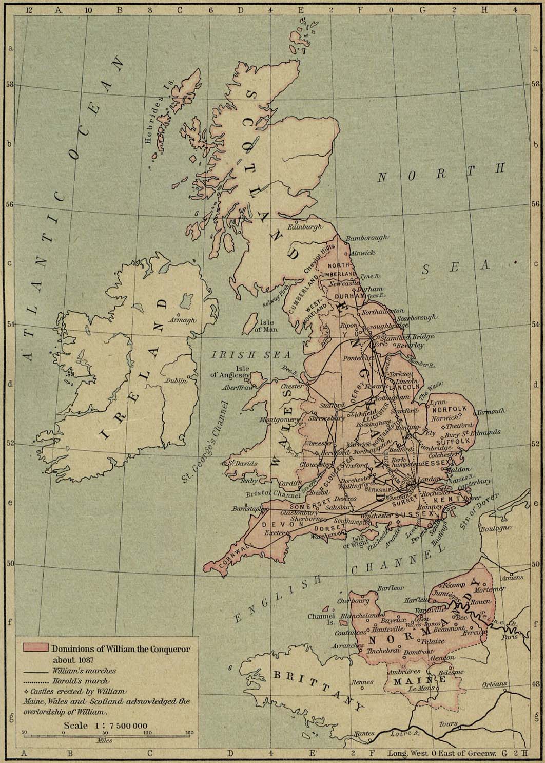
Dominions of William the Conqueror about 1087 [p.65]
●
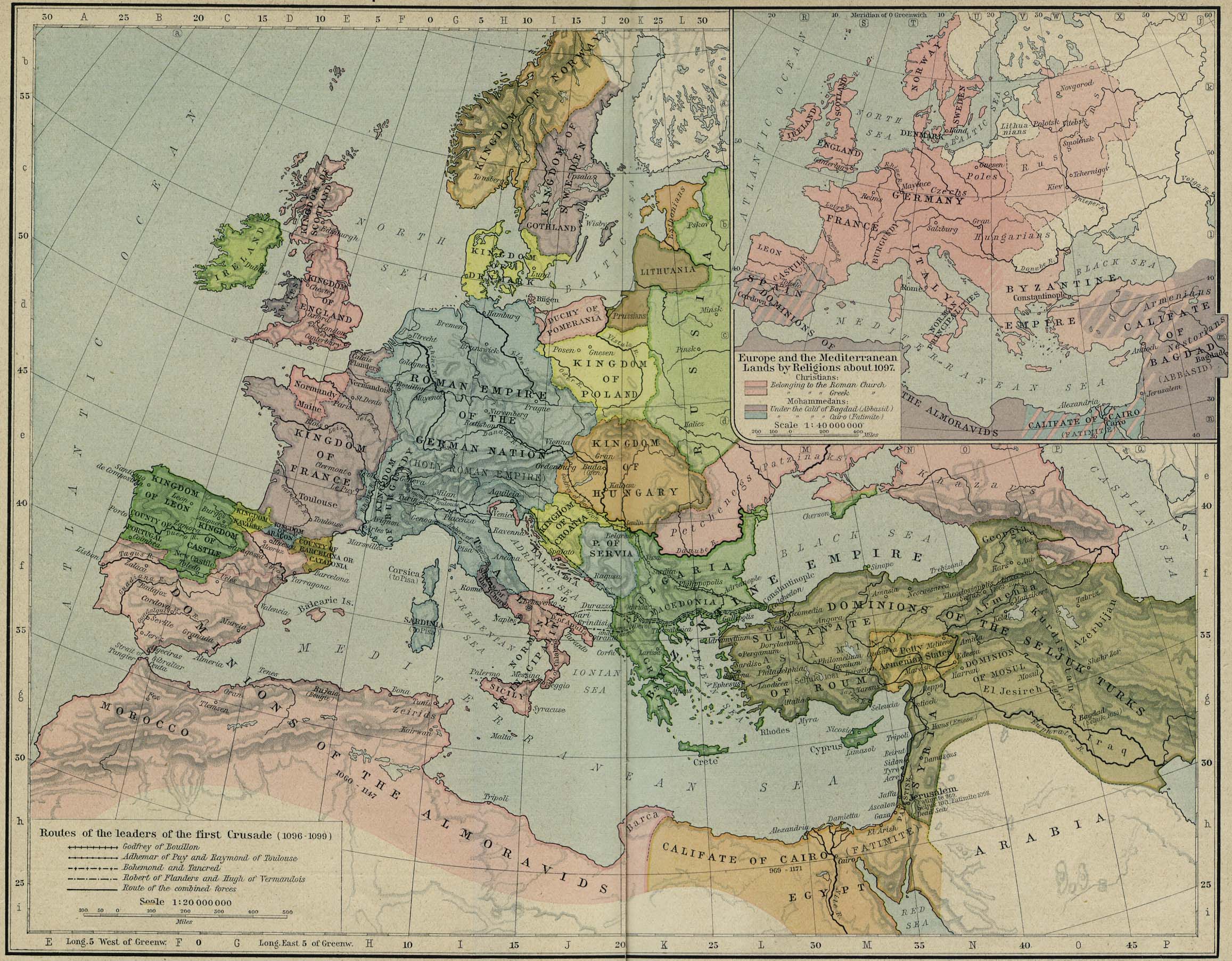
Europe and the Mediterranean Lands about 1097 [p.66-67]
Inset: Europe and the
Mediterranean Lands by Religions about 1097.
●
Asia Minor and the States of the Crusaders in Syria, about 1140
[p.68]
Insets: Palestine.
Plan of Jerusalem about 1187.
●
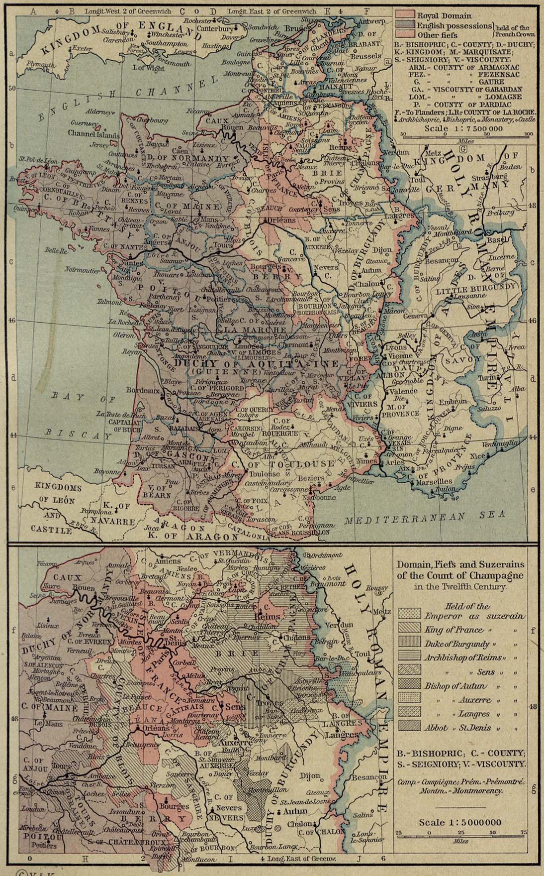
France, 1154-1184 [p.69]
Inset: Domain, Fiefs
and Suzerains of the Count of Champagne in the
Twelfth Century.
●
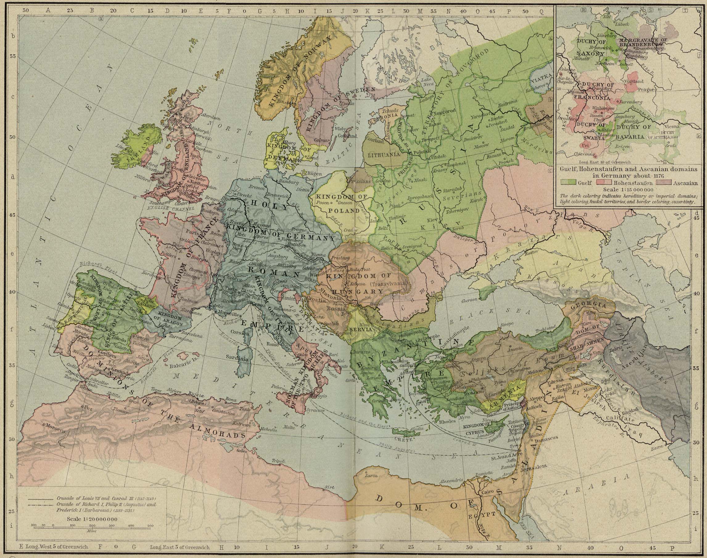
Europe and the Mediterranean Lands about 1190 [p.70-71]
Inset: Guelf,
Hohenstaufen and Ascanian Domains in Germany about 1176.
●
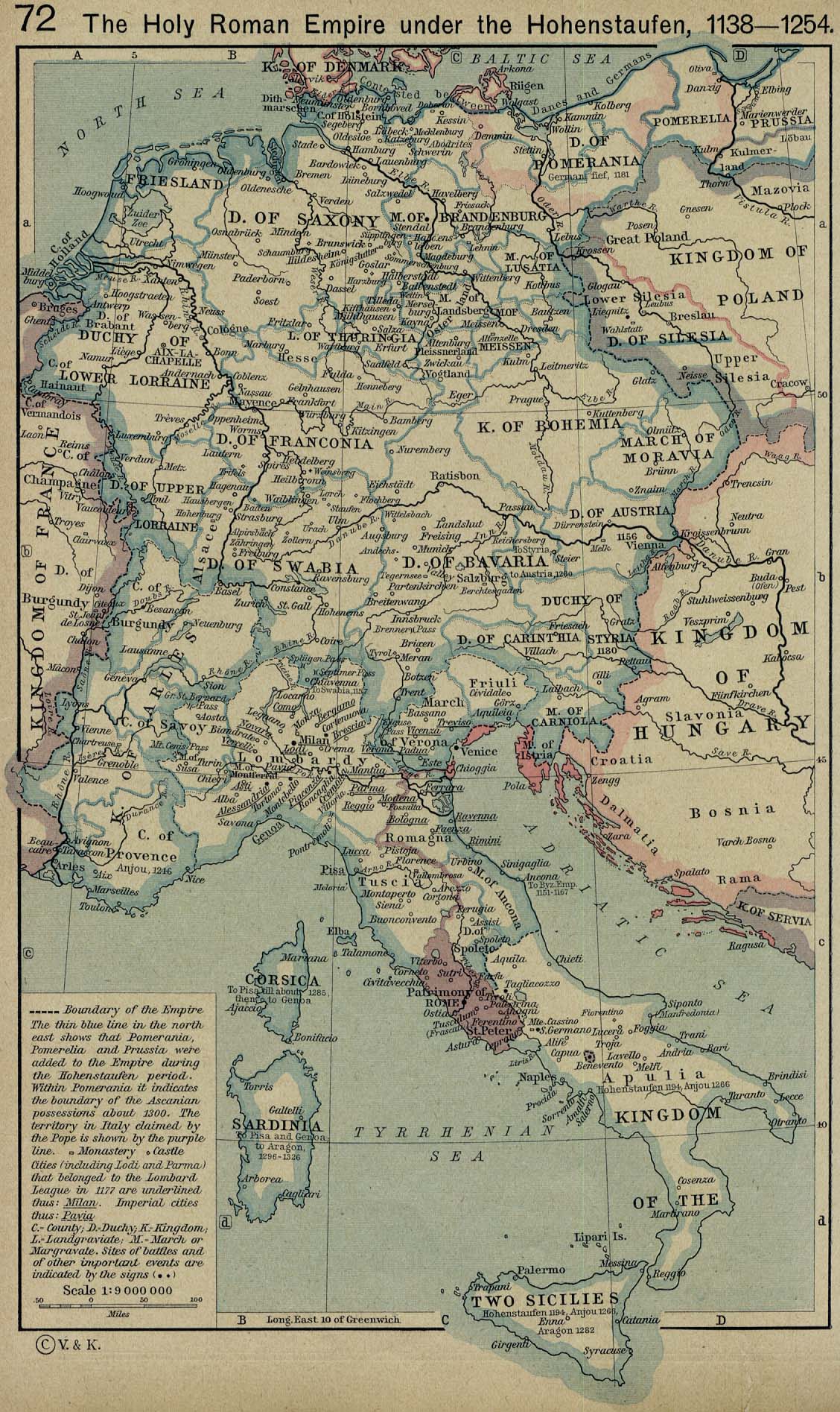
The Holy Roman Empire under the Hohenstaufen, 1138-1254 [p.72]
●
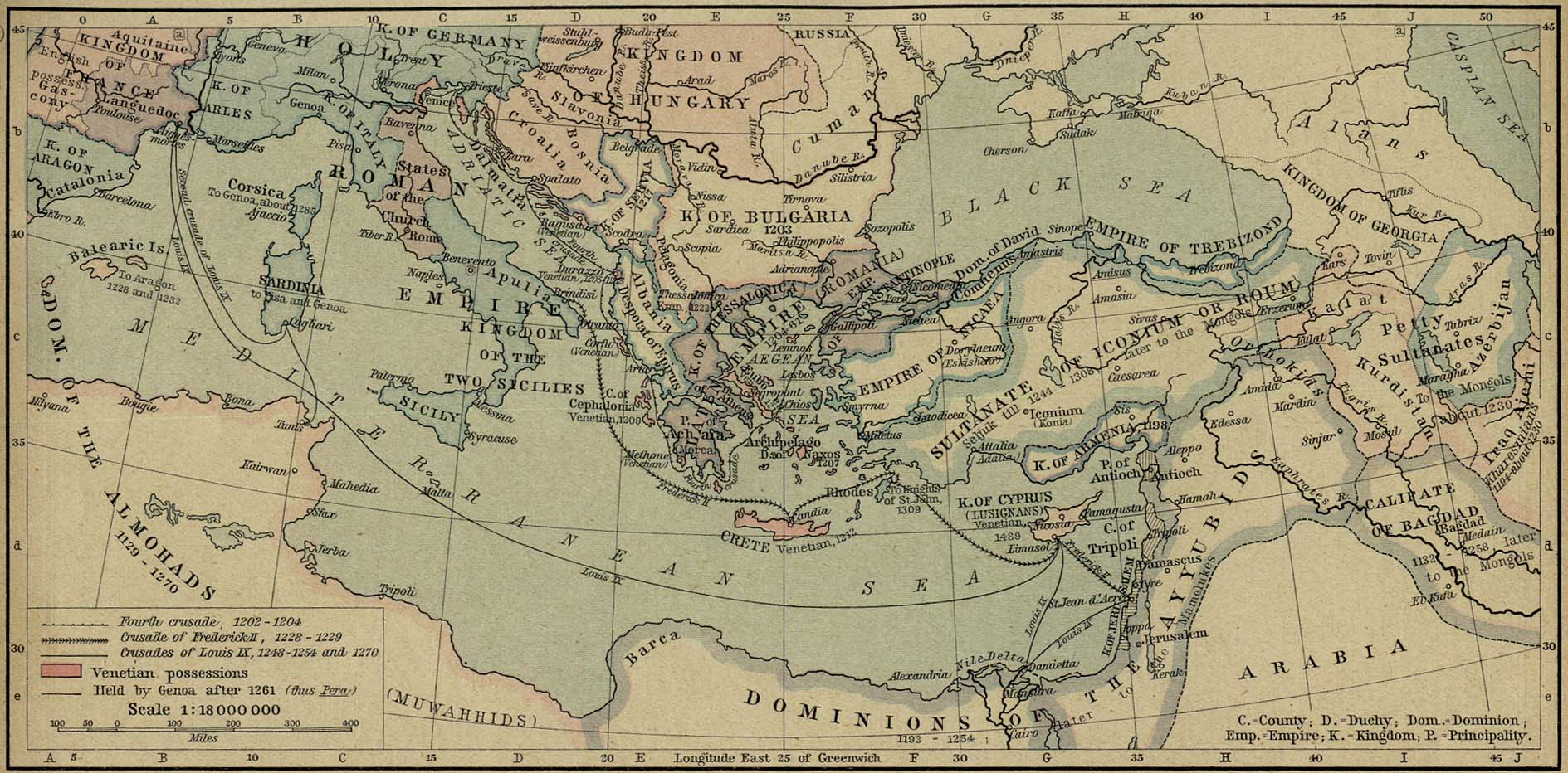
The Mediterranean Lands after 1204 [p.73]
●
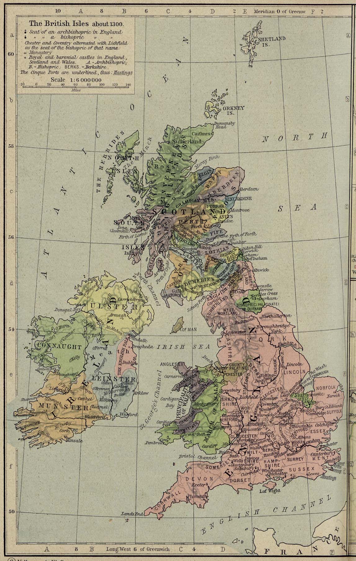
The British Isles about 1300 [p.74]
●
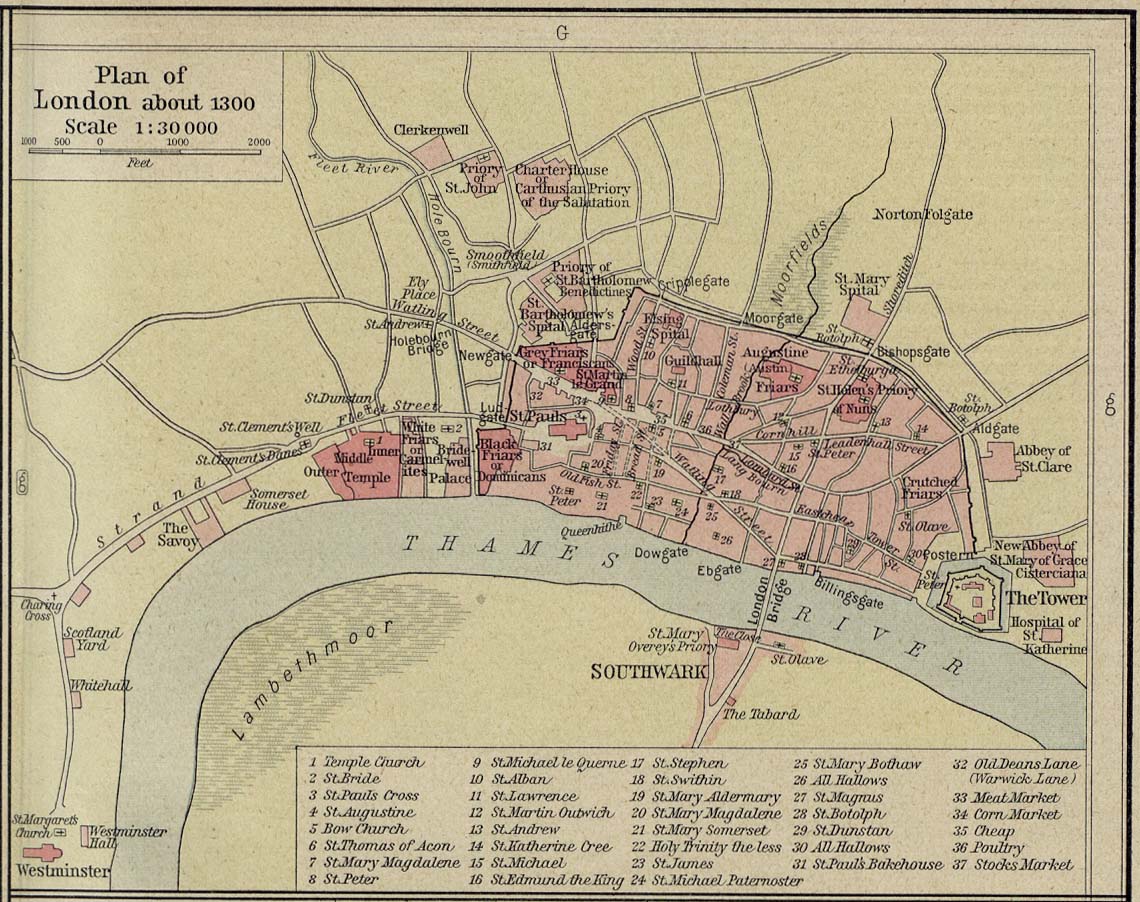
Plan of London about 1300 [p.75]
●
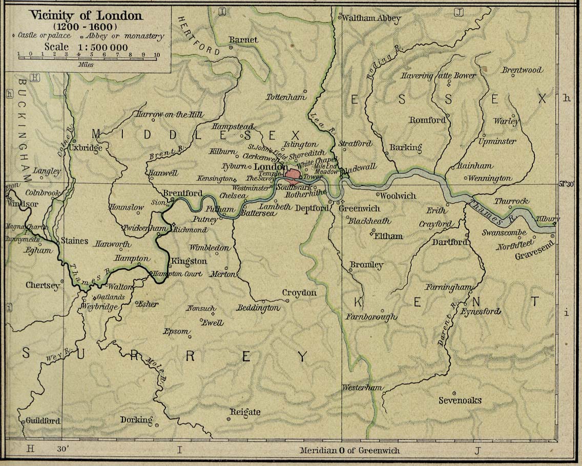
Vicinity of London, 1200-1600 [p.75]
●
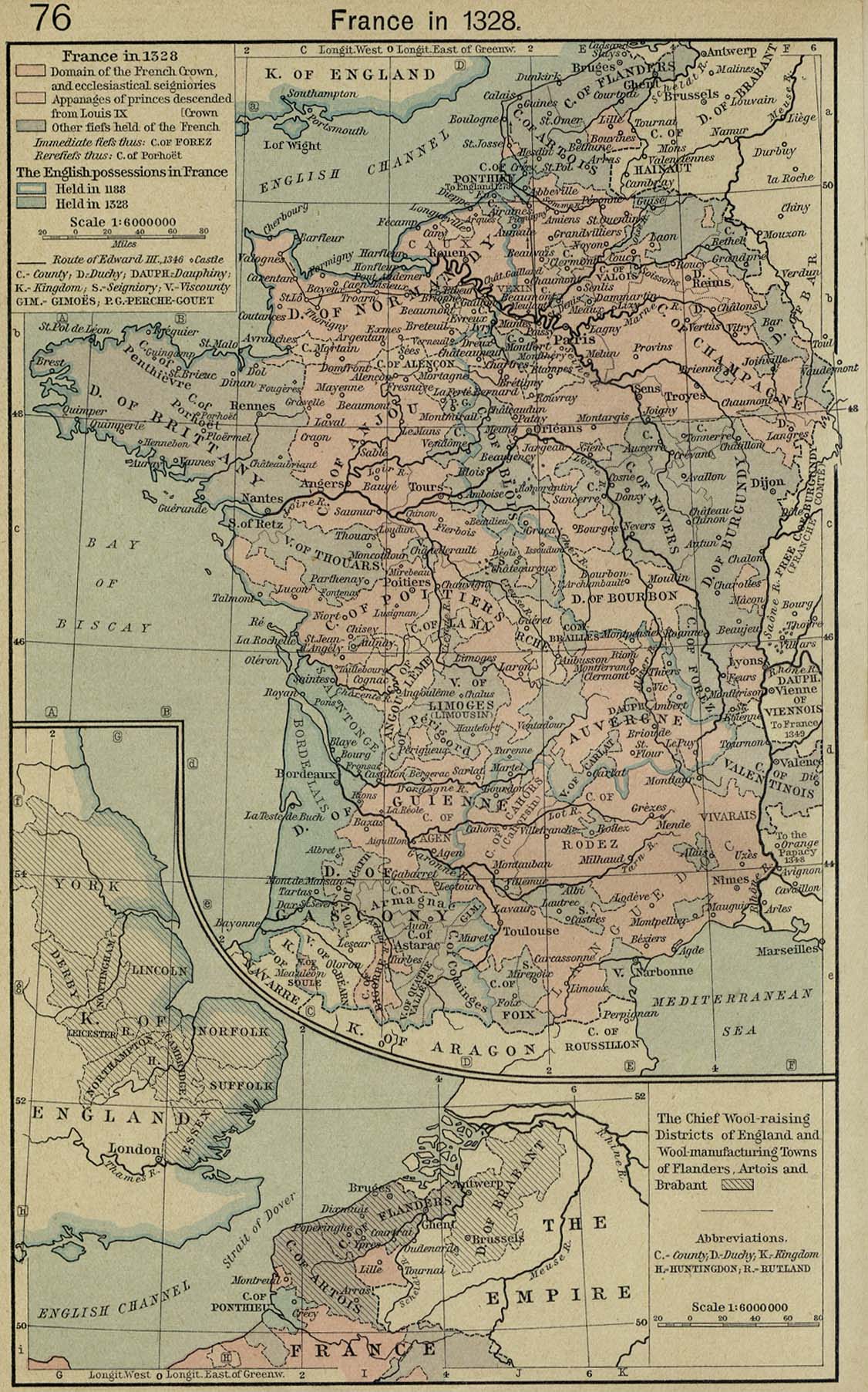
France in 1328 [p.76]
Inset: The Chief
Wool-raising Districts of England and Wool-manufacturing
Towns of Flanders,
Artois and Brabant.
●
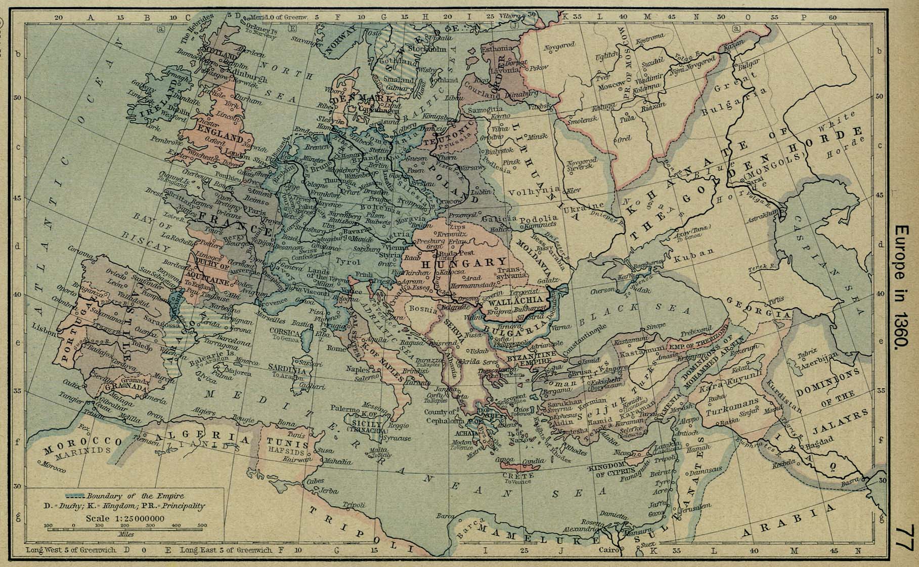
Europe in 1360 [p.77]
●
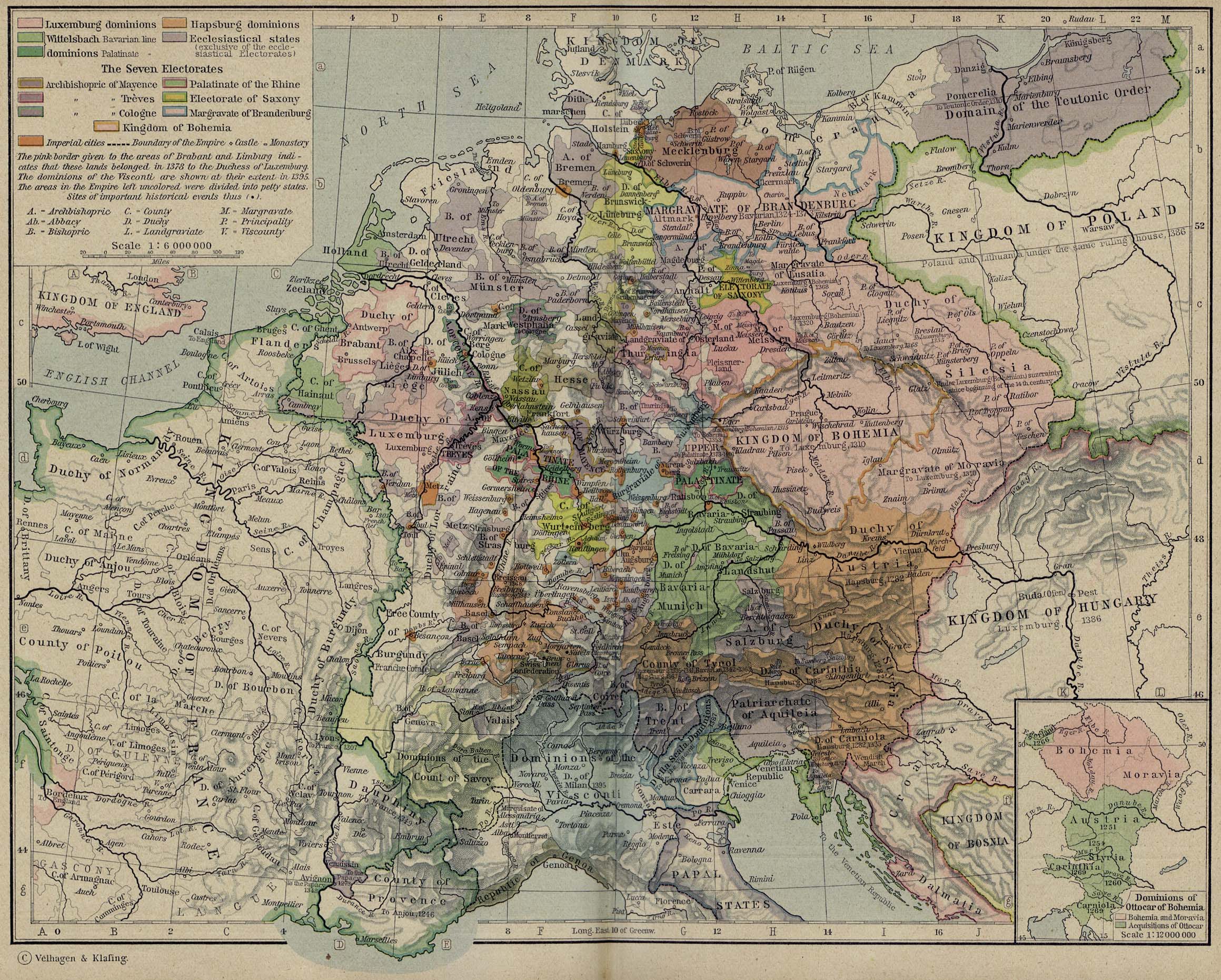
Central Europe in 1378 [p.78-79]
Inset: Dominions of
Ottocar of Bohemia.
●
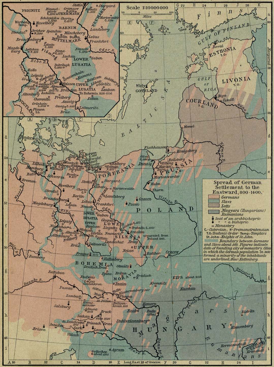
Spread of German Settlements to the Eastward, 800-1400 [p.80]
Inset: The March of
Lusatia.
●
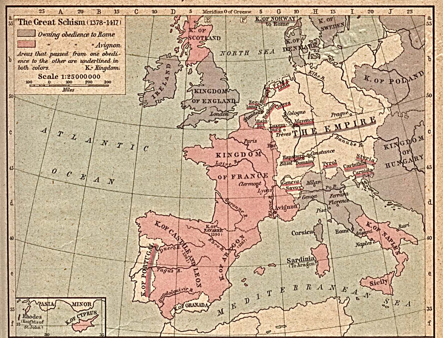
The Great Schism, 1378-1417 [p.81]
●
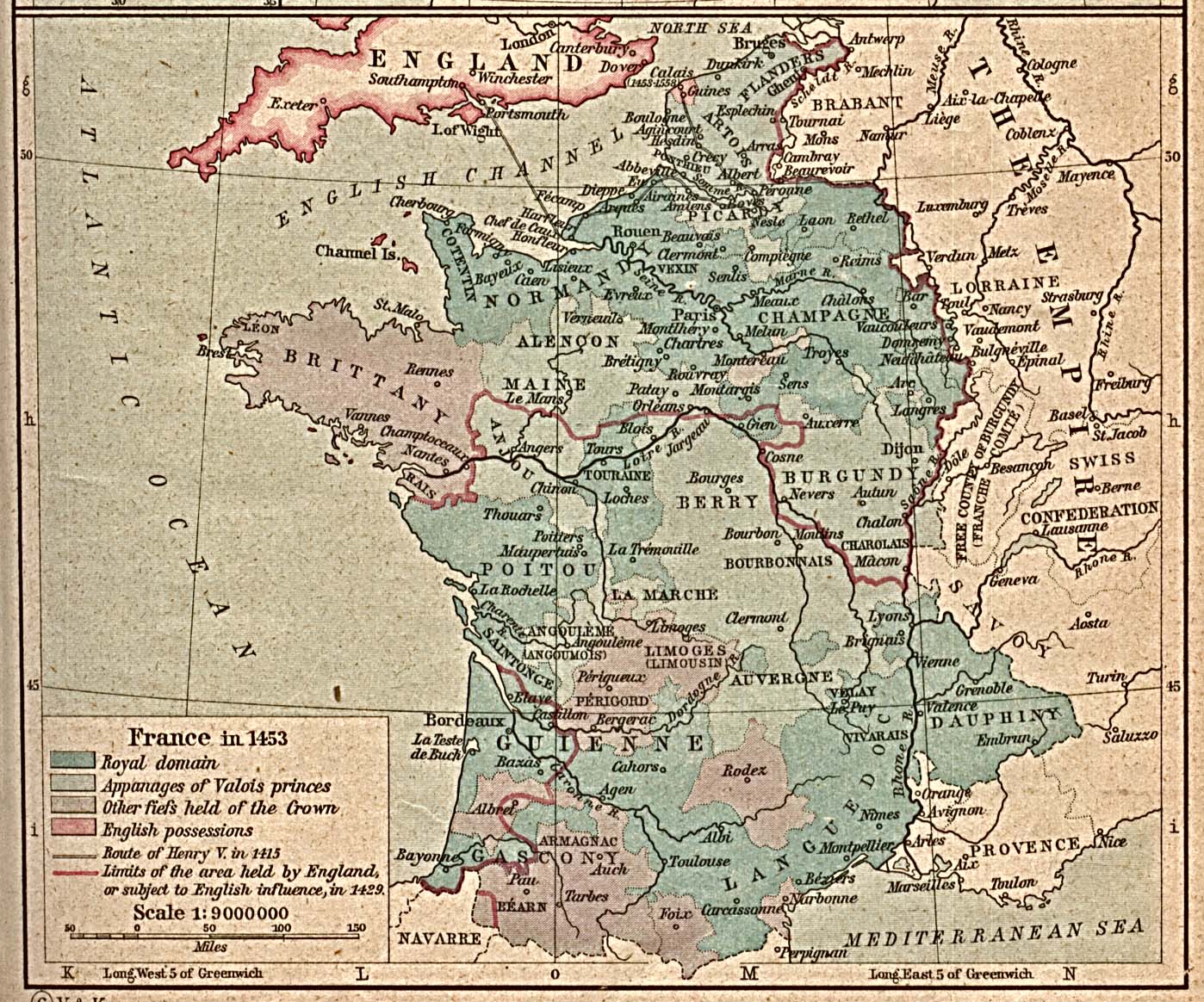
France in 1453 [p.81]
●
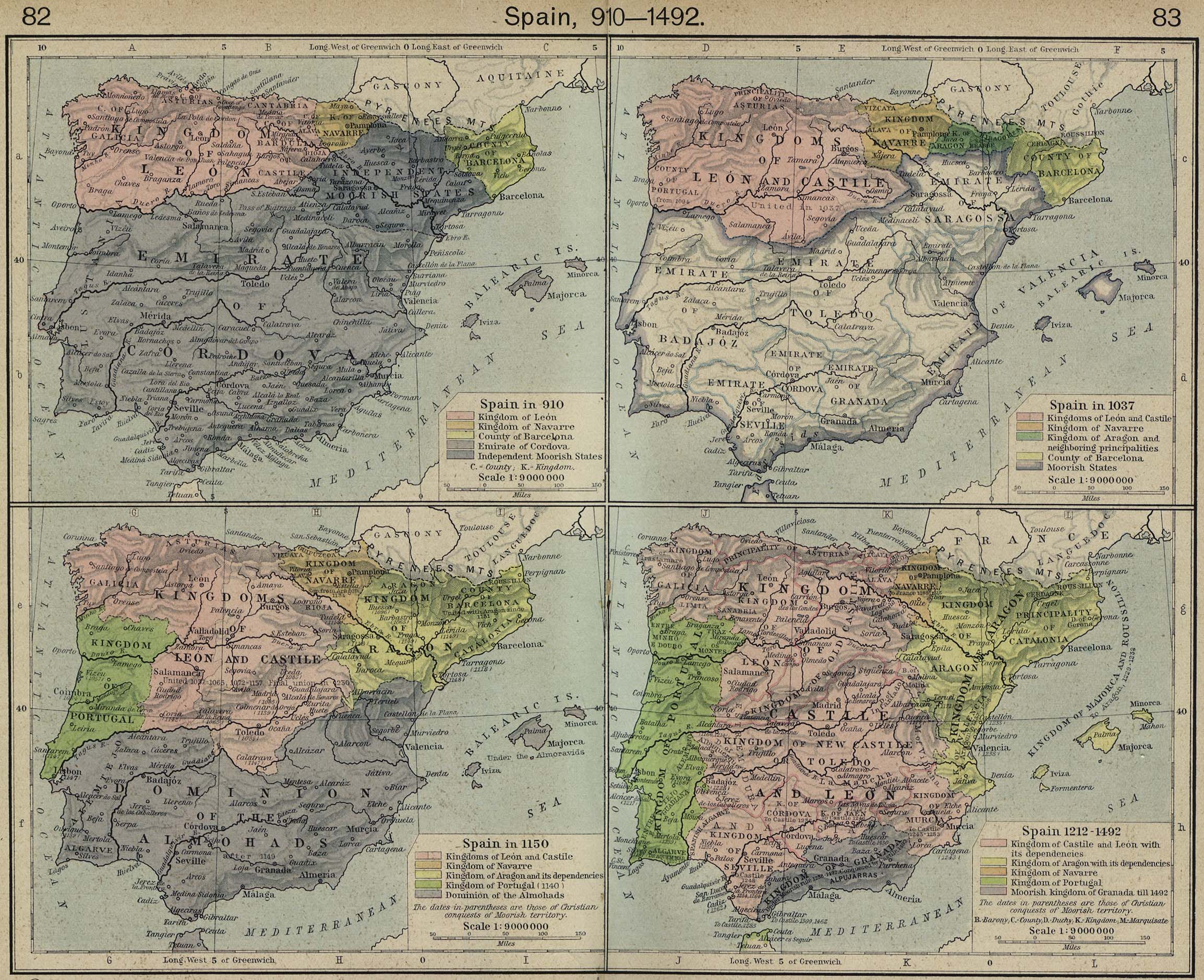
Spain, 910-1492 [p.82-83]
Spain in
910.
Spain in
1037.
Spain in
1150.
Spain
1212-1492.
●
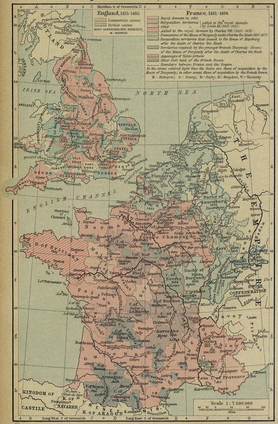
England and France, 1455-1494 [p.84]
●
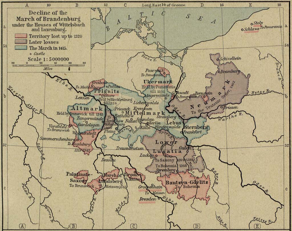
Decline of the March of Brandenburg under the Houses of Wittelsbach
and Luxemburg, 1320-1415 [p.85]
●
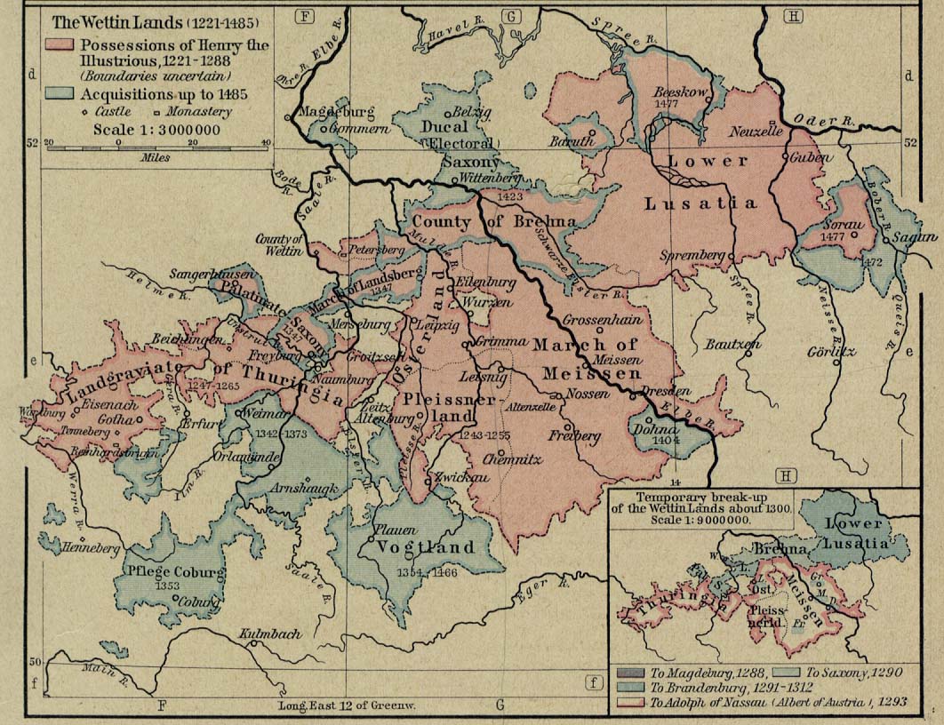
The Wettin Lands, 1221-1485 [p.85]
Inset: Temporary
break-up of the Wettin Lands about 1300.
●
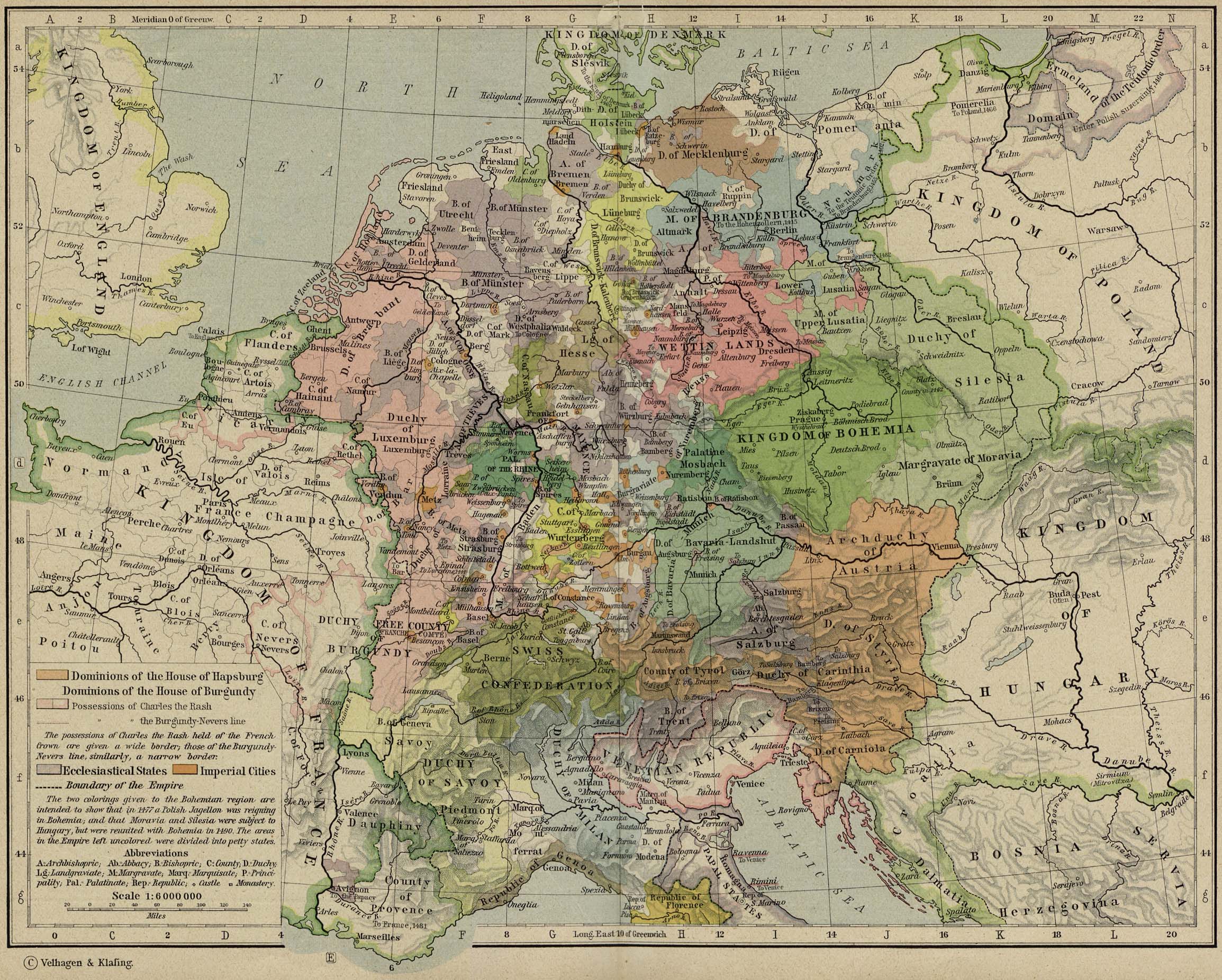
Central Europe about 1477 [p.86-87]
●
Decline of German Power in the Baltic Region, 1380-1560 [p.88]
●
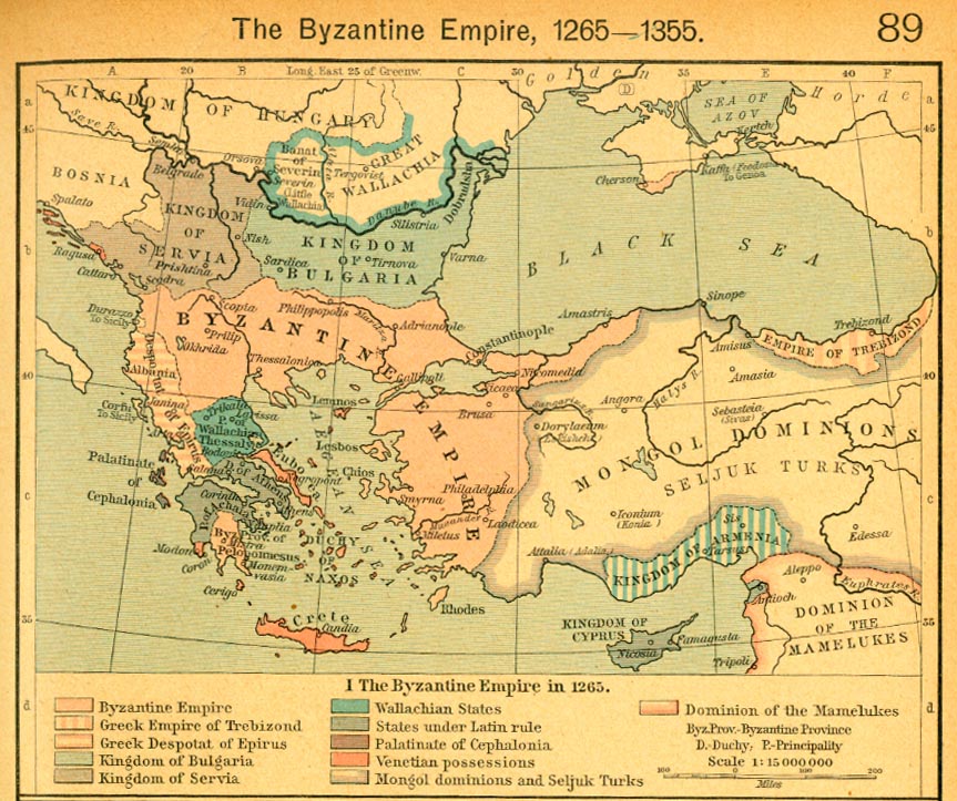
The Byzantine Empire in 1265 [p.89]
The
Byzantine Empire, 1265-1355.
The
Byzantine Empire in 1265.
●
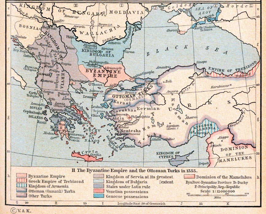
The Byzantine Empire and the Ottoman Turks in 1355 [p.89]
The
Byzantine Empire, 1265-1355.
The
Byzantine Empire and the Ottoman Turks in 1355.
●
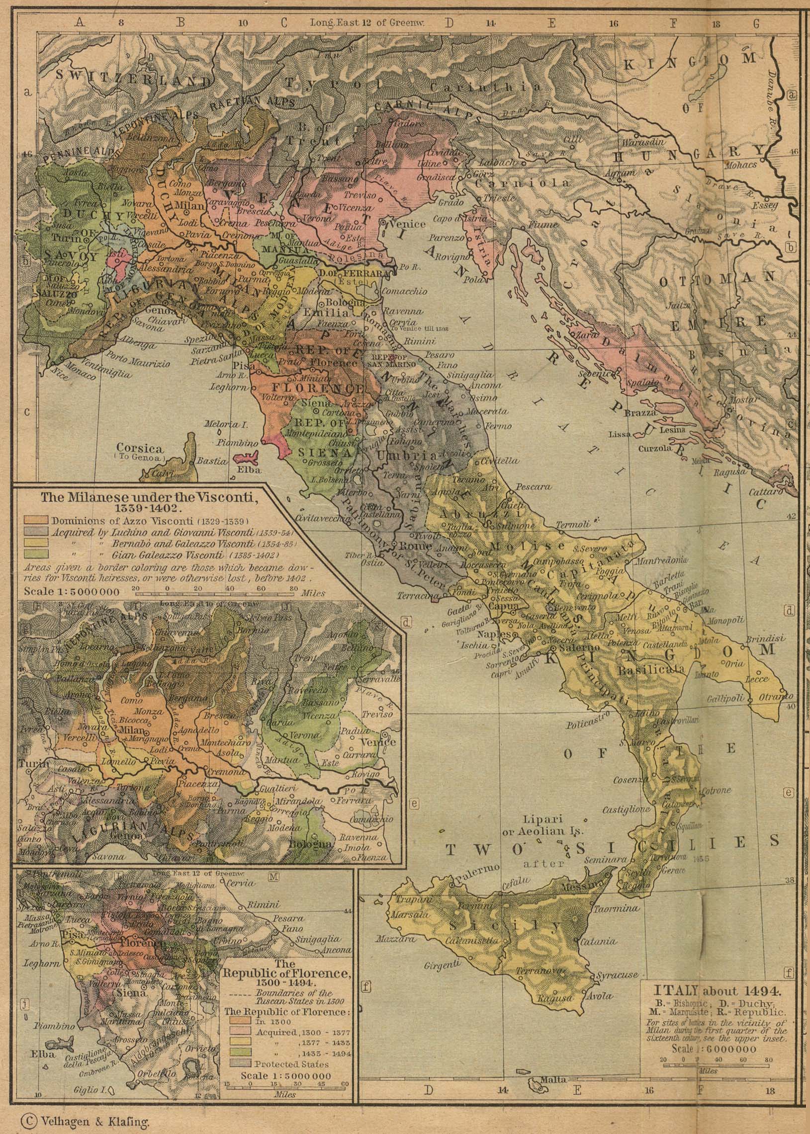
Italy about 1494 [p.90]
Insets: The Milanese
under the Visconti, 1339-1402.
The
Republic of Florence, 1300-1494.
●
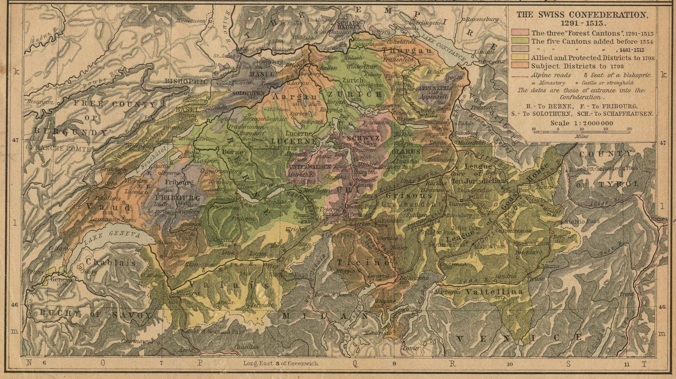
The Swiss Confederation, 1291-1513 [p.91]
●
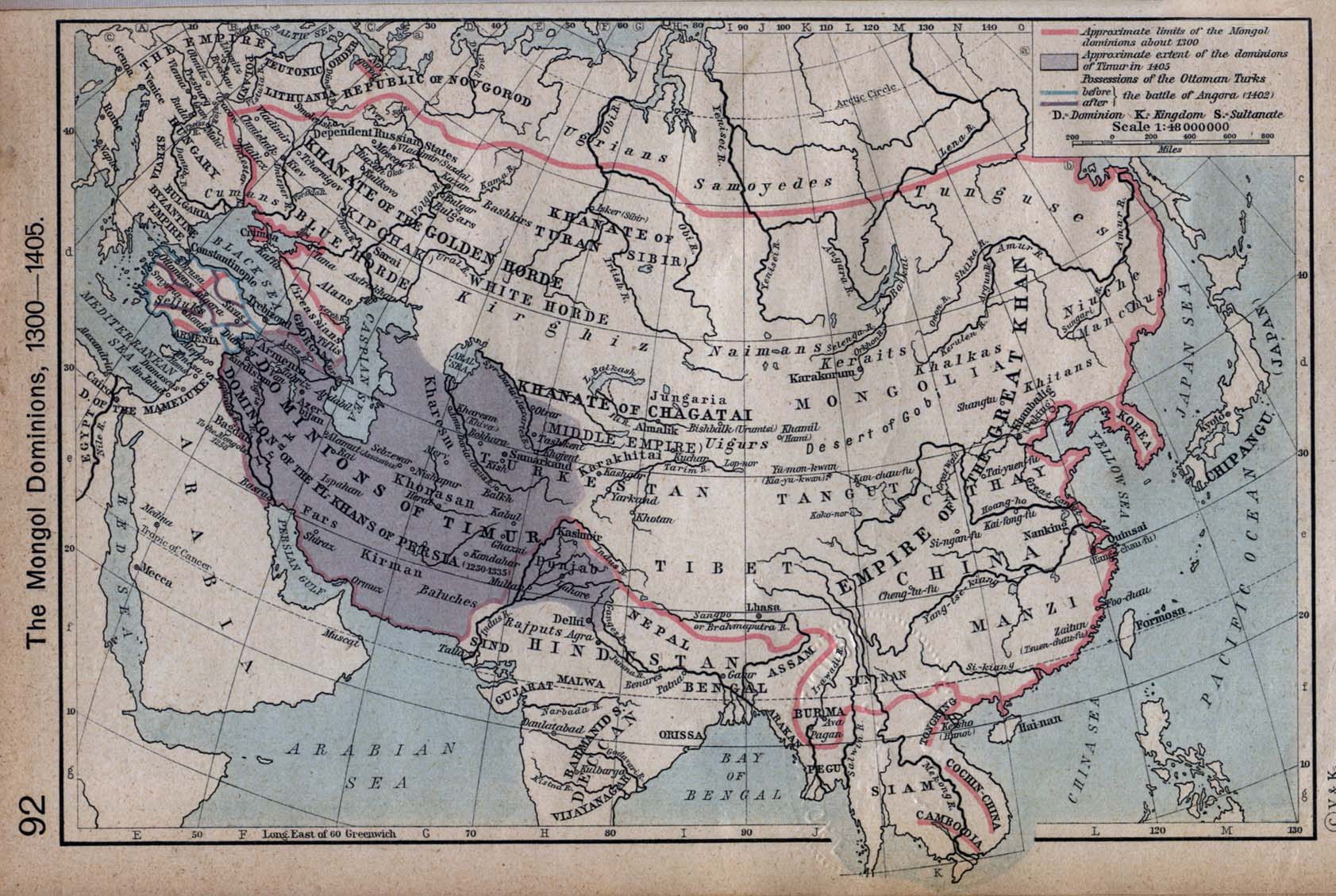
The Mongol Dominions, 1300-1405 [p.92]
●
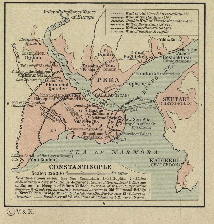
The Ottoman Empire, 1451-1481. Constantinople [p.93]
●
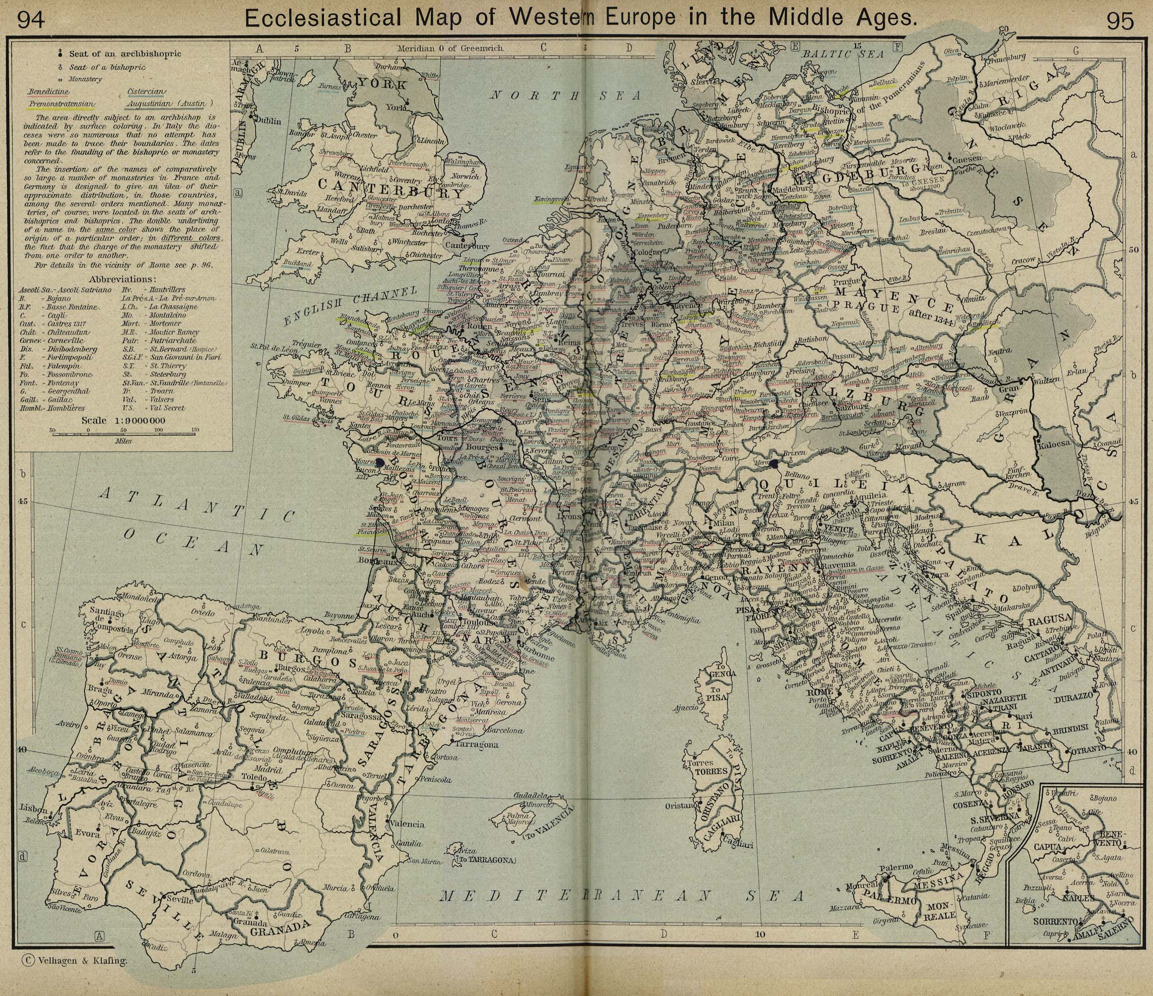
Ecclesiastical Map of Western Europe in the Middle Ages
[p.94-95]
Inset: Vicinity of
Naples.
●
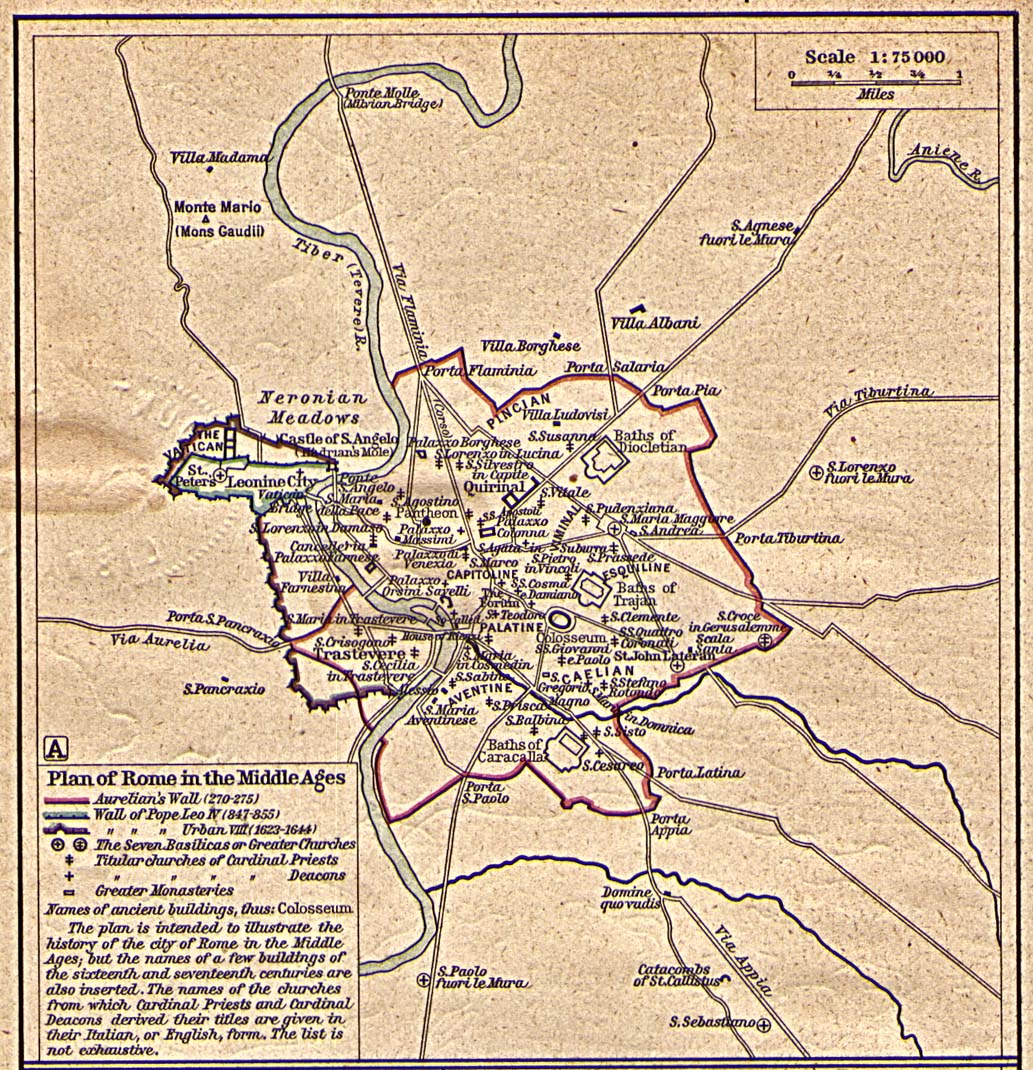
Plan of Rome in the Middle Ages [p.96]
●
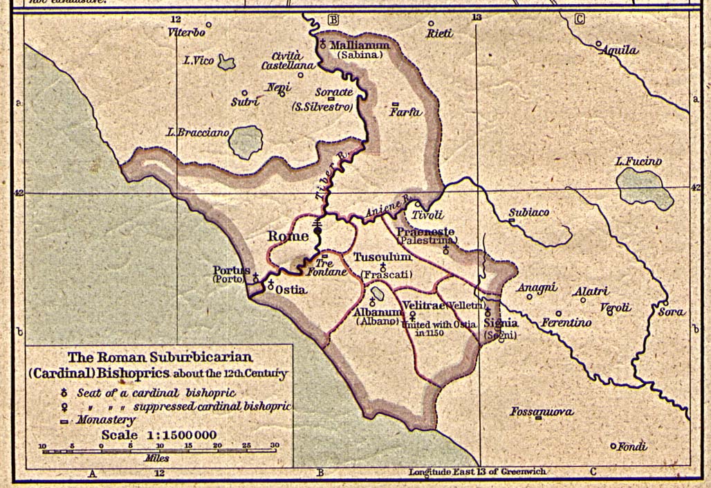
The Roman Suburbicarian (Cardinal) Bishoprics about the 12th Century
[p.96]
●
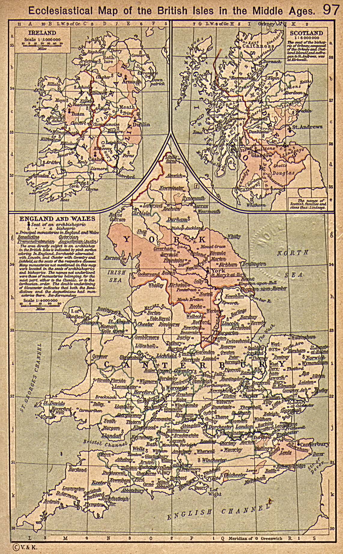
Ecclesiastical Map of the British Isles in the Middle Ages
[p.97]
●
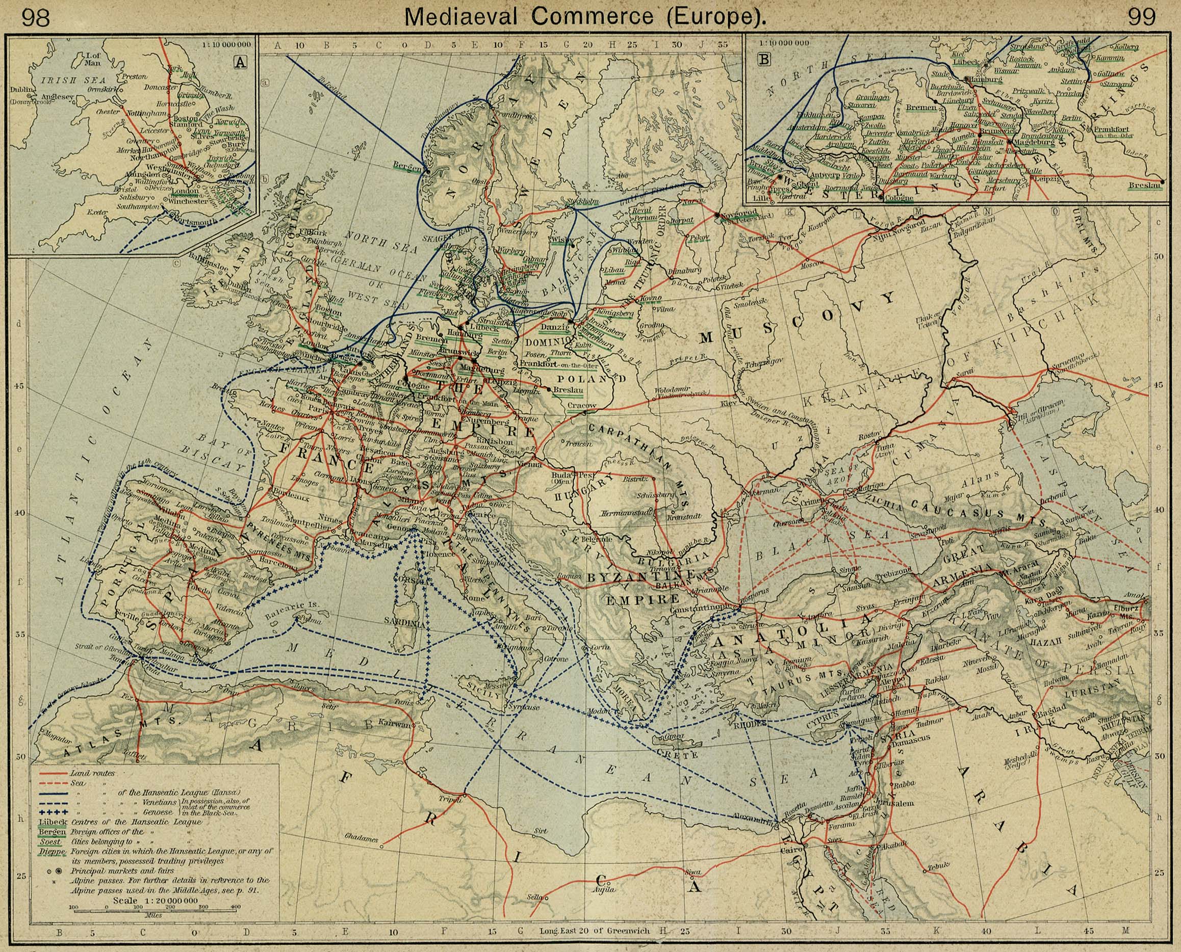
Mediaeval Commerce (Europe) [p.98-99]
Insets: England.
Hanseatic
League in Northern Germany.
●
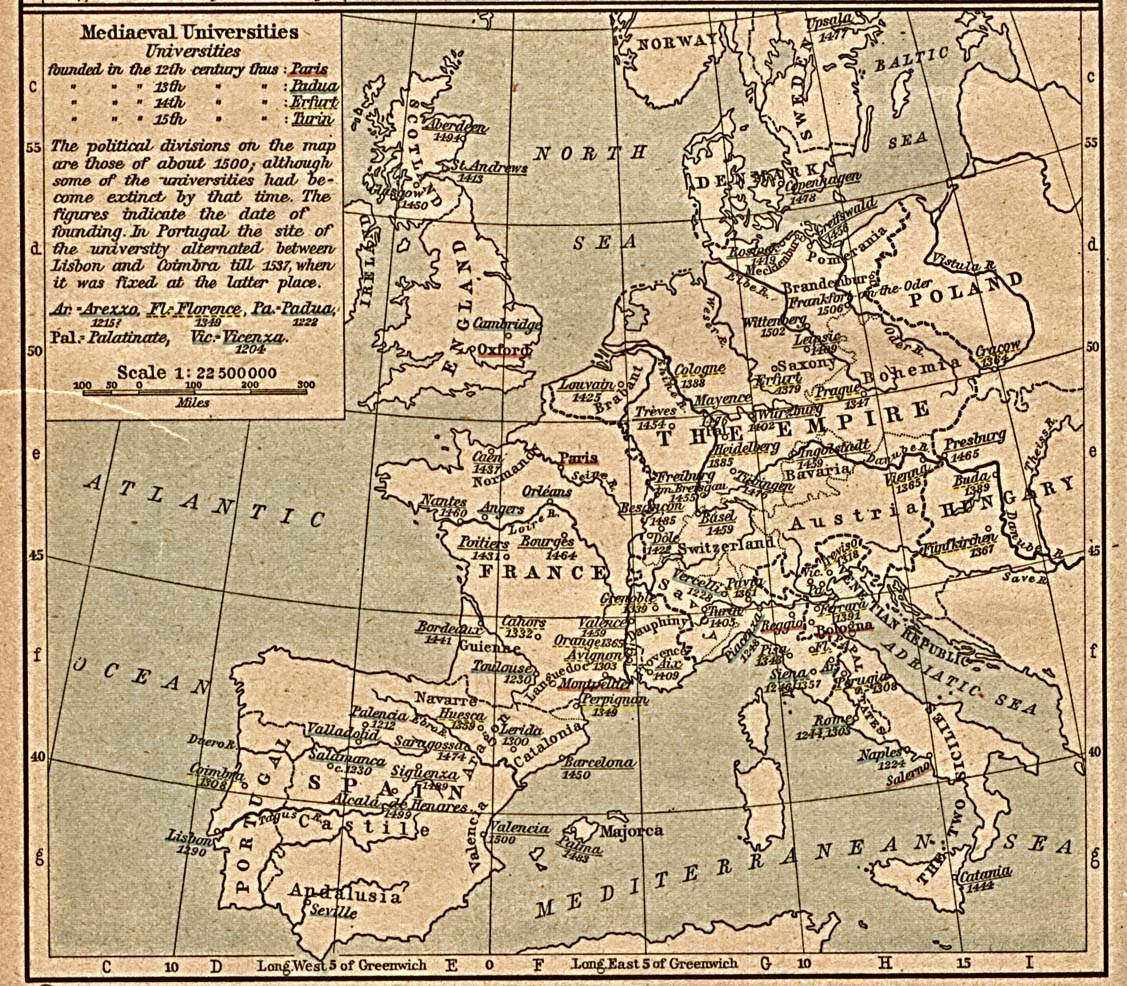
Mediaeval Universities [p.100]
●
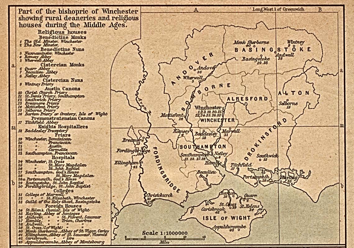
Rural Deaneries [p.100]
Part of
the bishopric of Winchester showing rural deaneries and
religious
houses during the
Middle Ages.
●
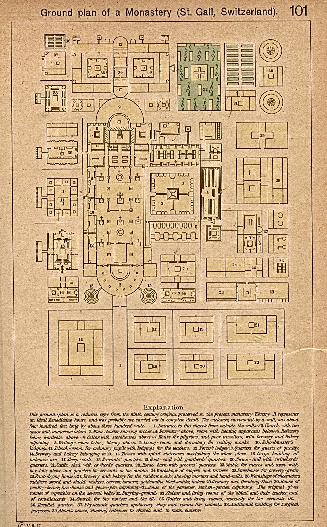
Ground Plan of a Monastery (St.Gall, Switzerland) [p.101]
●
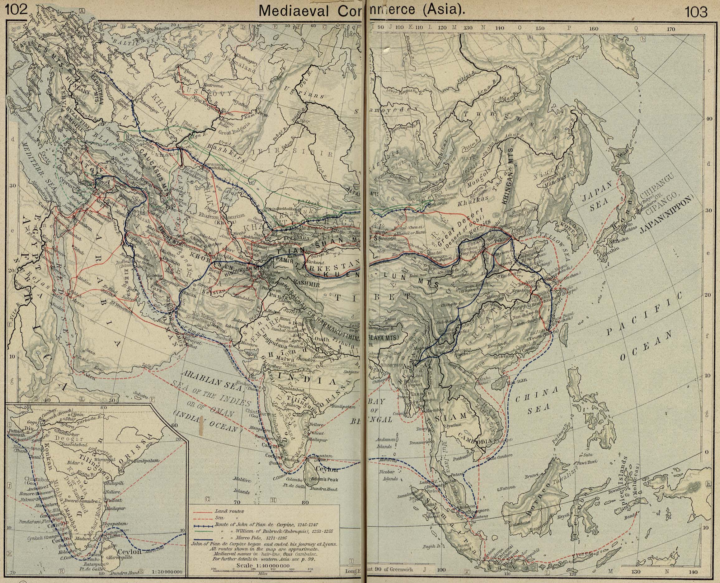
Mediaeval Commerce (Asia) [p.102-103]
Inset: India.
●
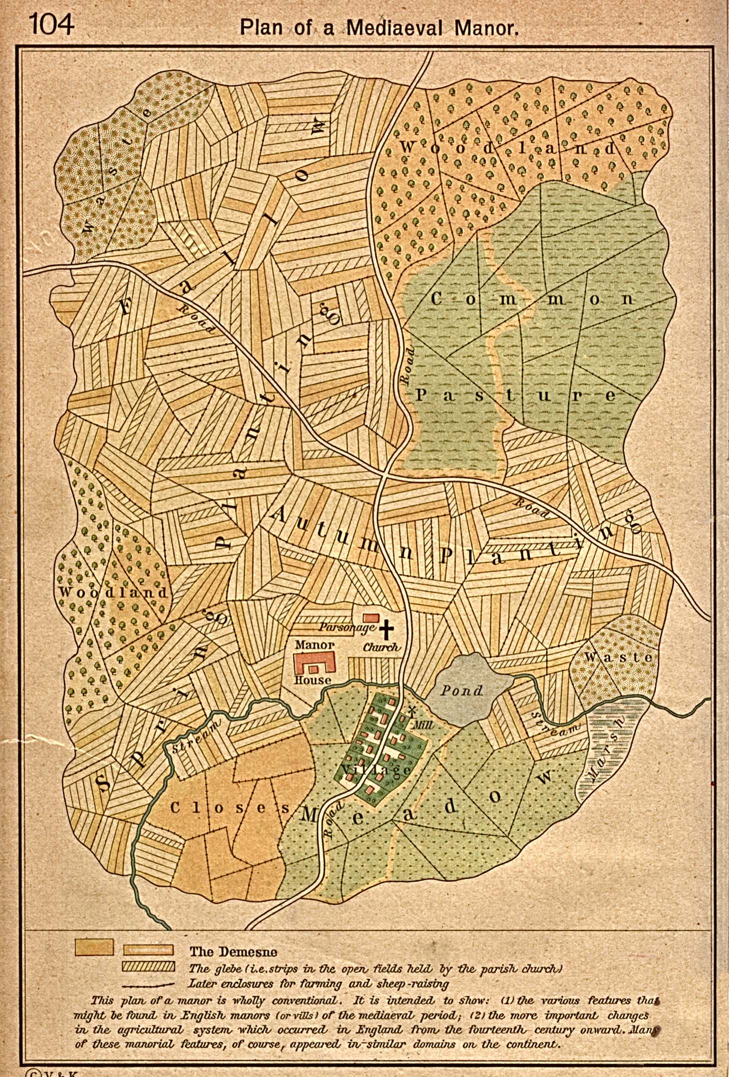
Plan of a Mediaeval Manor [p.104]
●
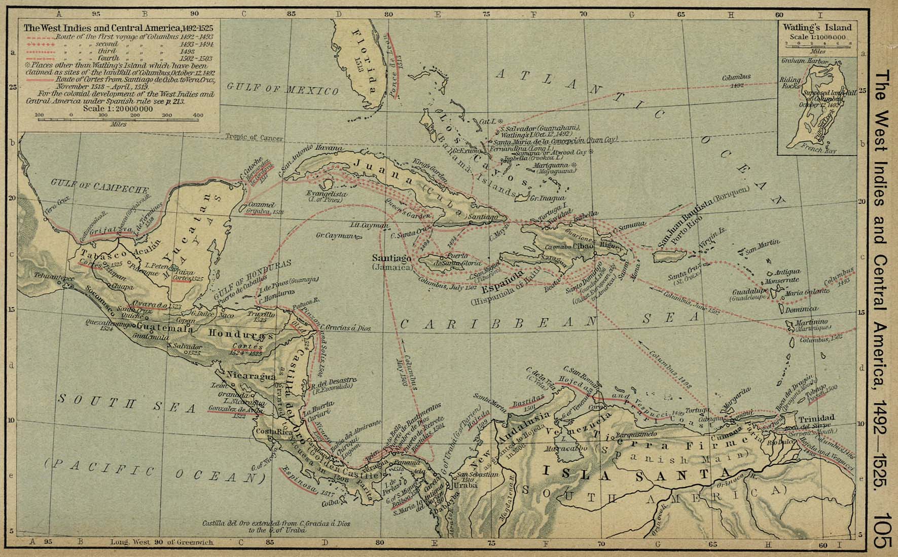
The West Indies and Central America, 1492-1525 [p.105]
Inset: Watling's
Island.
●
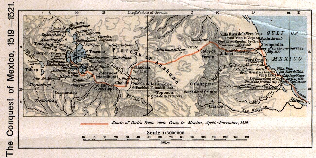
The Conquest of Mexico, 1519 - 1521 [p.106]
●
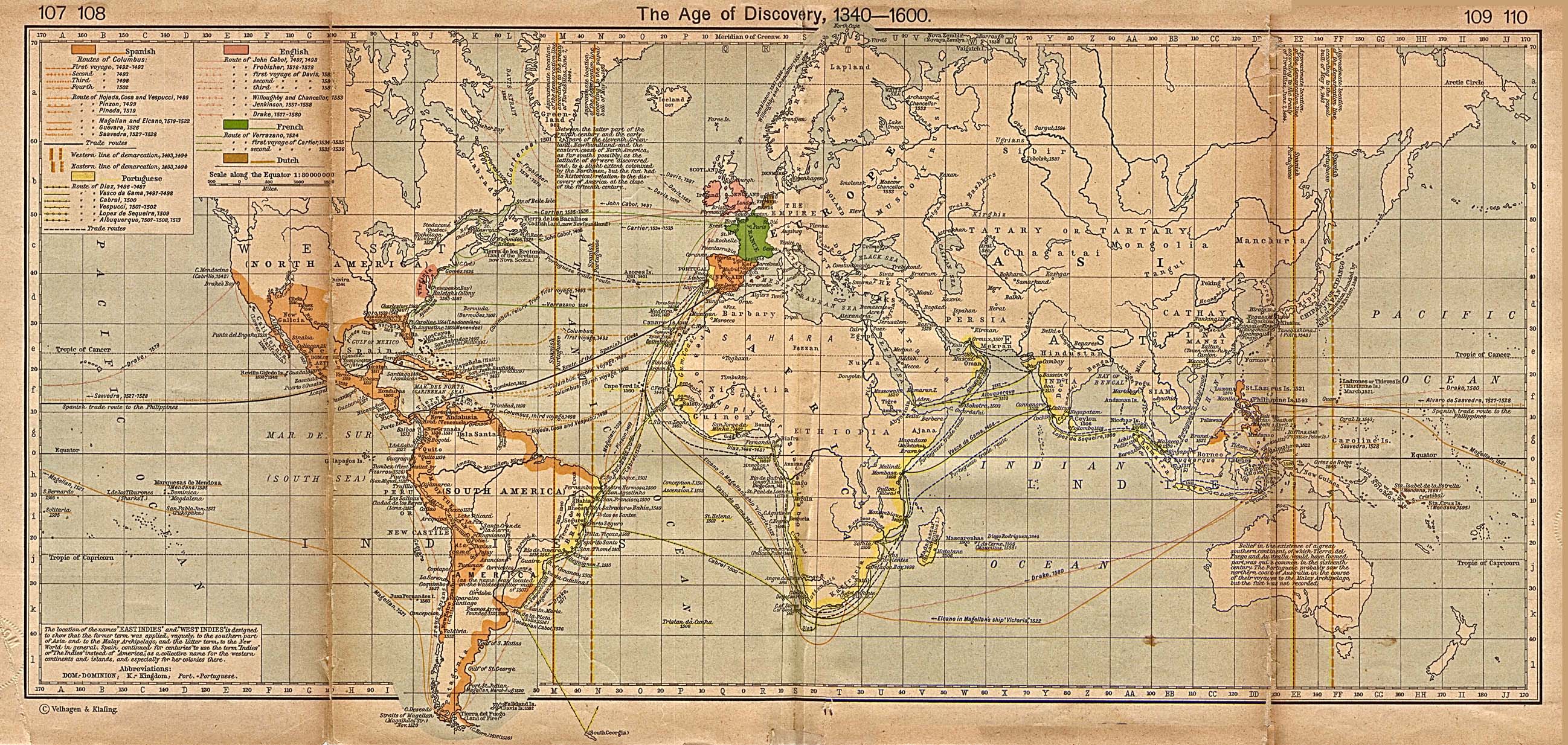
The Age of discovery 1340-1600 [p.107-108]
●
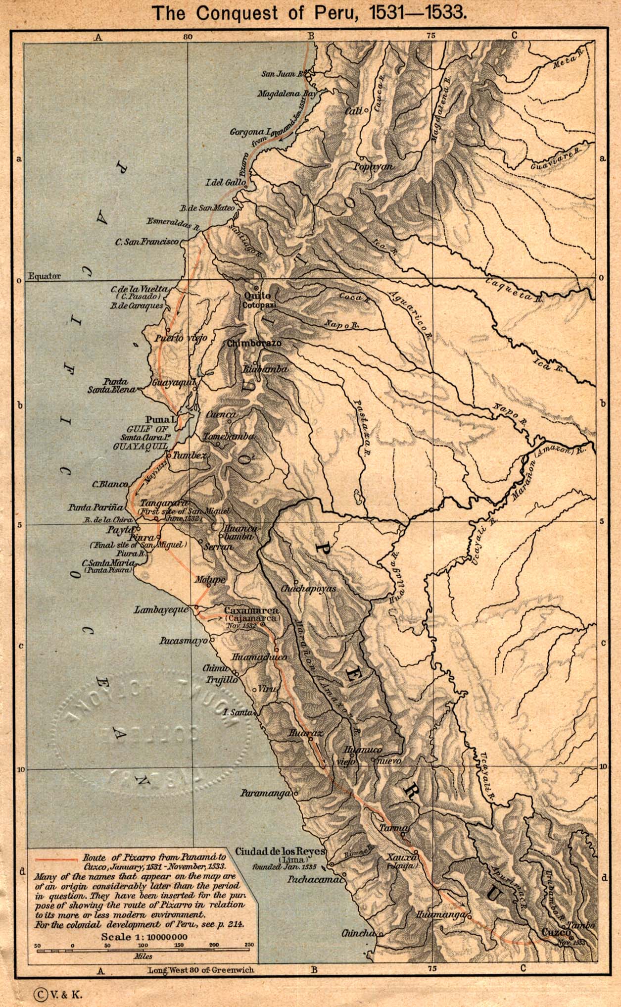
The Conquest of Peru, 1531 - 1533 [p.111]
●
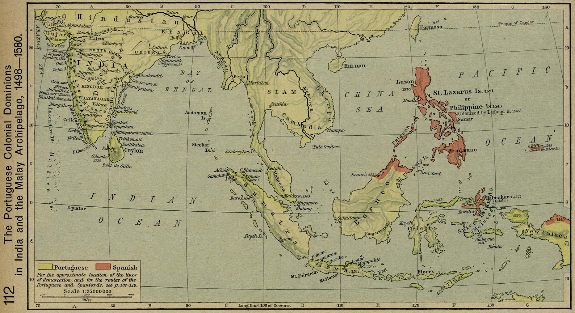
The Portuguese Colonial Dominions in India and the Malay
Archipelago, 1498-1580 [p.112]
●
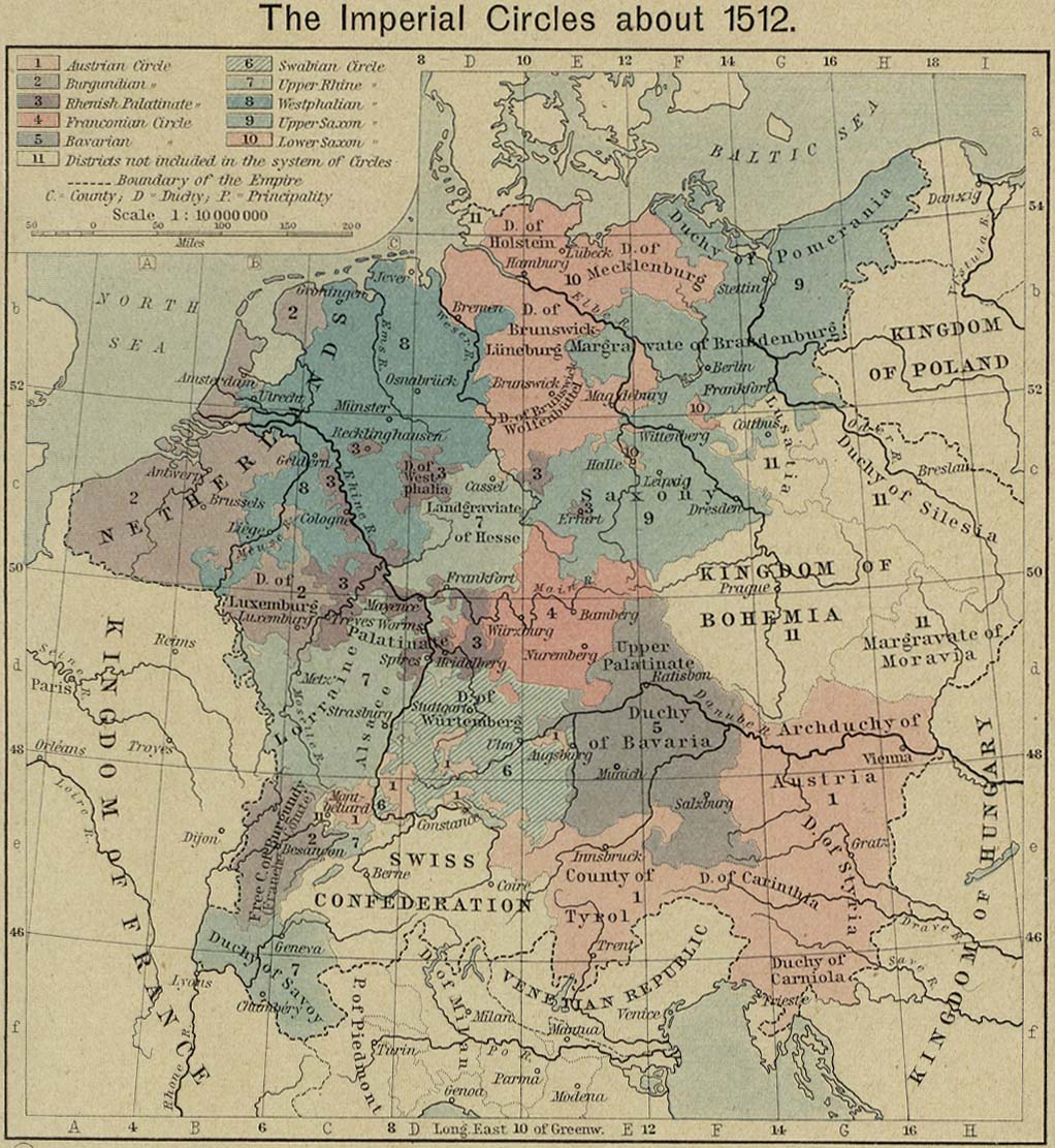
The Imperial Circles about 1512 [p.113]
●
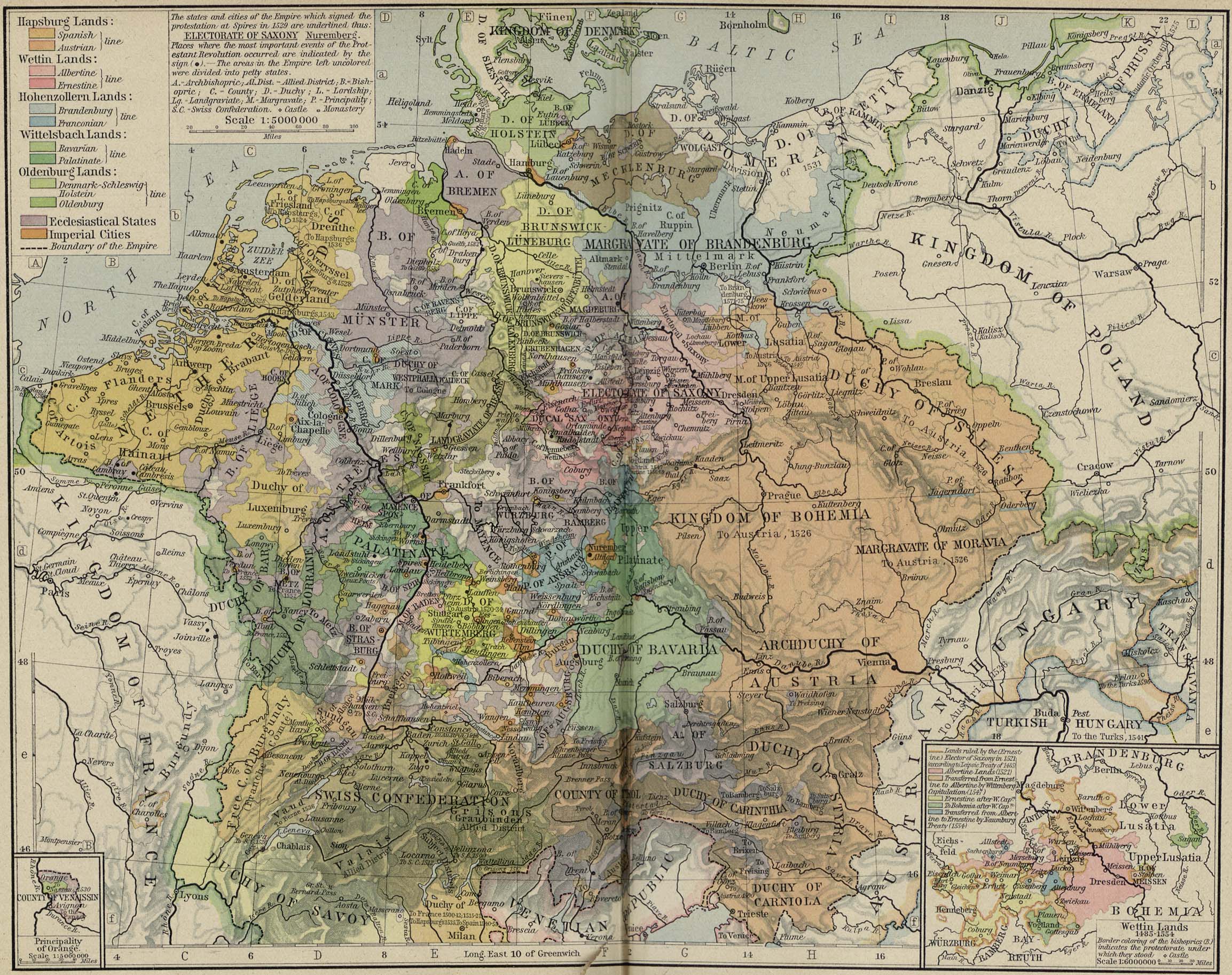
Central Europe about 1547 [p.114-115]
Insets: Principality
of Orange.
Wettin
Lands, 1485-1554.
●
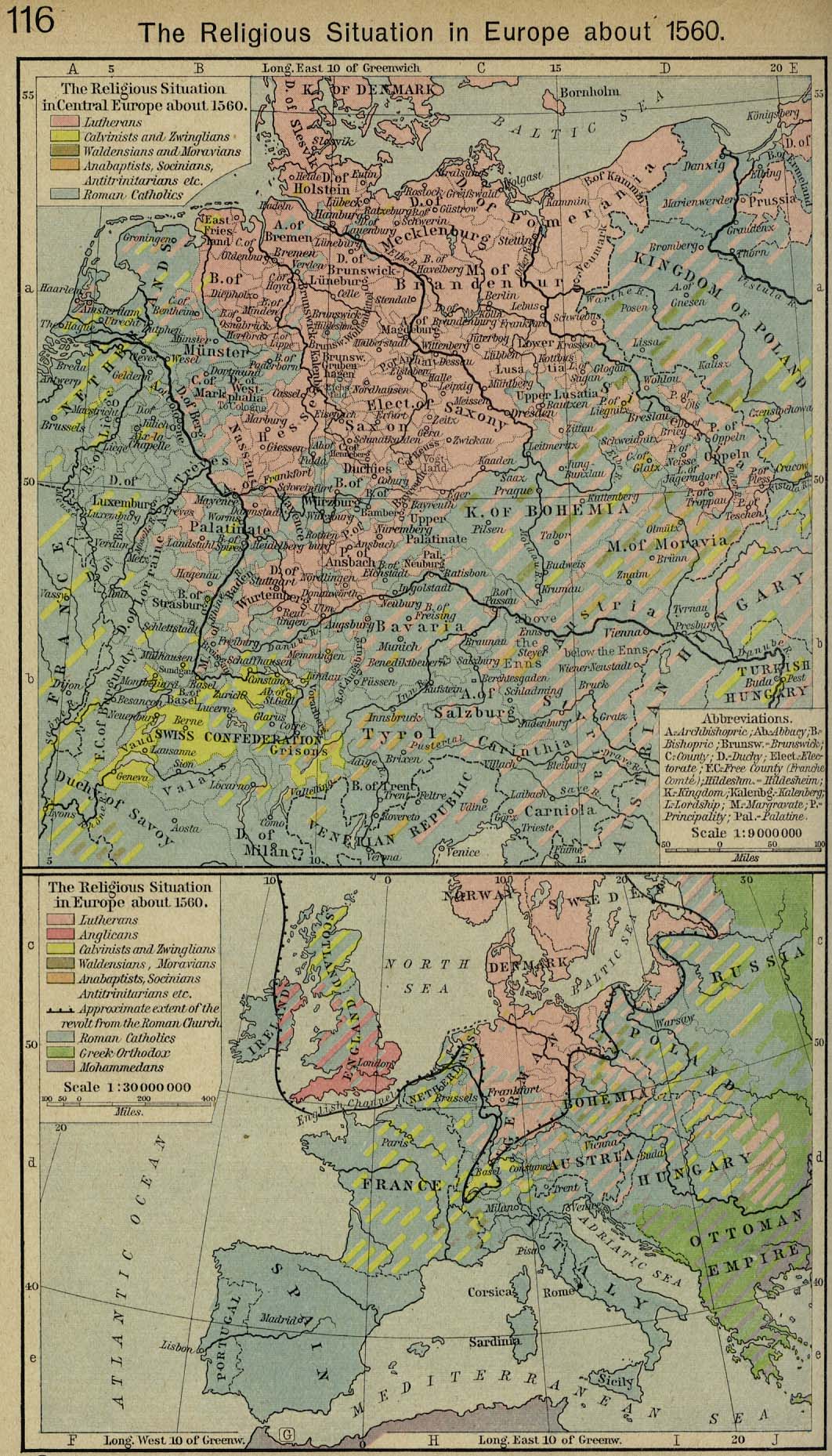
The Religious Situation in Europe about 1560 [p.116]
The
Religious Situation in Central Europe about 1560.
The
Religious Situation in Europe about 1560.
●
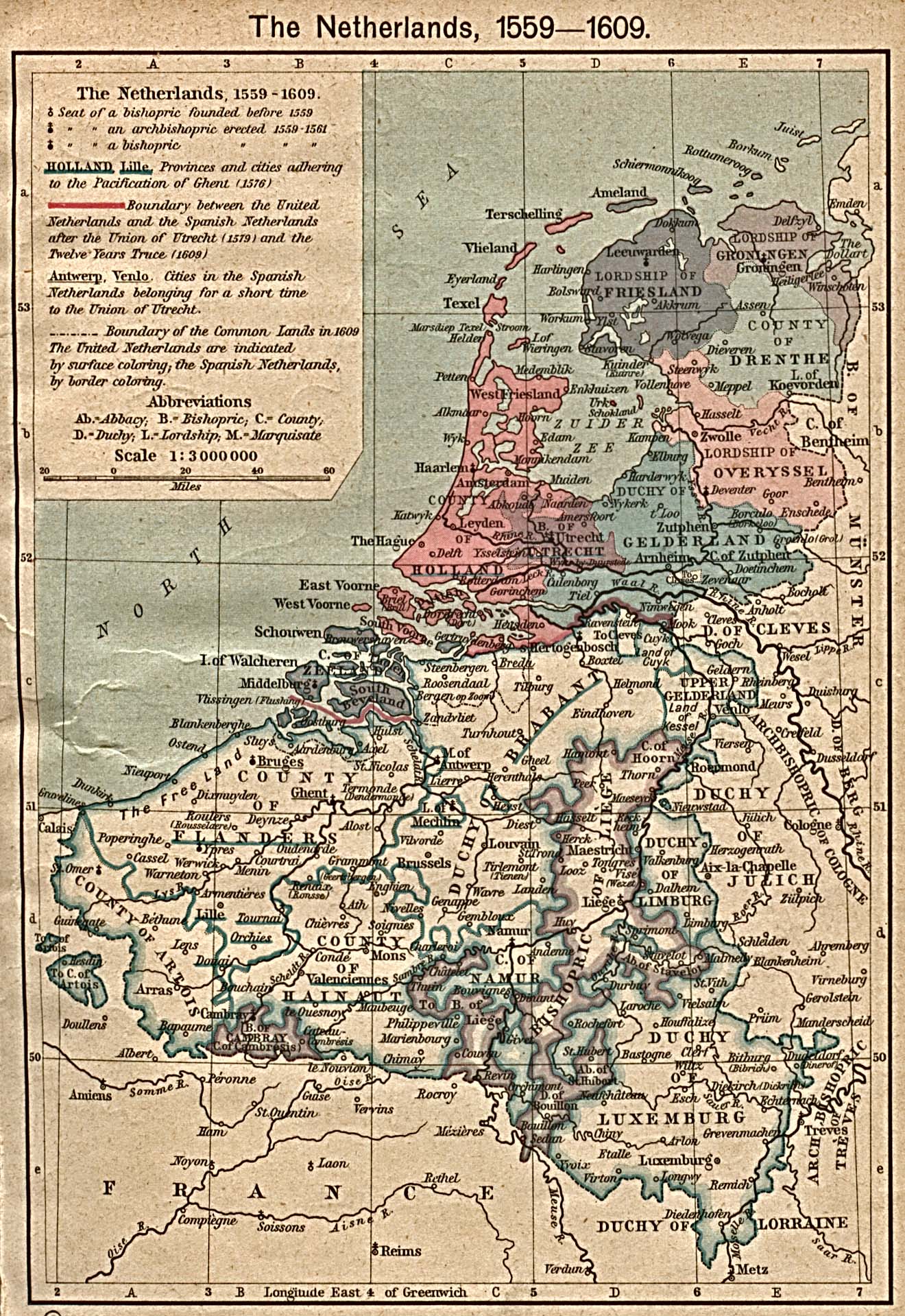
The Netherlands 1559-1609 [p.117]
●
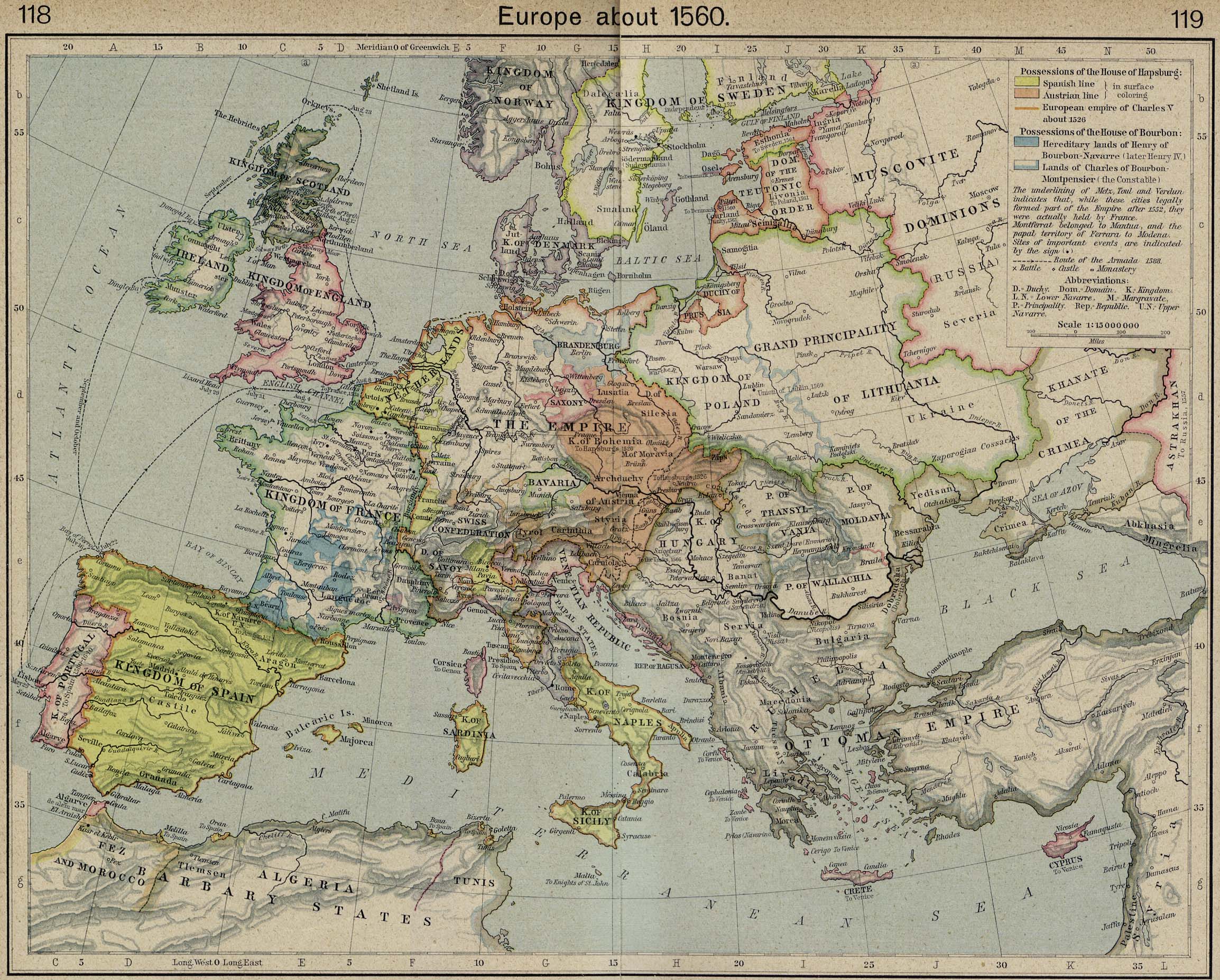
Europe about 1560 [p.118-119]
●
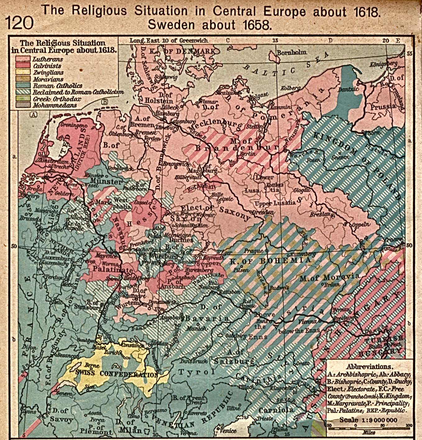
The Religious Situation in Central Europe about 1618 [p.120]
●
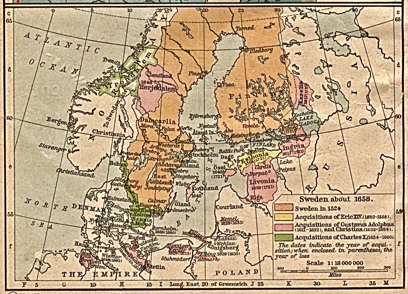
Sweden about 1658 [p.120]
●
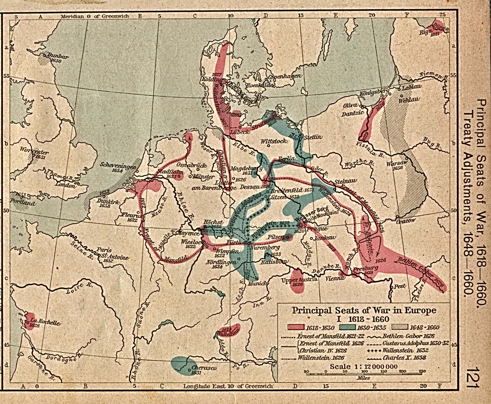
Principal Seats of War in Europe, I. 1618-1660 [p.121]
●
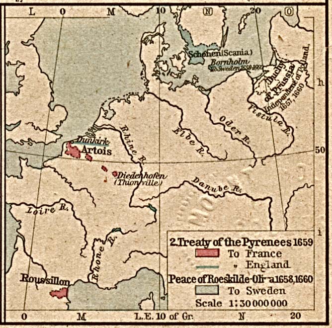
Treaty of the Pyrenees 1659 [p.121]
Treaty Adjustments, 1648-1660.
Treaty of
Pyrenees, 1659;
Peace of
Roeskilde-Oliva, 1658, 1660
●
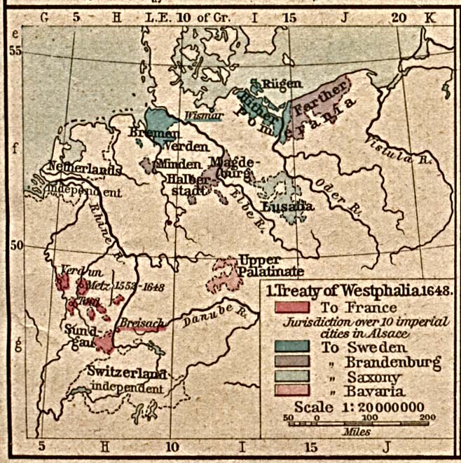
Treaty of Westphalia 1648 [p.121]
Treaty
Adjustments, 1648-1660.
Treaty of
Westphalia 1648.
●
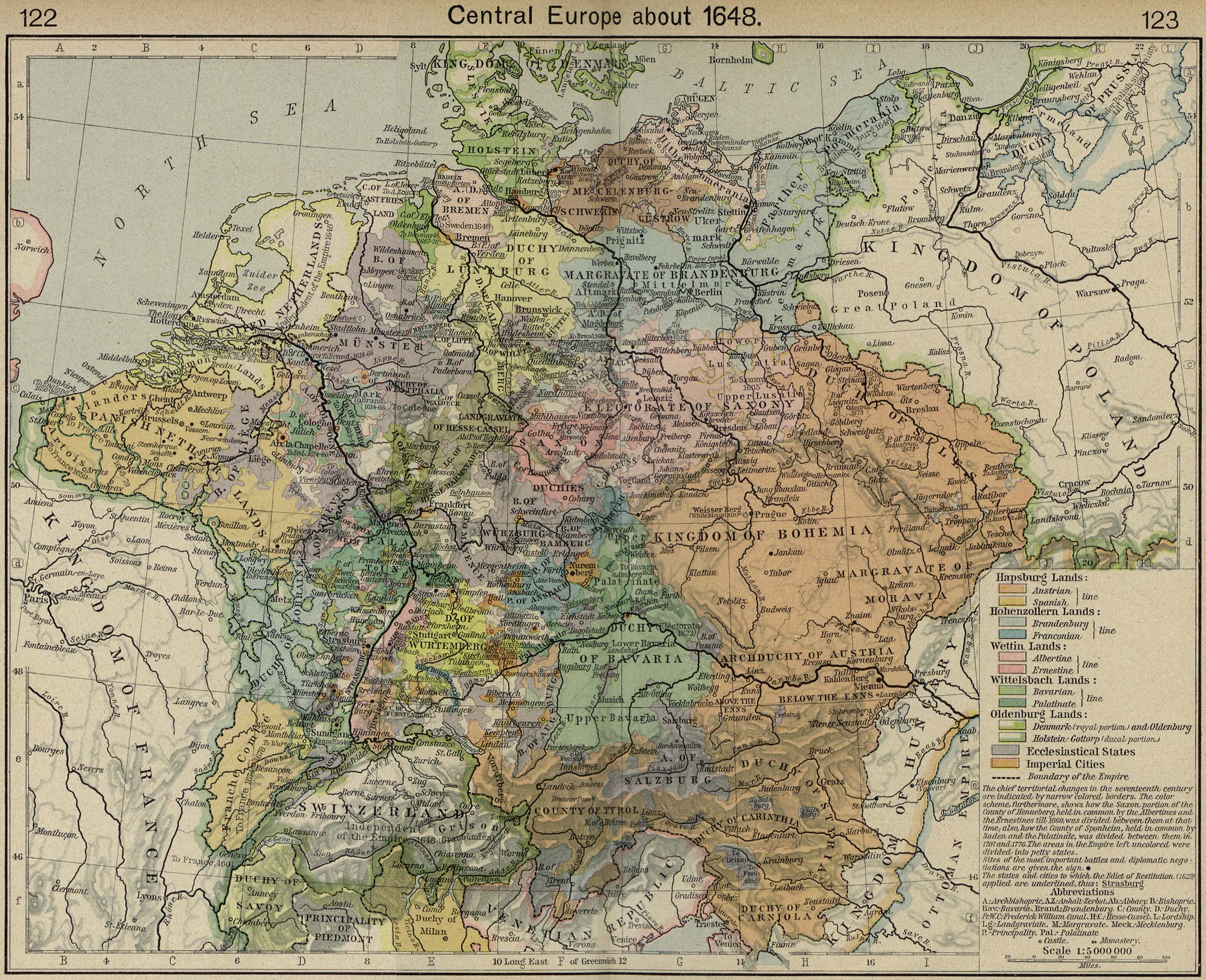
Central Europe about 1648 [p.122-123]
●
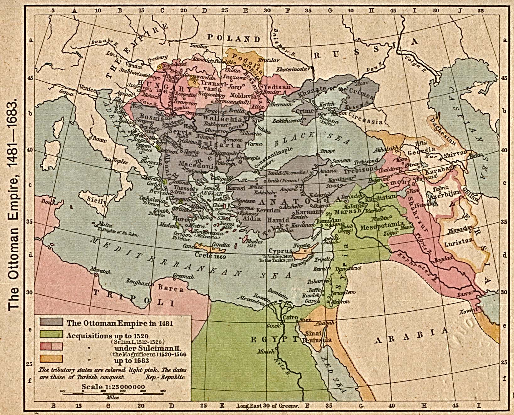
The Ottoman Empire, 1481-1683 [p.124]
●
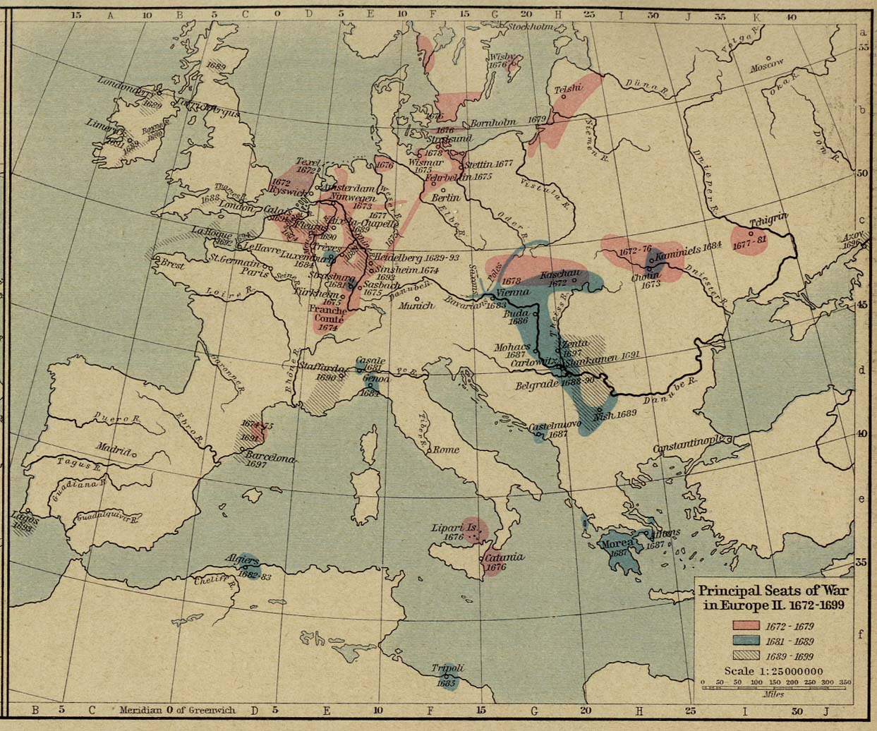
Principal Seats of War in Europe, II. 1672-1699 [p.125]
●
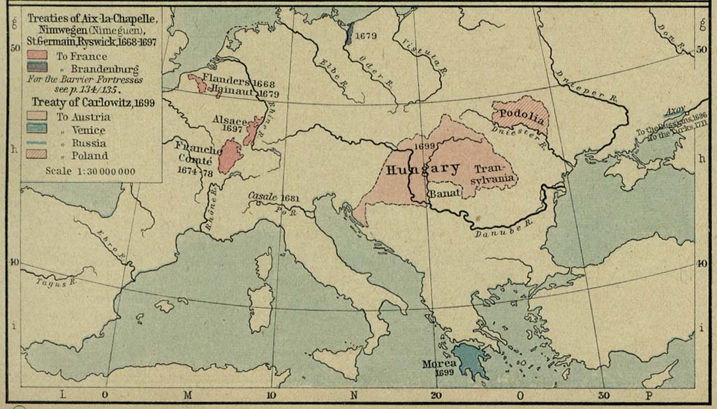
Treaty Adjustments, 1668-1699 [p.125]
Treaties of Aix-la-Chapelle, Nimwegen, St. Germain, Ryswick,
Carlowitz.
●
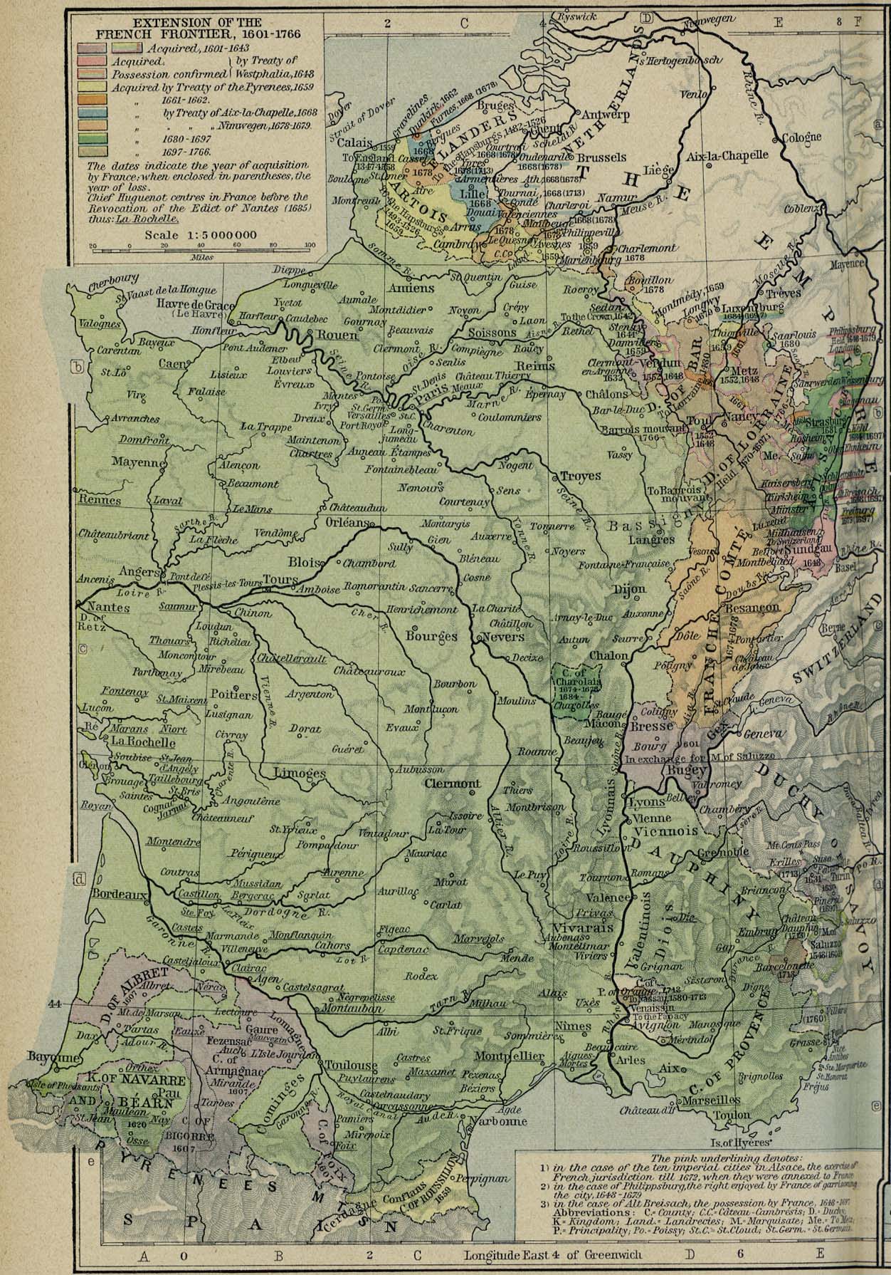
Extension of the French Frontiers, 1601-1766 [p.126]
●
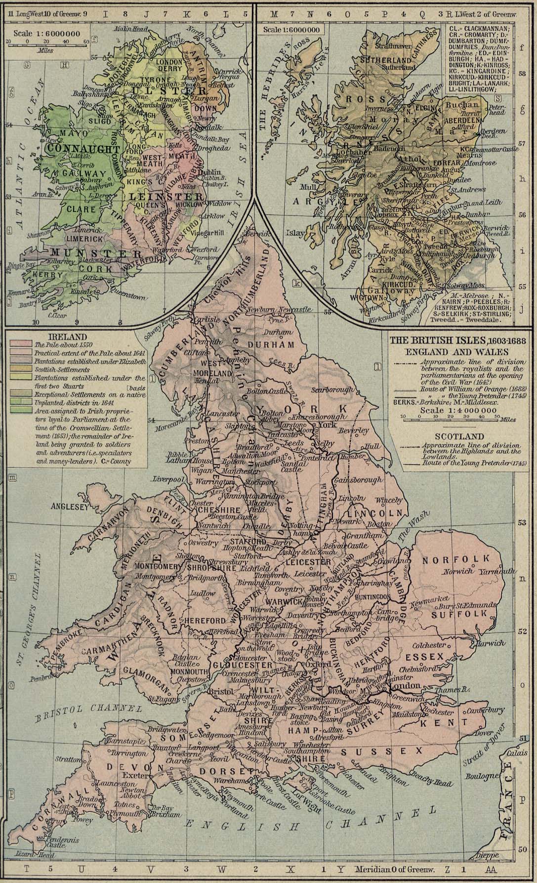
The British Isles, 1603-1688 [p.127]
●
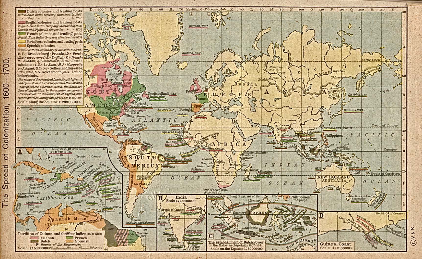
The Spread of Colonization, 1600-1700 [p.128]
Insets: Partition of
Guiana and the West Indies.
India.
The
Establishment of Dutch Power in the Malay Archipelago, 1602-1641.
Guinea
Coast.
●
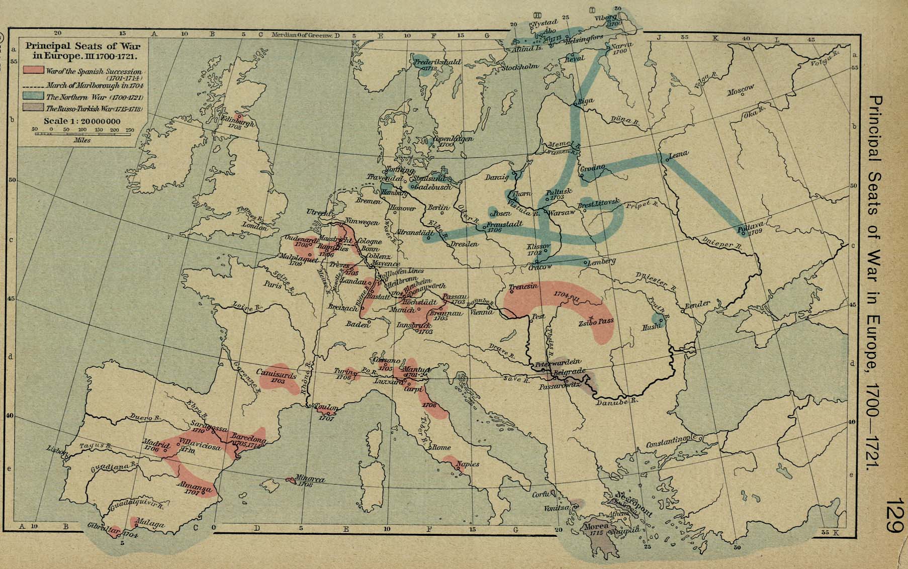
Principal Seats of War in Europe, III. 1700-1721 [p.129]
●
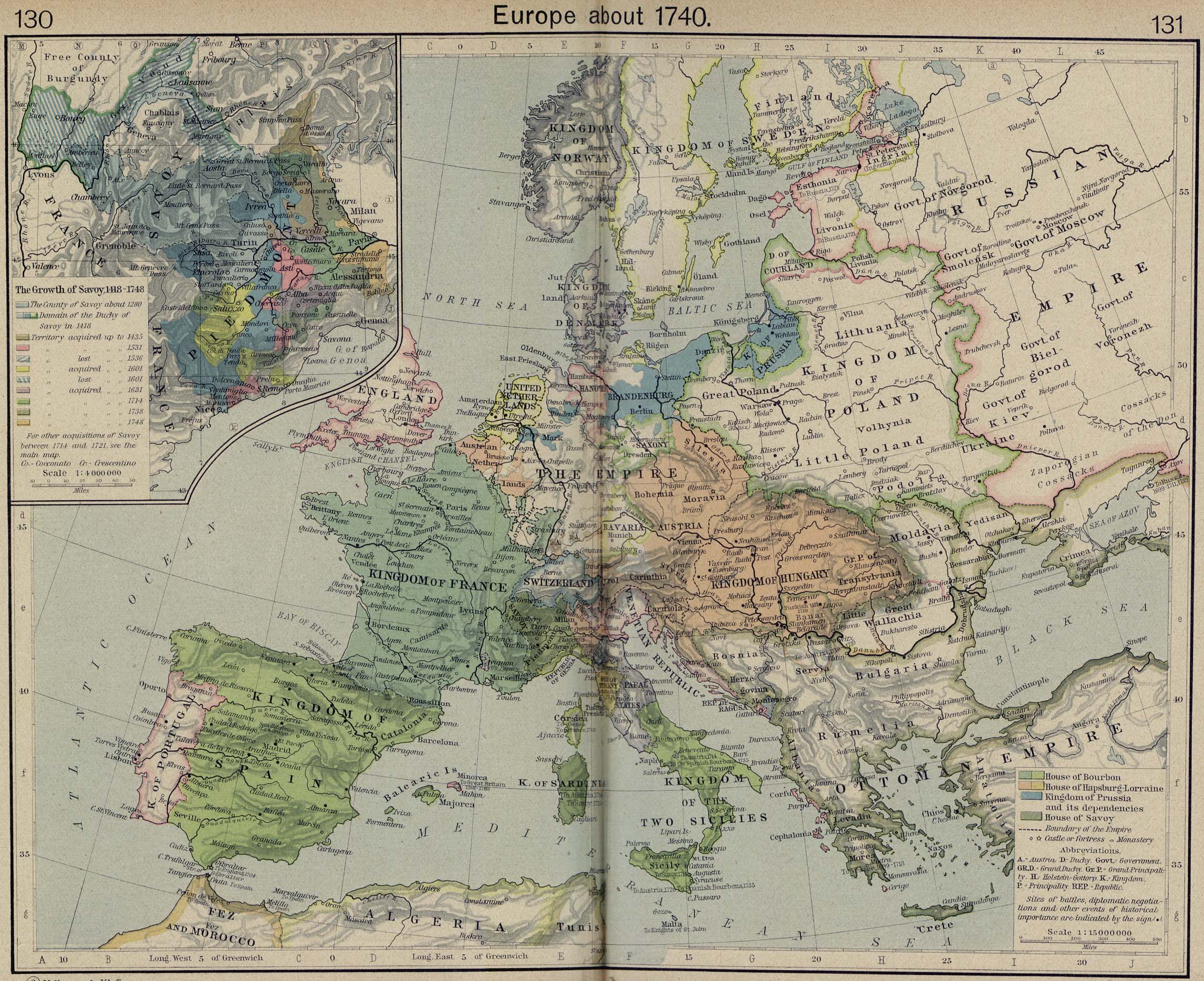
Europe about 1740 [p.130-131]
Inset: The Growth of
Savoy, 1418-1748.
●
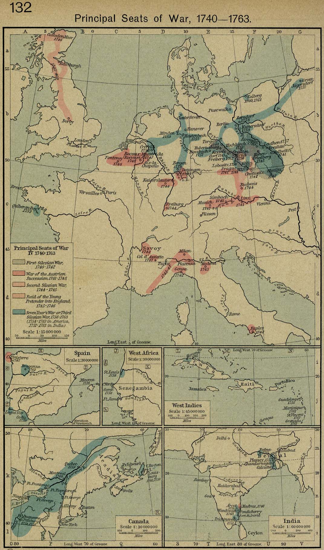
Principal Seats of War, IV. 1740-1763 [p.132]
Insets: Spain.
West
Africa.
West
Indies.
Canada.
India.
●
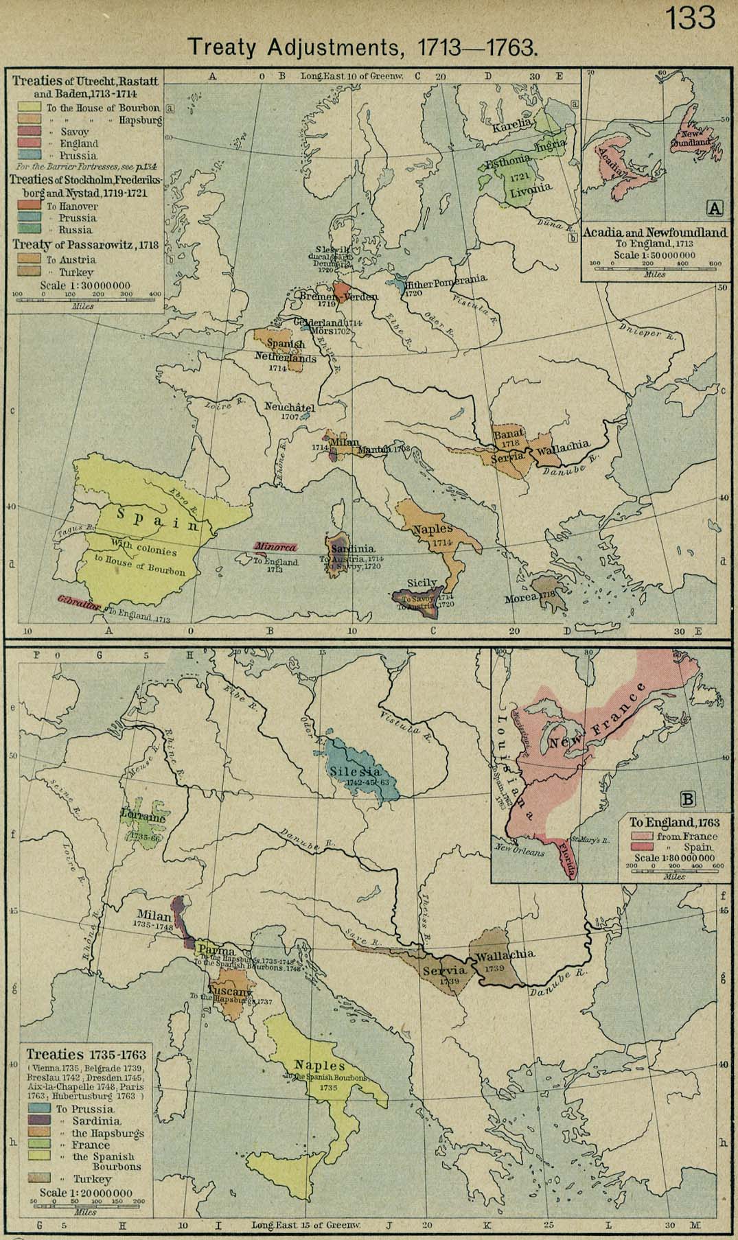
Treaty Adjustments, 1713-1763 [p.133]
Treaties
of Utrecht, Rastatt, Baden, Stockholm, Frederiksborg, Nystad,
Passarowitz, Vienna, Belgrade, Breslau, Dresden, Aix-la-Chapelle,
Paris,
Hubertusburg.
Insets: Acadia and
Newfoundland.
Eastern
North America.
●
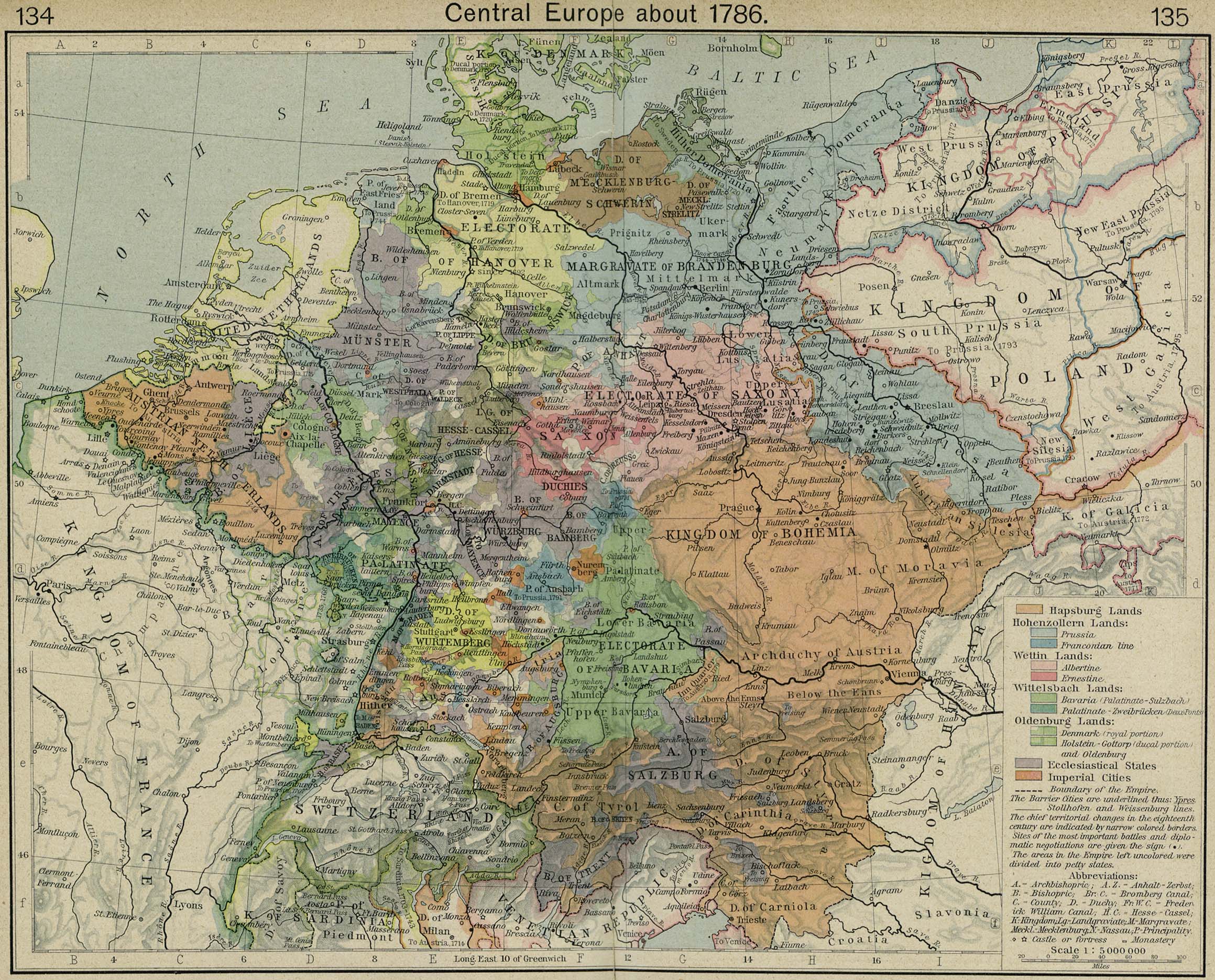
Central Europe about 1786 [p.134-135]
●
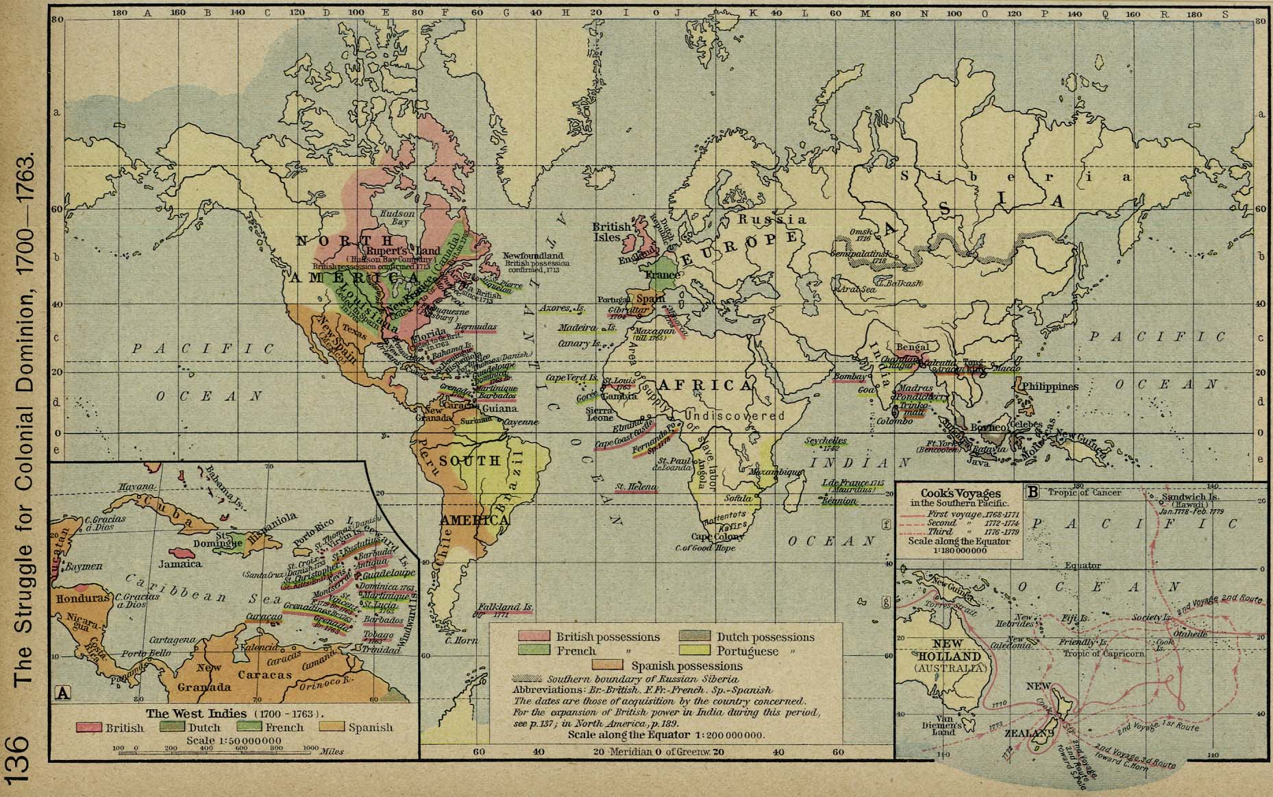
The Struggle for Colonial Dominion, 1700-1763 [p.136]
Insets: The West
Indies, 1700-1763.
Cook's
Voyages in the Southern Pacific.
●
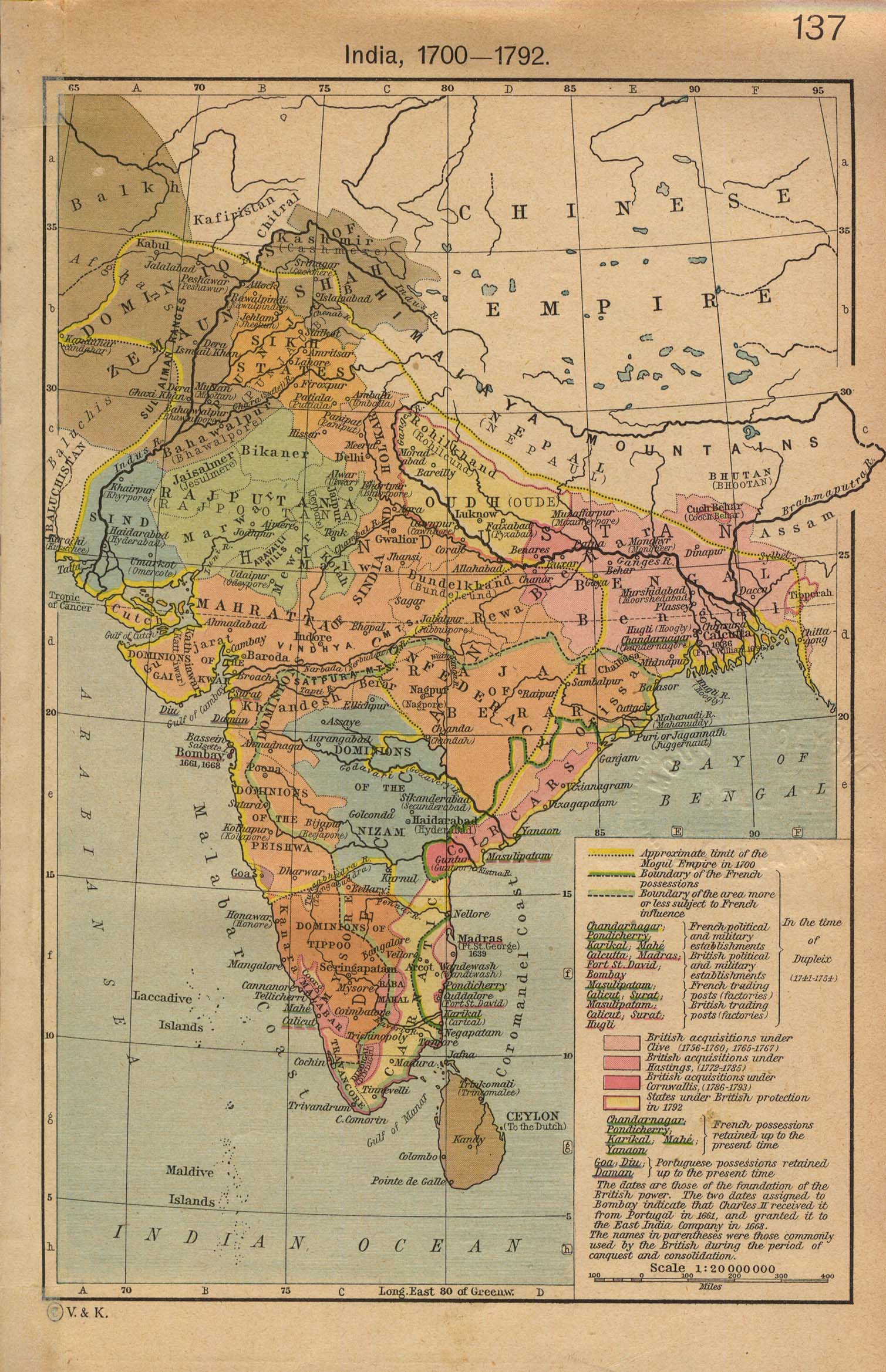
India, 1700-1792 [p.137]
●
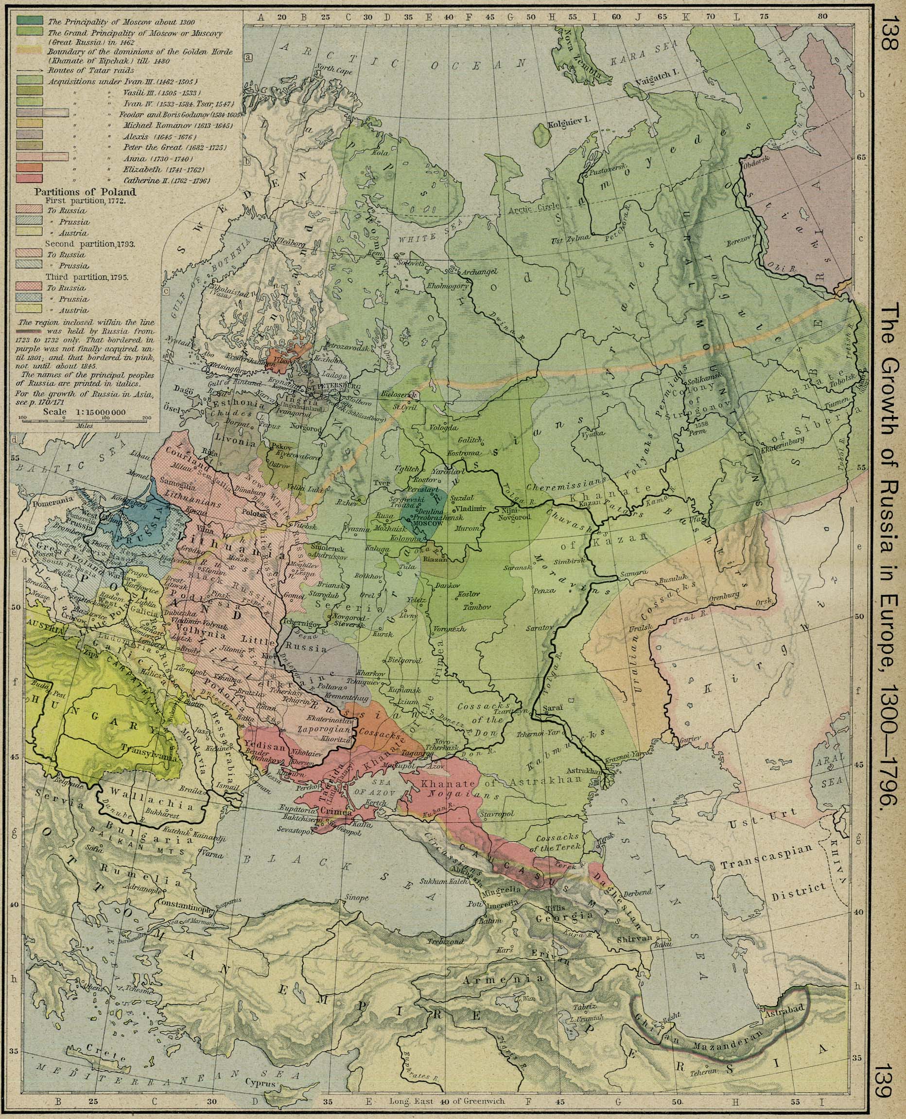
The Growth of Russia in Europe, 1300-1796 [p.138-139]
●
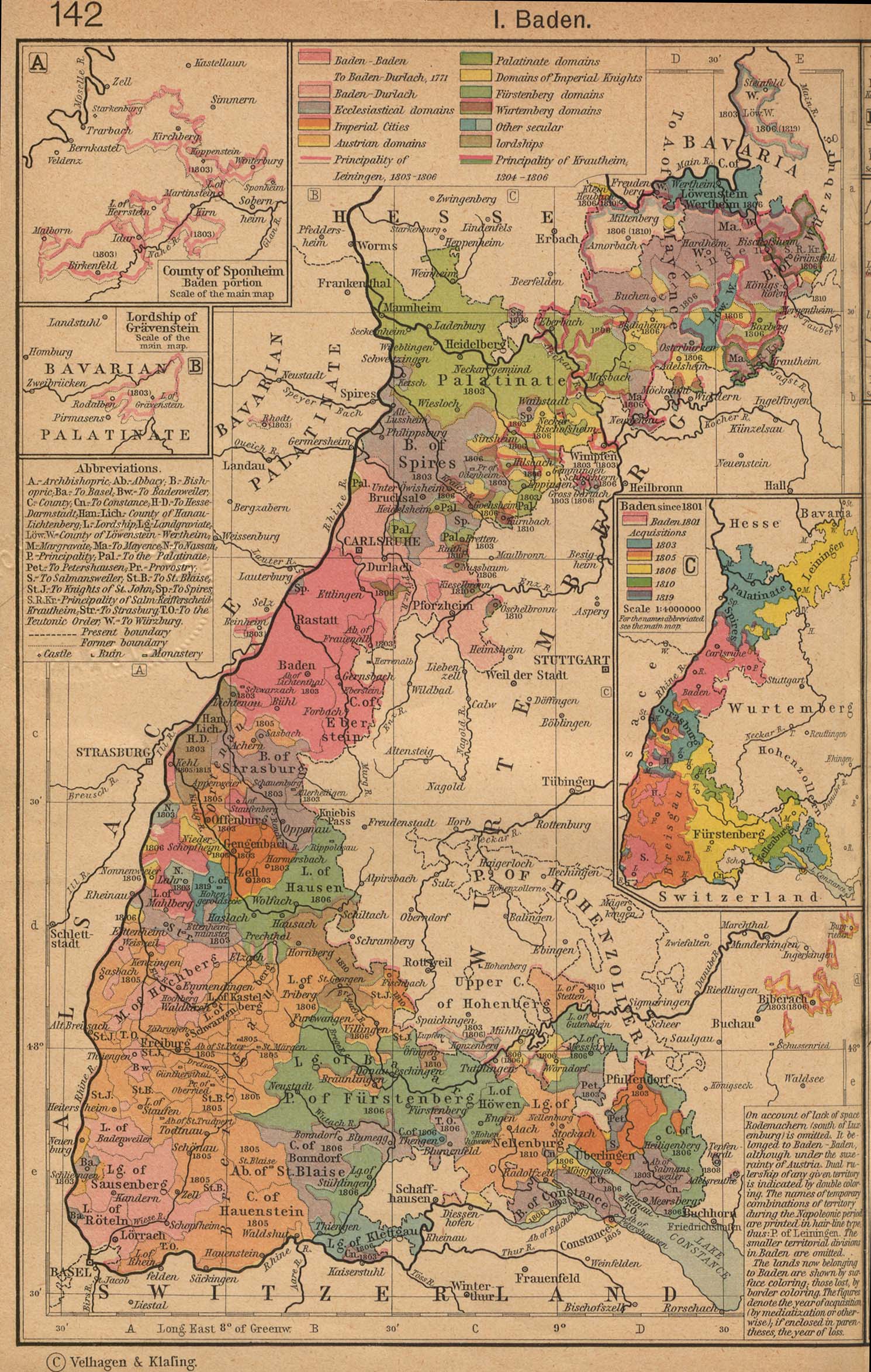
Typical German States Before and since the French Revolution: I.
Baden [p.142]
Insets: The County of
Sponheim.
Lordship
of Gravenstein.
Baden
since 1801.
●
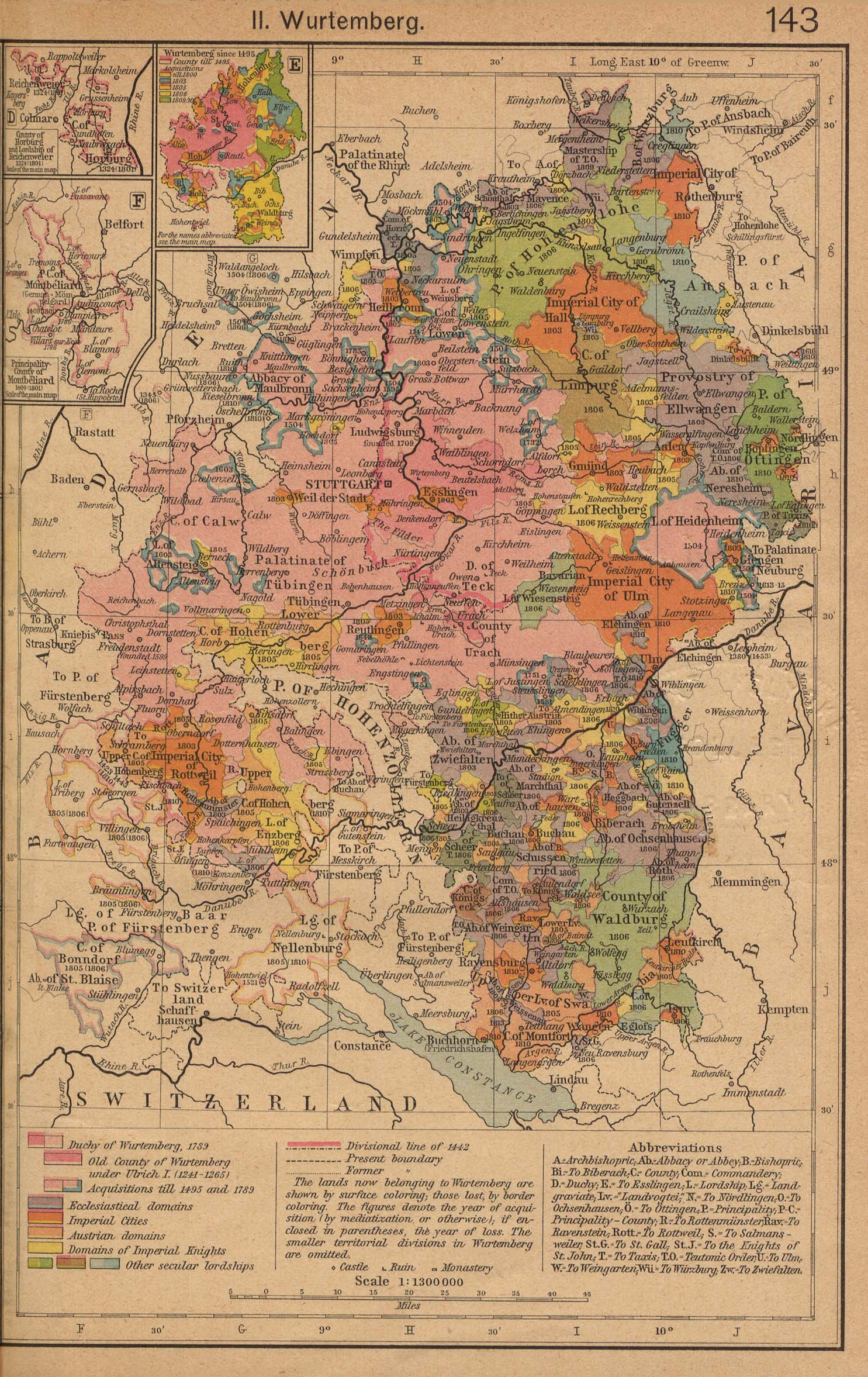
Typical German States Before and since the French Revolution: II.
Wurtemberg [p.143]
Insets: County of
Horburg and Lordship of Reichenweier.
Principality-County of Montbeliard.
Wurtemberg
since 1495.
●
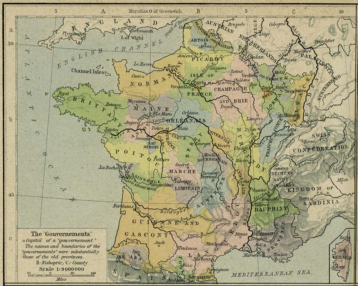
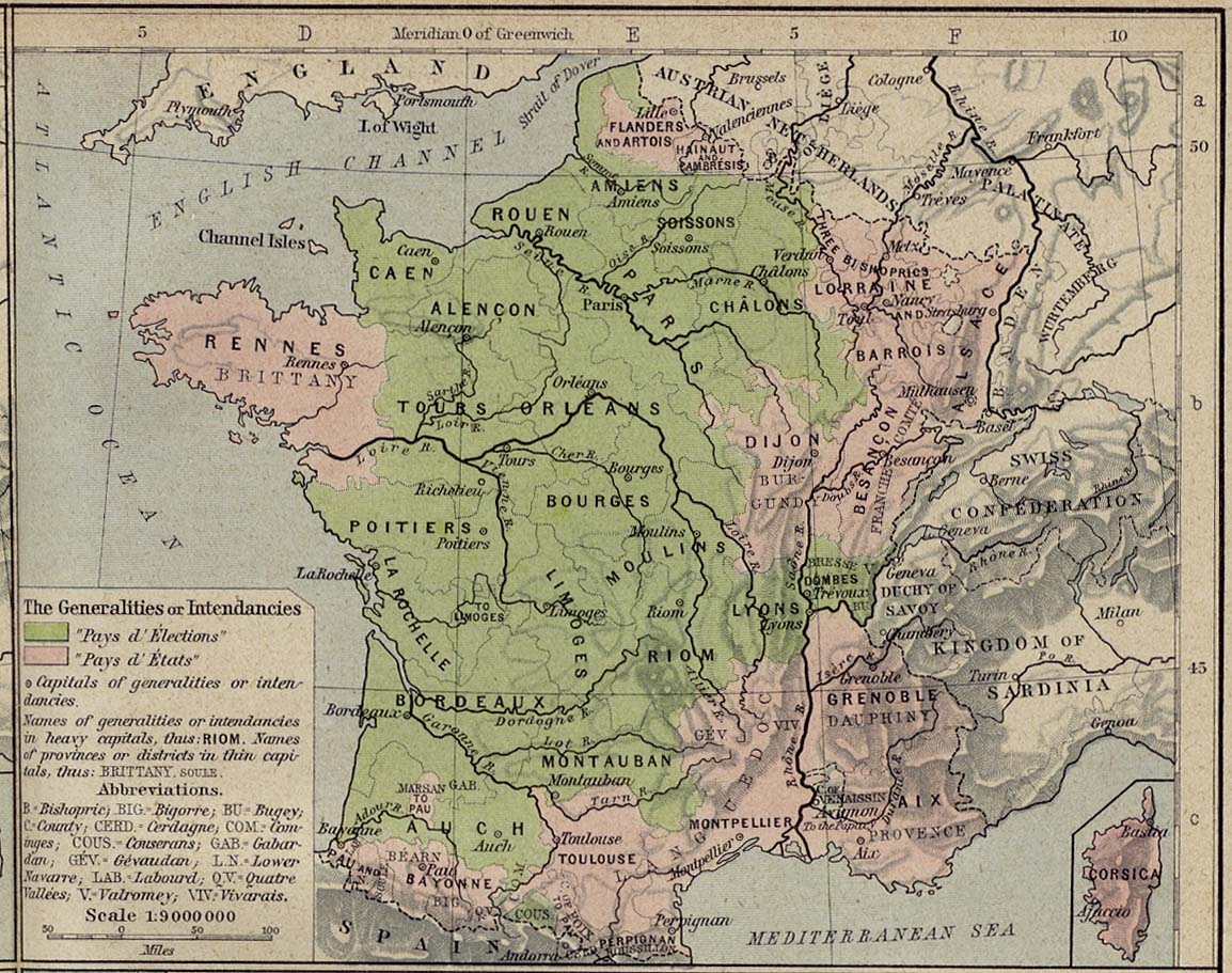
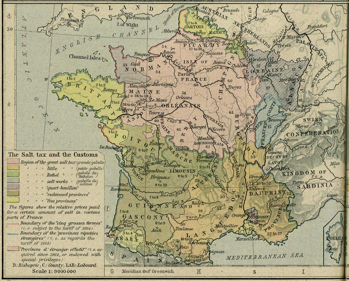
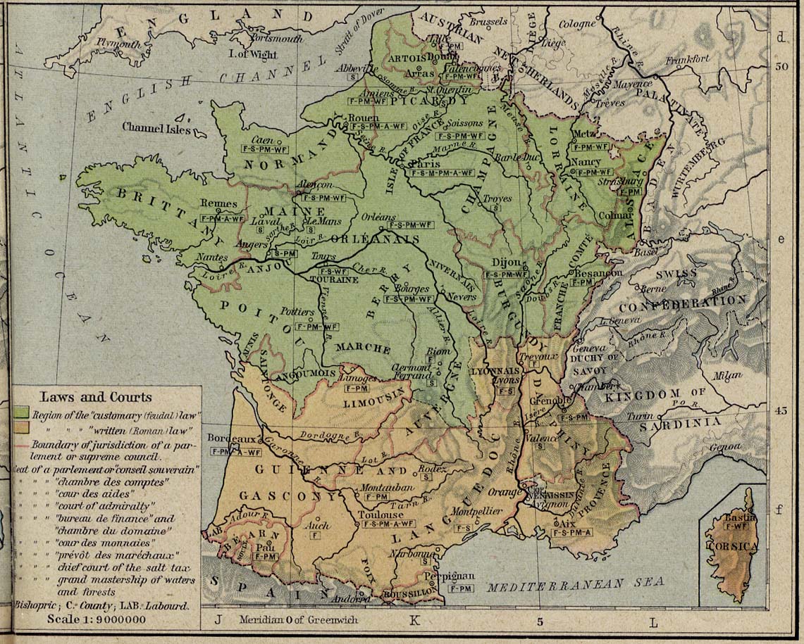
France in 1789:
The "Gouvernements"The
Generalities or Intendancies
The Salt TaxLaws
and Courts[p.146-147]
●
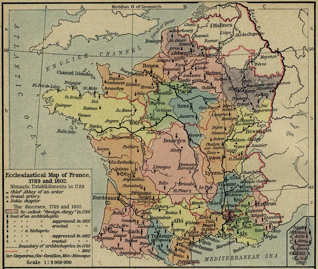
Ecclesiastical Map of France, 1789 and 1802 [p.148]
●
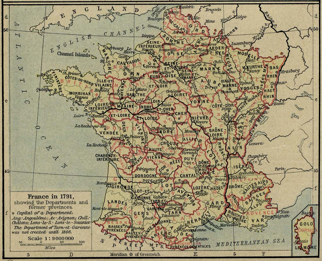
France in 1791 [p.148]
●
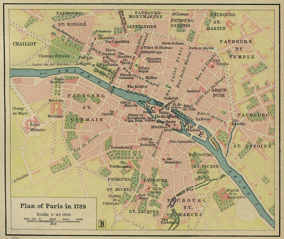
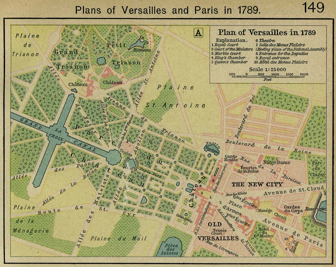
Plans of
Paris and
Versailles [p.149]
●
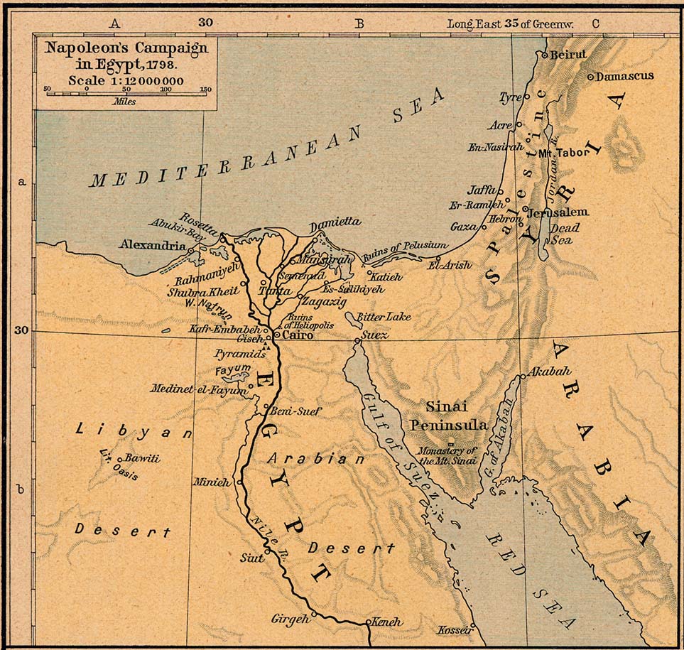
Napoleon's Campaign in Egypt, 1798 [p.150]
●
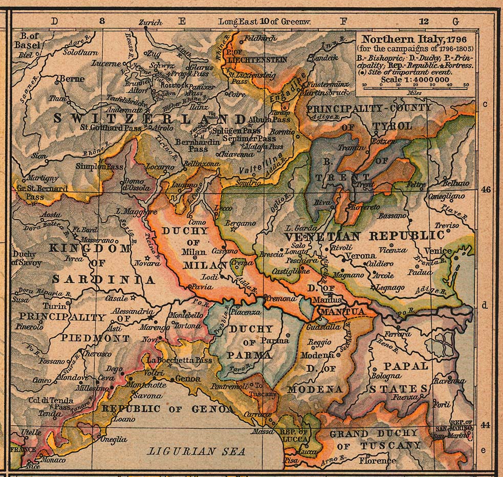
Northern Italy, 1796 (for the campaigns of 1796-1805) [p.150]
●
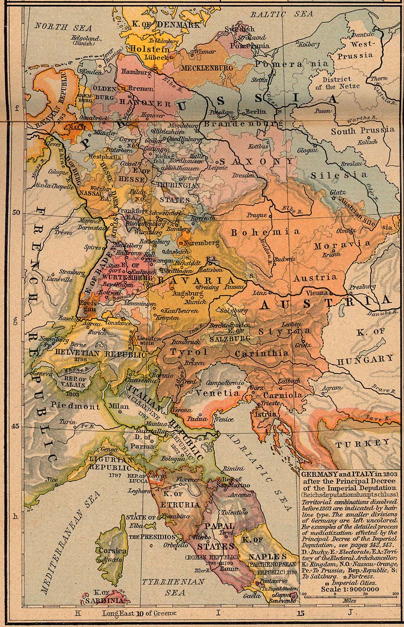
Germany and Italy in 1803 [p.151]
●
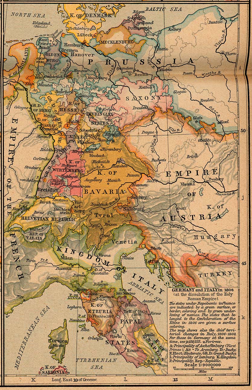
Germany and Italy in 1806 [p.151]
●
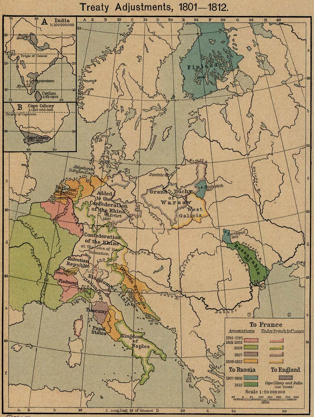
Treaty Adjustments, 1801-1812 [p.152]
Insets: India.
Cape
Colony.
●
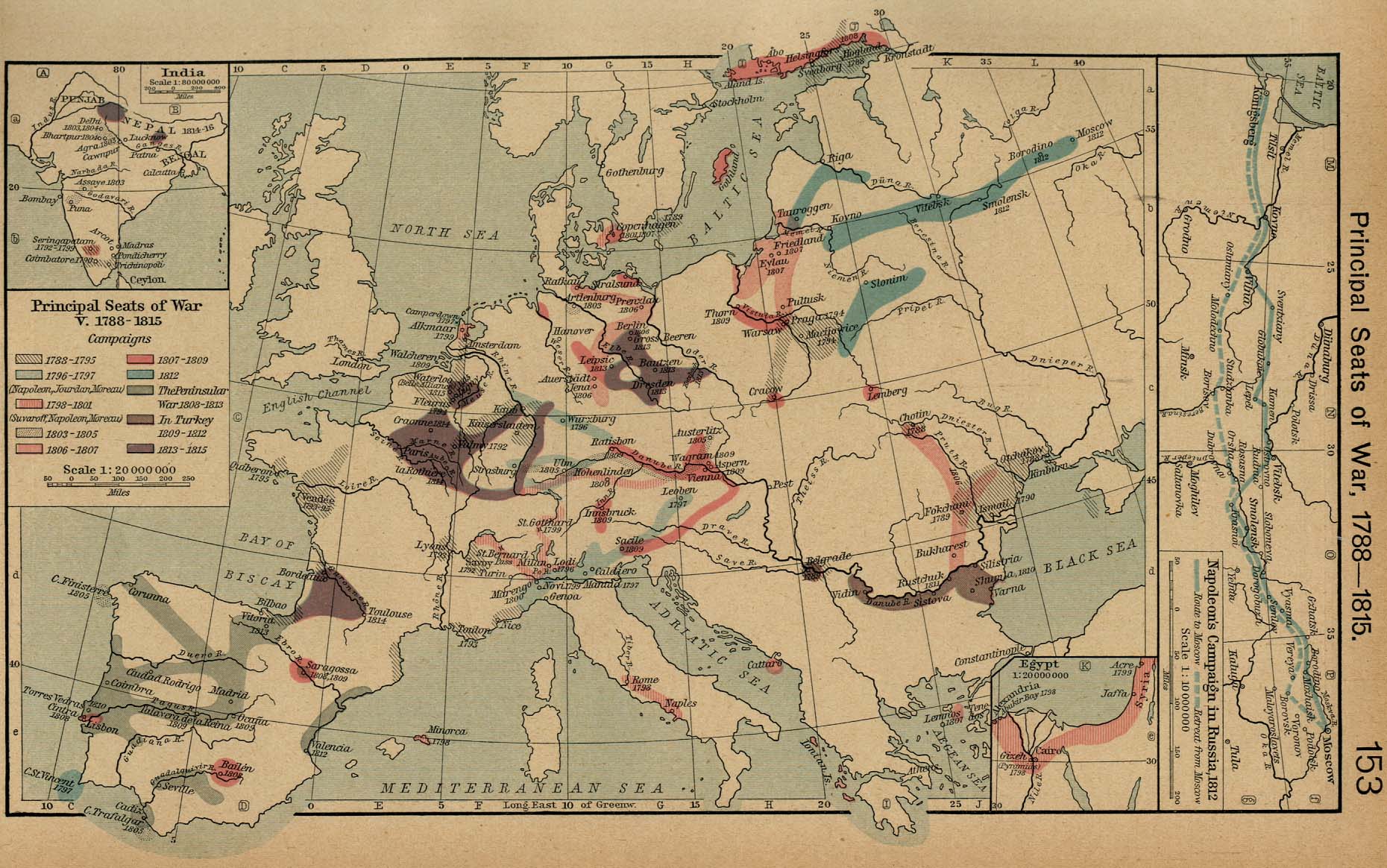
Principal Seats of War, V. 1788-1815 [p.153]
Insets: India. Egypt.
Napoleon's
Campaign in Russia, 1812.
●
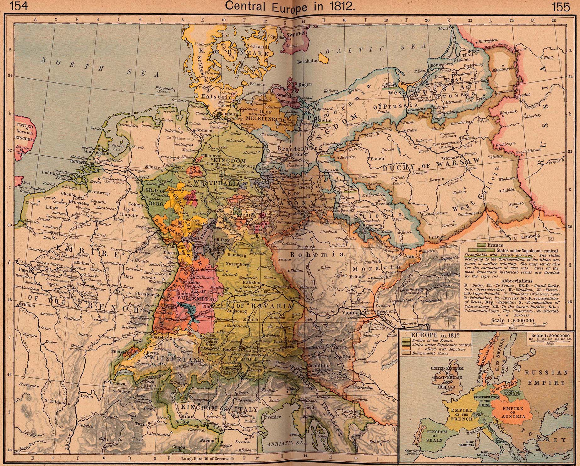
Central Europe in 1812 [p.154-155]
Inset: Europe in
1812.
●
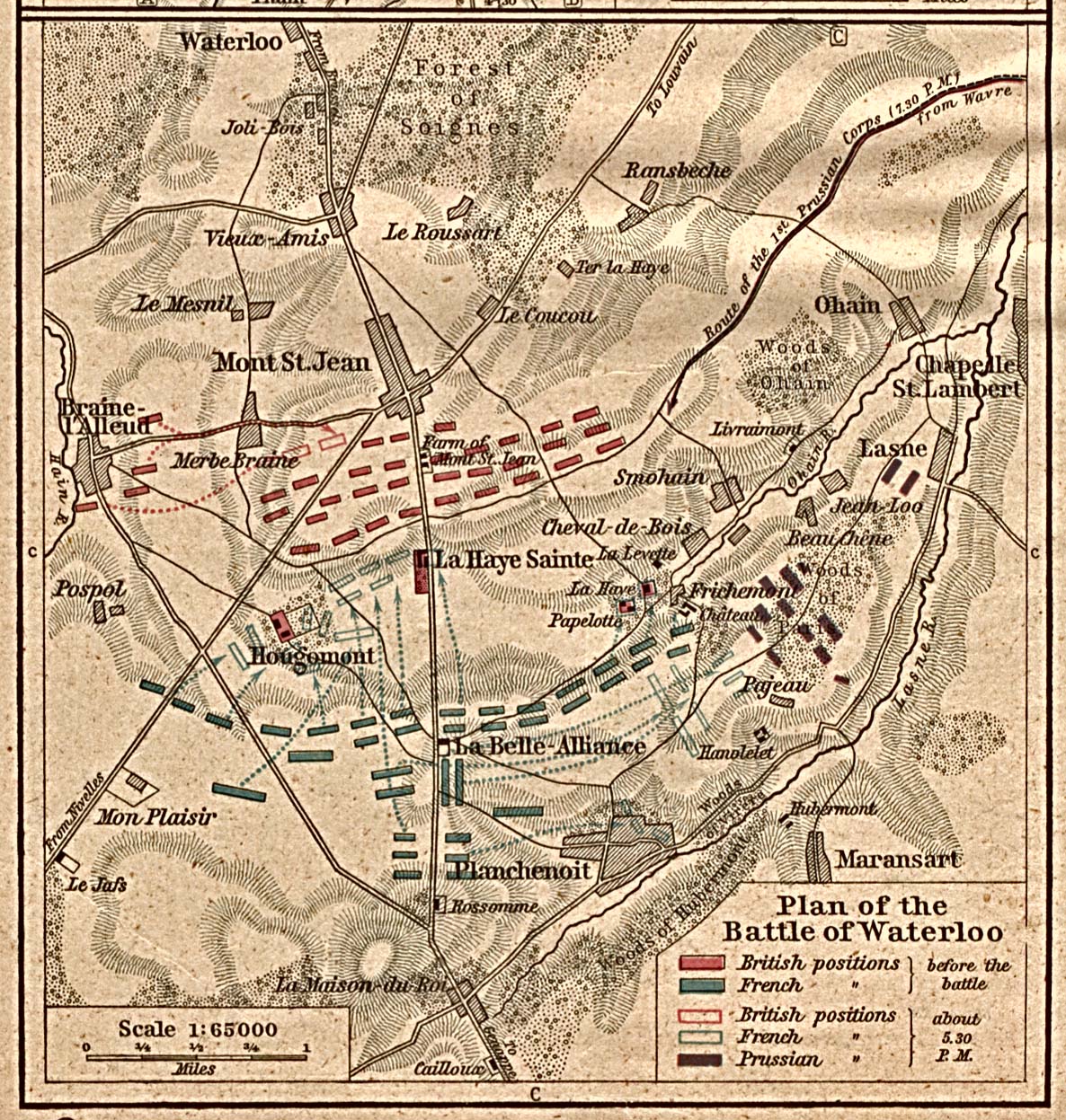
Plan of the Battle of Waterloo [p.156]
●
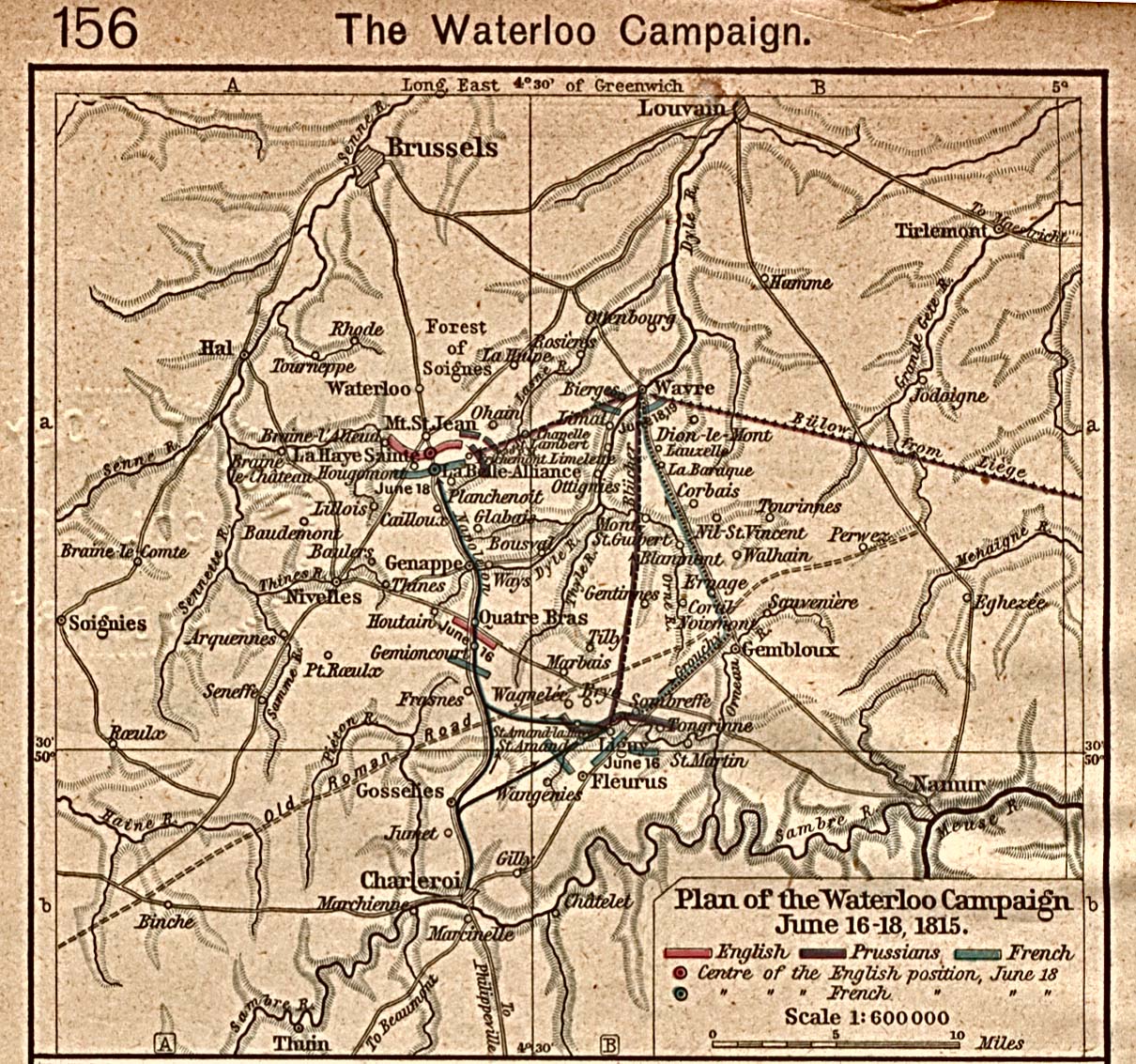
Plan of the Waterloo Campaign, June 16-18, 1815 [p.156]
●
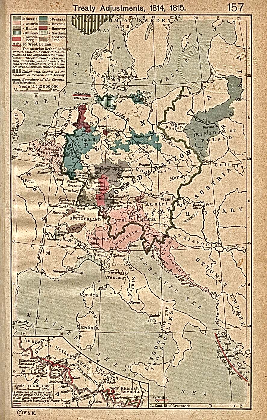
Treaty adjustments, 1814,1815 [p.157]
Inset: Fortresses
along the French Frontier.
●
Central Europe, 1815-1866 [p.158-159]
●
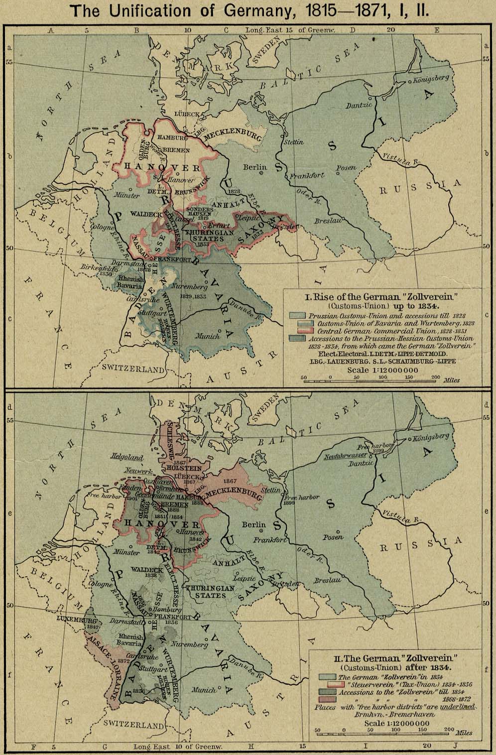
The Unification of Germany, 1815-1871 [p.160]
I. Rise of
the German "Zollverein" (Customs-Union) up to 1834.
II. The
German "Zollverein" (Customs-Union) after 1834.
●
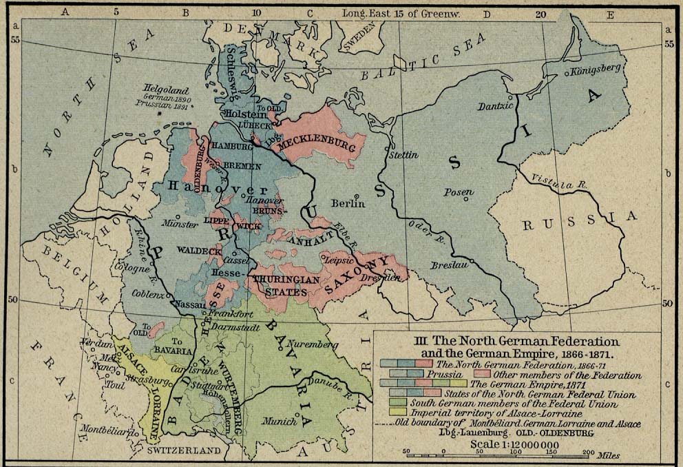
The Unification of Germany, 1815-1871 [p.161]
III. The
North German Federation and the German Empire 1866-1871.
●
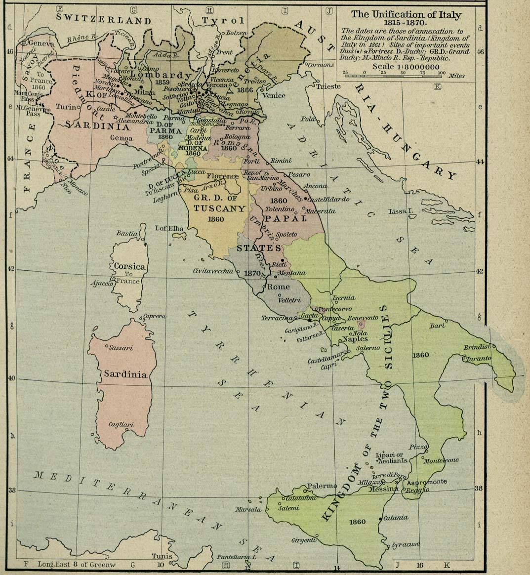
The Unification of Italy, 1815-1870 [p.161]
●
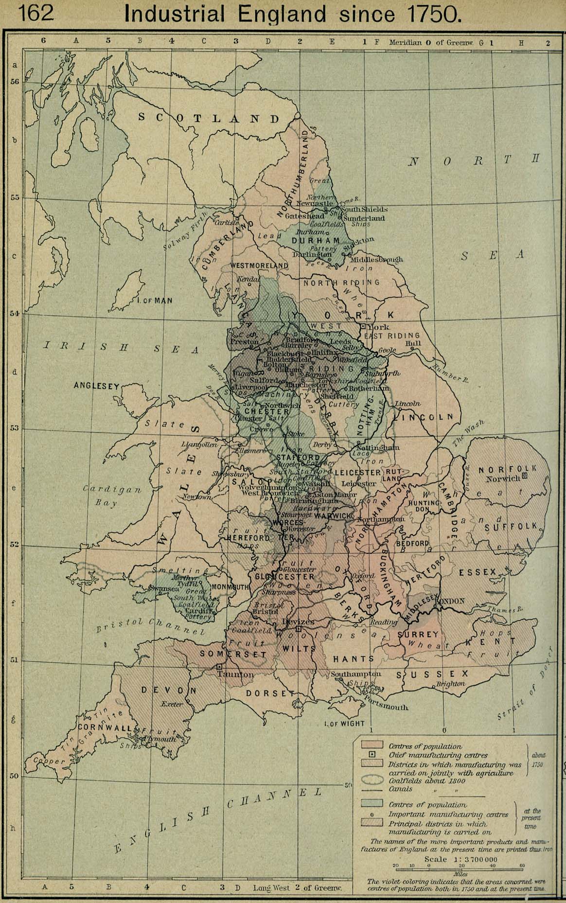
Industrial England since 1750 [p.162]
●
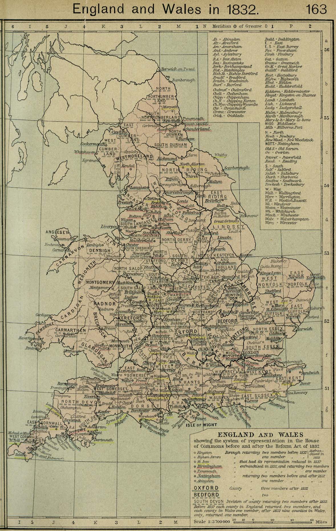
England and Wales in 1832 [p.163]
●
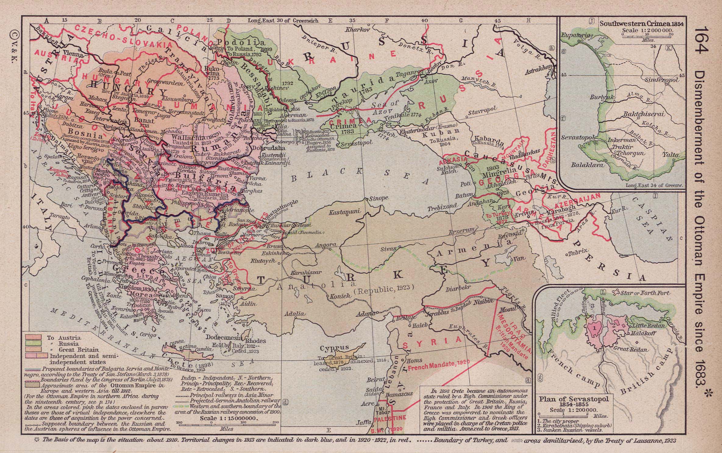
Dismemberment of the Ottoman Empire since 1683 [p.164]
Insets: Southwestern
Crimea, 1854.
Plan of
Sevastopol, 1854-1855.
●
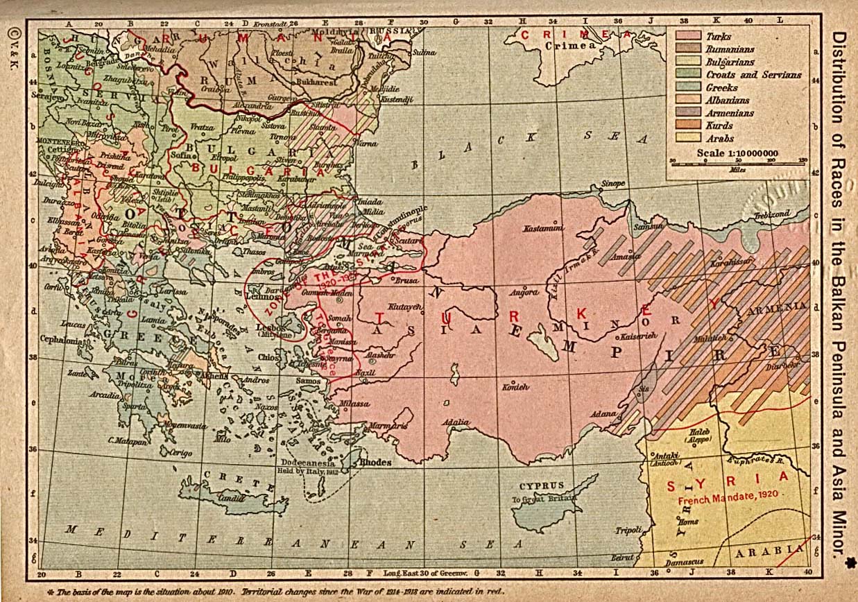
Distibution of Races in the Balkan Peninsula and Asia Minor
[p.165]
●
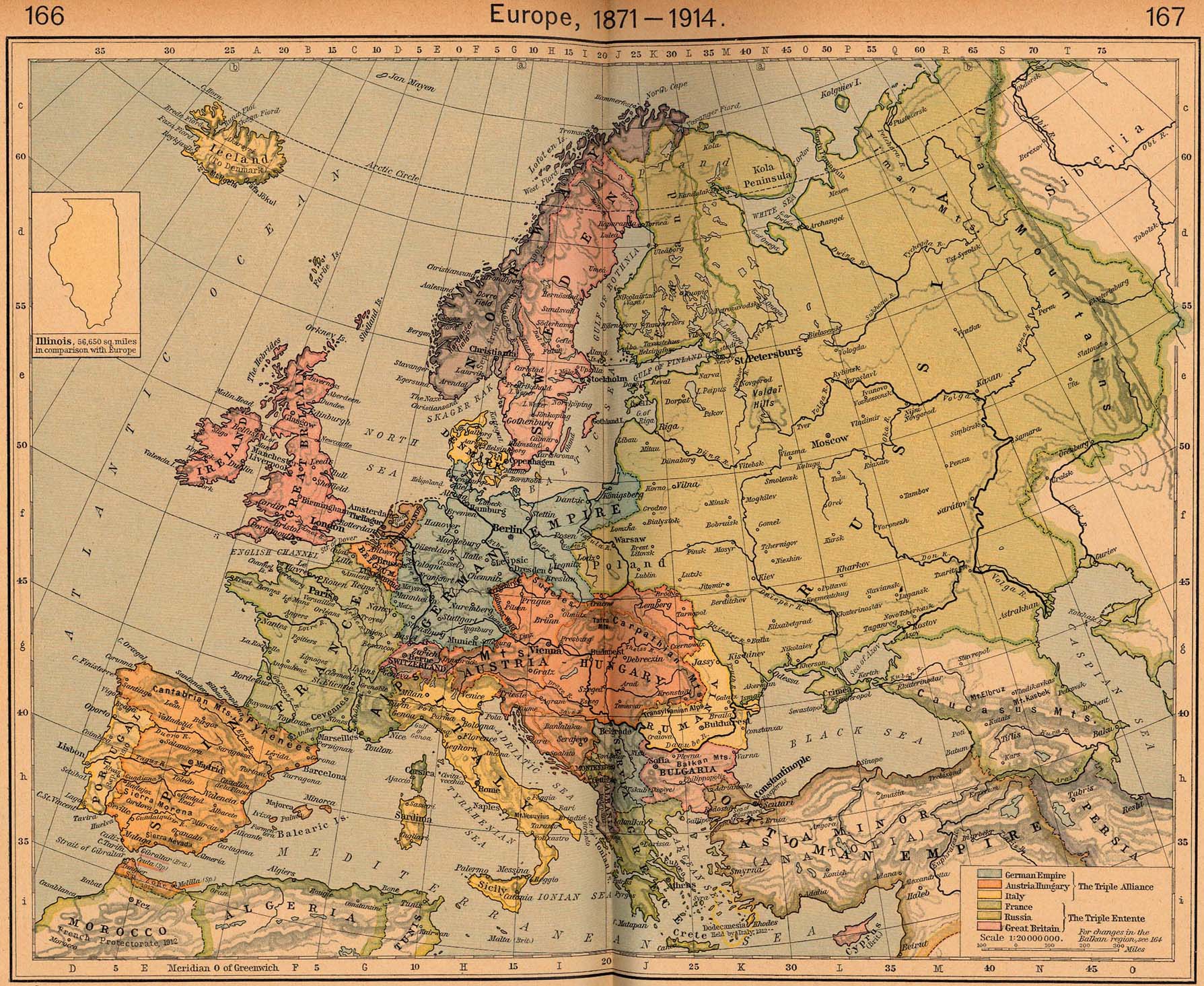
Europe, 1871-1914 [p.166-167]
●
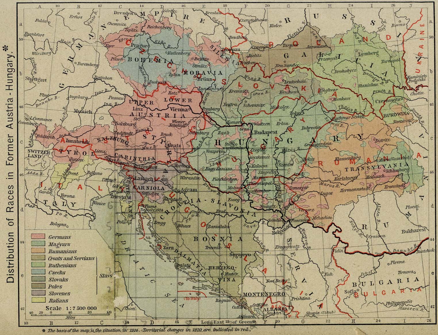
Distribution of Races in Former Austria-Hungary [p.168]
●
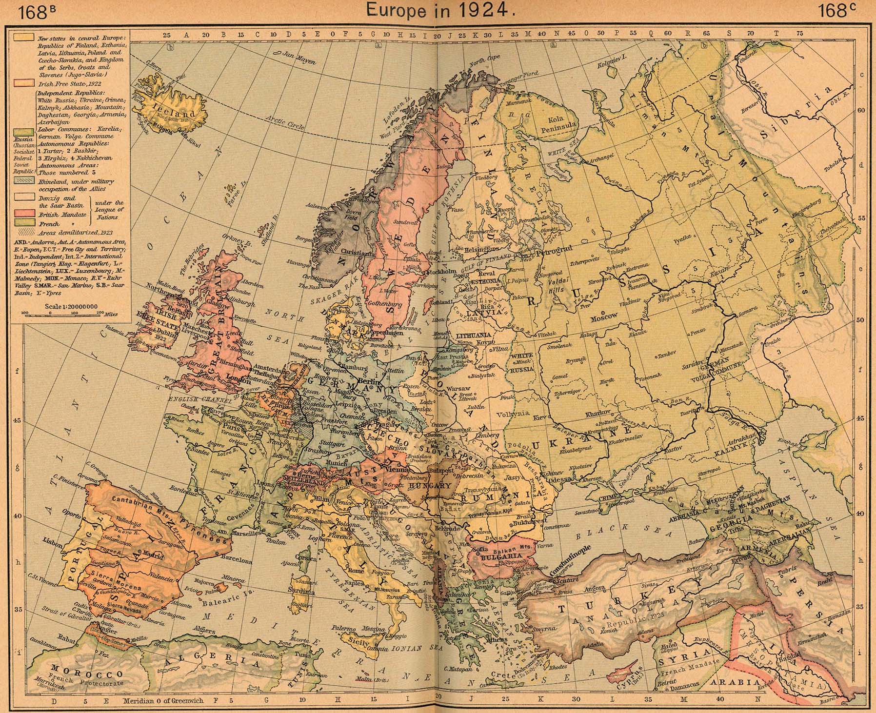
Europe in 1924 [p.168B-168C]
●
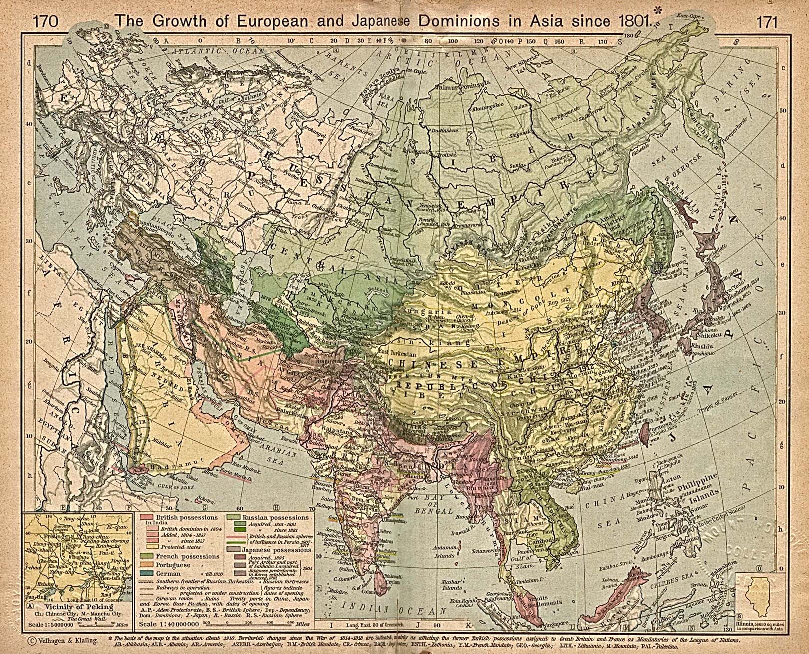
The Growth of European and Japanese Dominions in Asia since 1801
[p.170-171]
Inset: Vicinity of
Peking.
●
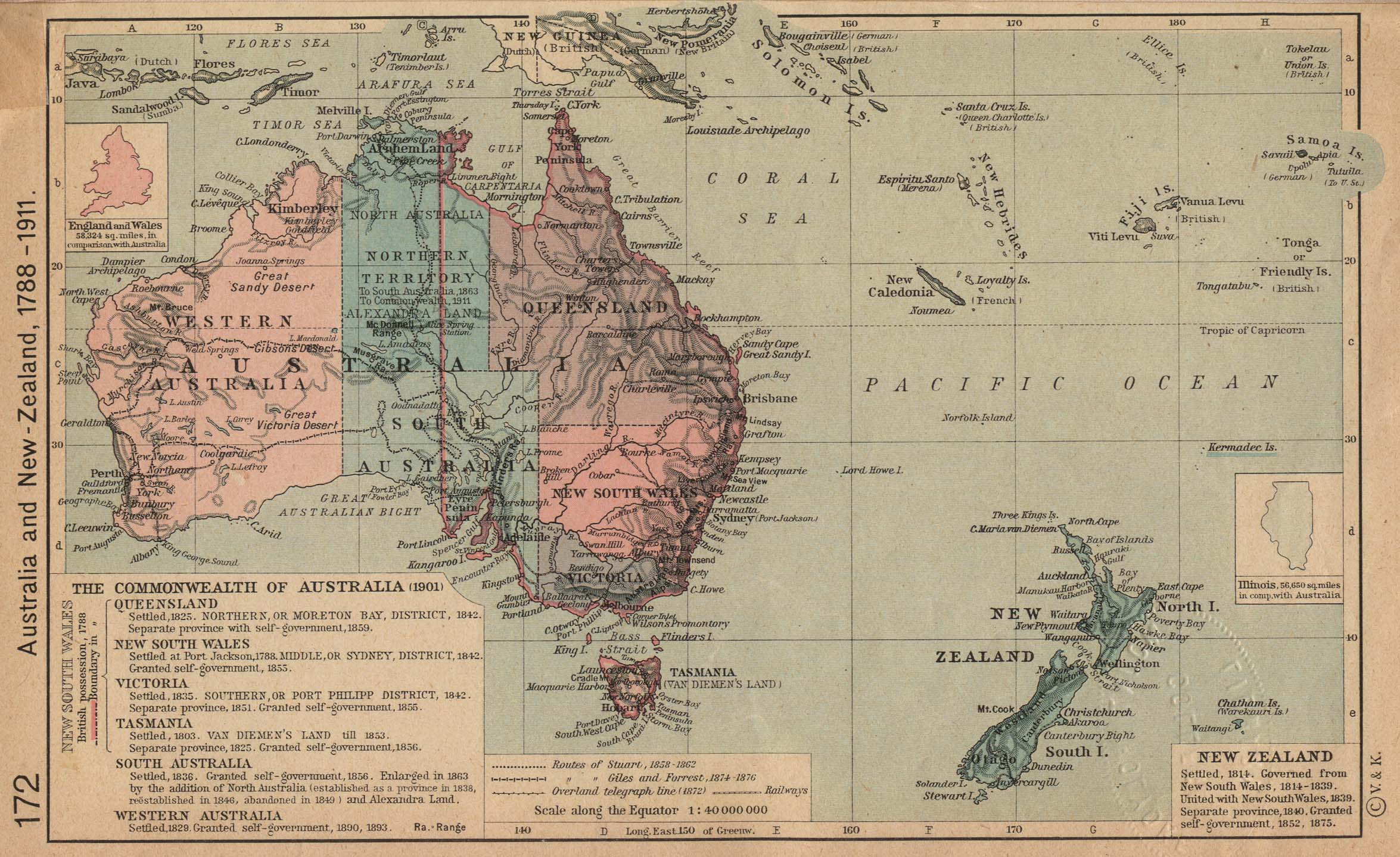
Australia and New Zealand, 1788-1911 [p.172]
●
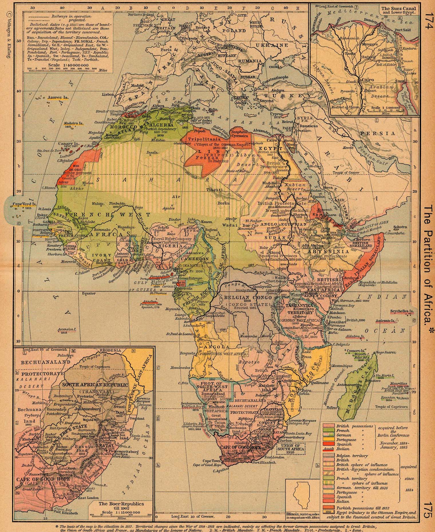
The Partition of Africa [p.174-175]
Insets: The Suez
Canal and Lower Egypt.
The Boer
Republics till 1902.
●
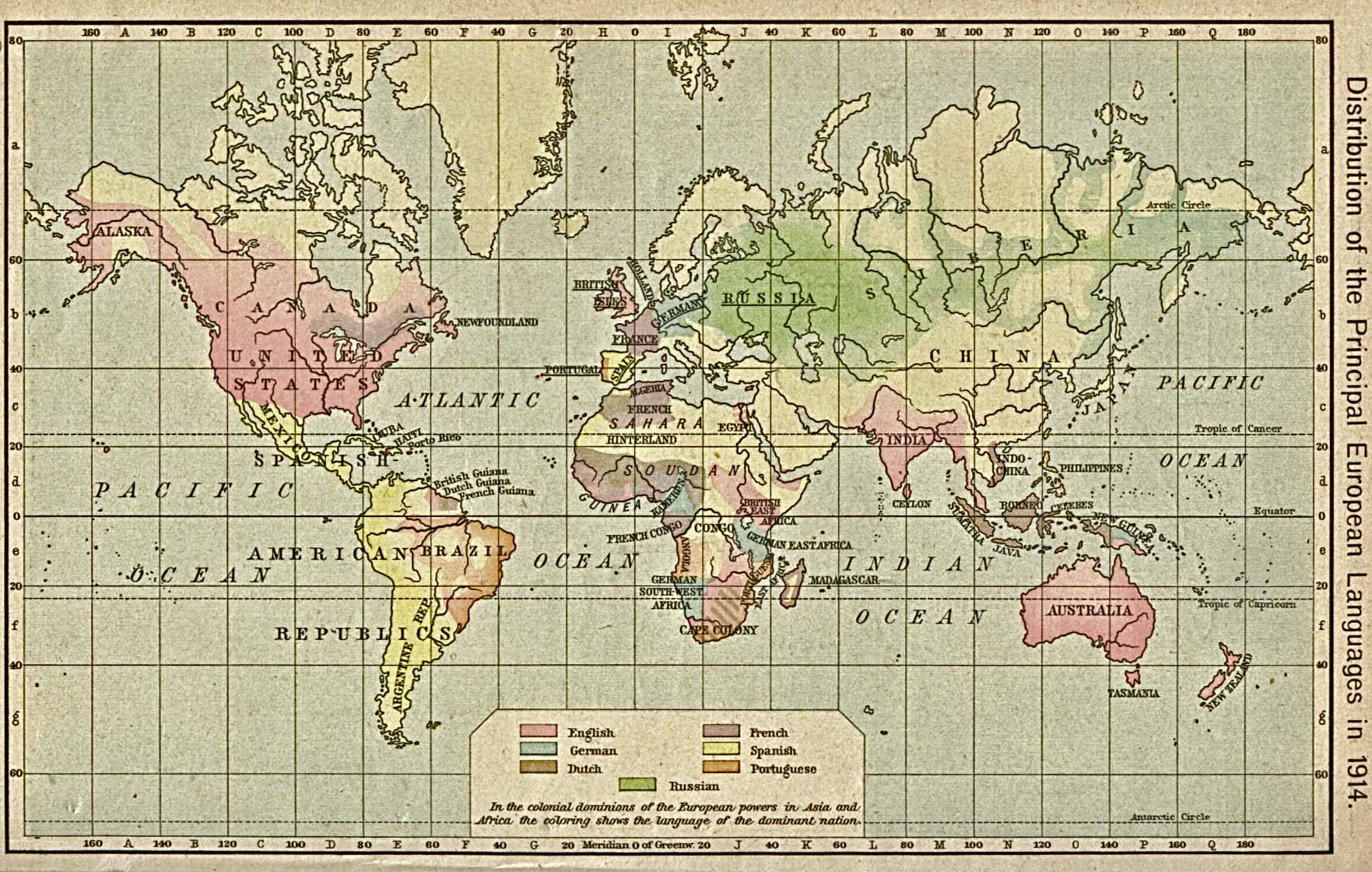
Distribution of the Principal European Languages in 1914 [p.176]
●
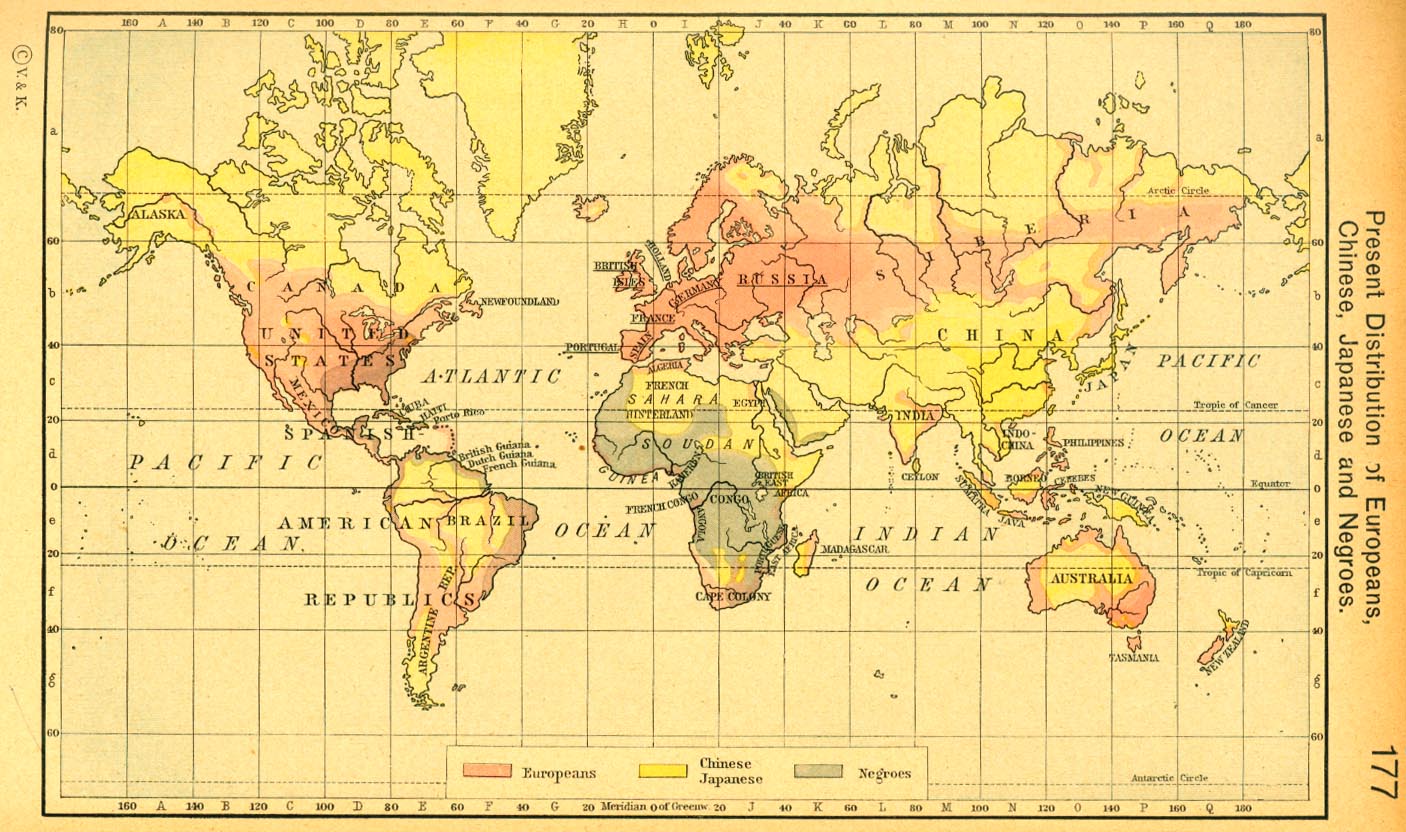
Distribution of Europeans, Chinese, Japanese and Negroes [p.177]
●
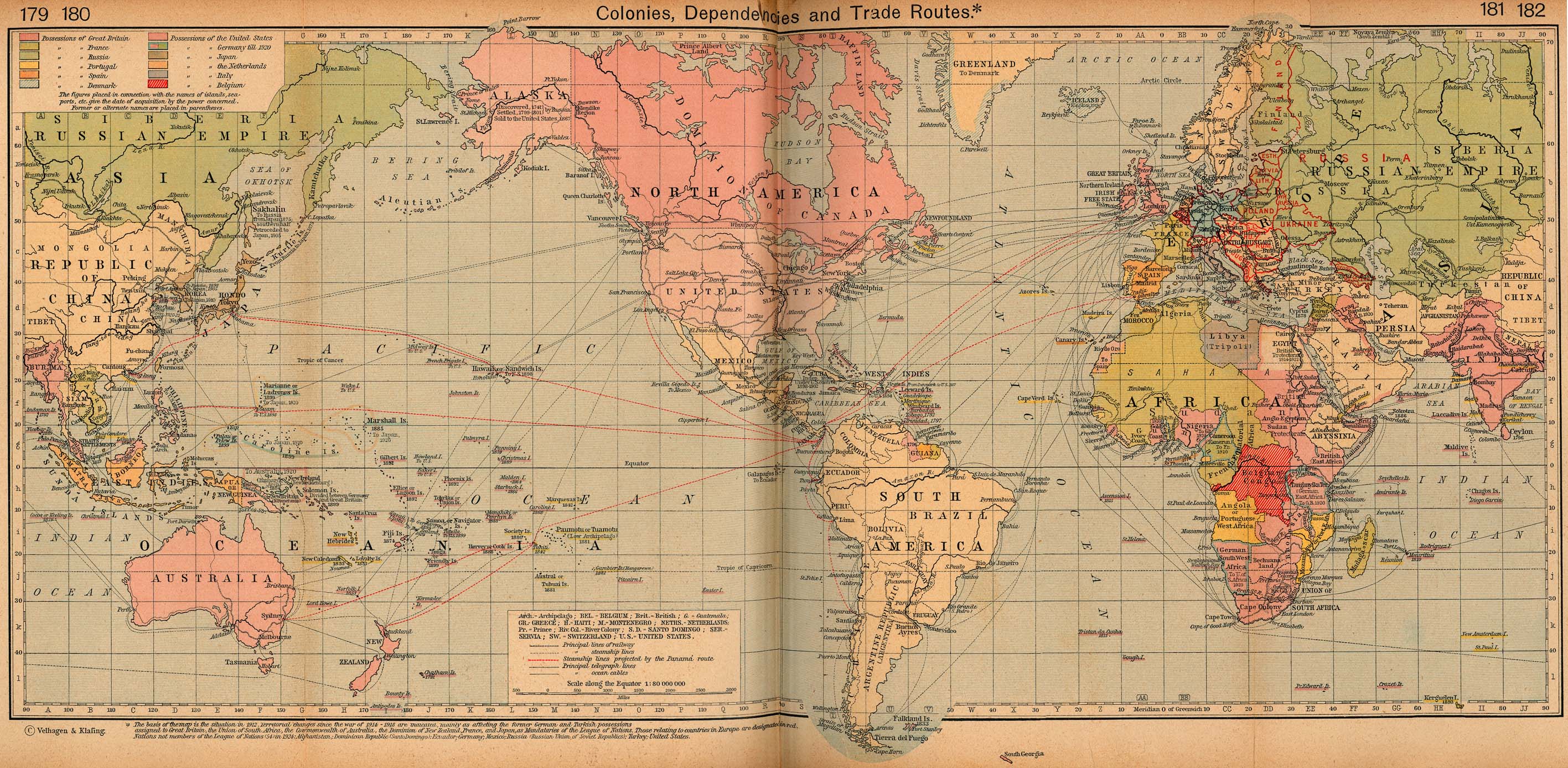
Colonies, Dependencies and Trade Routes [p.179-182]
●
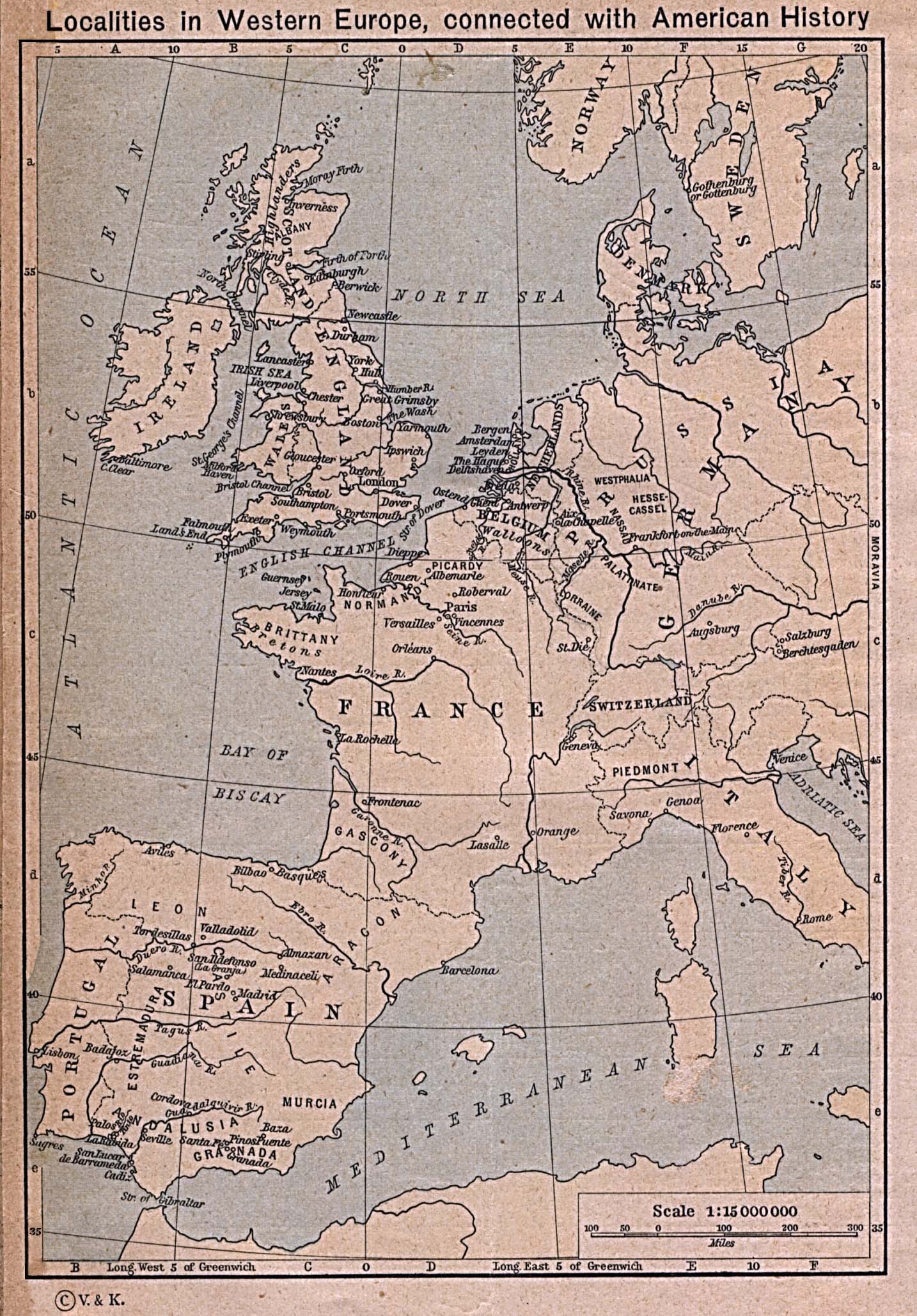
Localities in Western Europe connected with American History
[p.184]
●
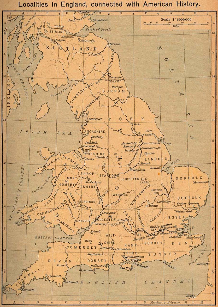
Localities in England connected with American History [p.185]
●
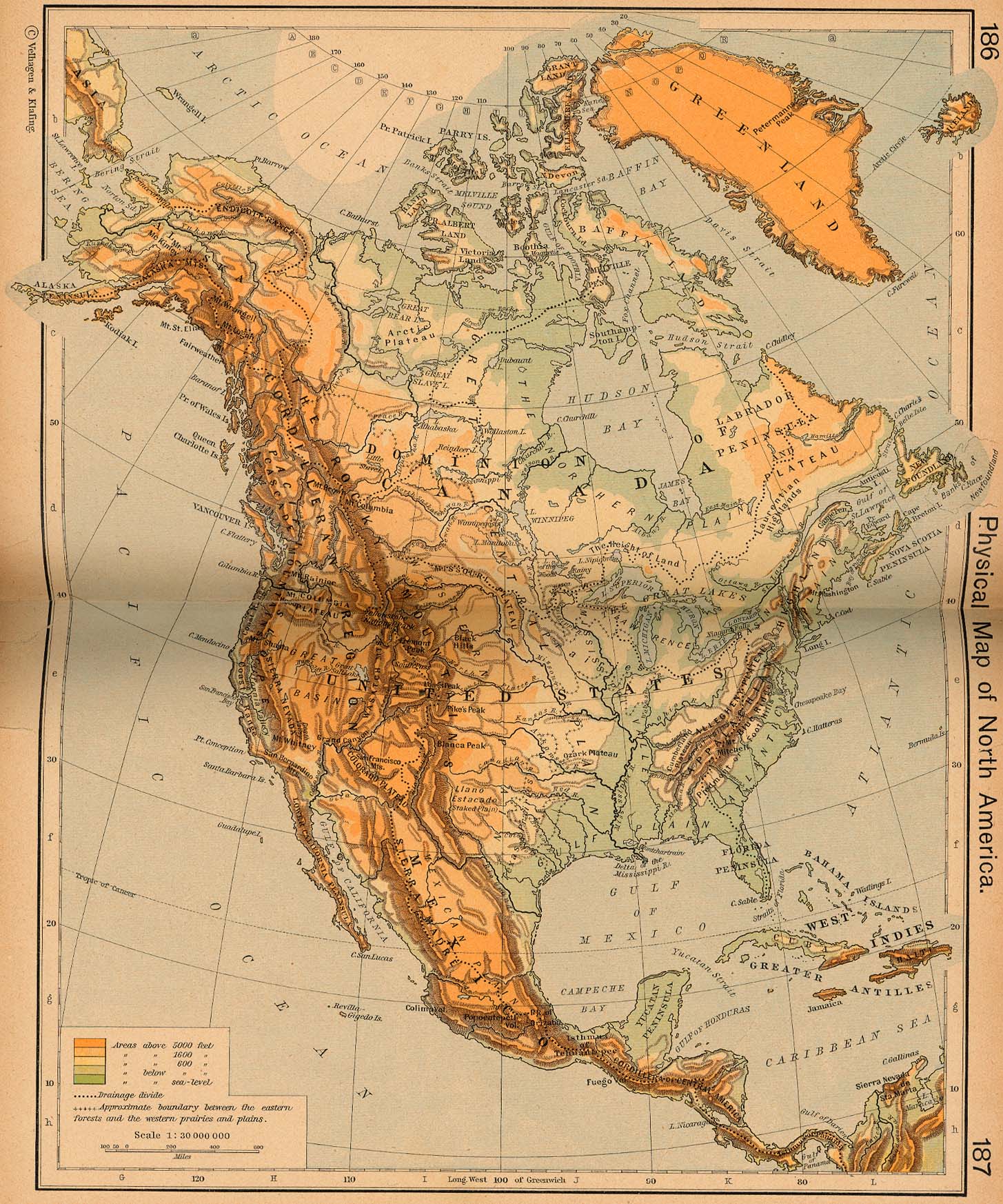
Physical Map of North America [p.186-187]
●
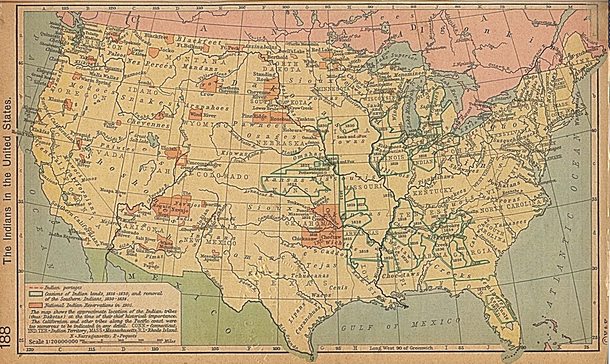
The Indians in the United States [p.188]
●
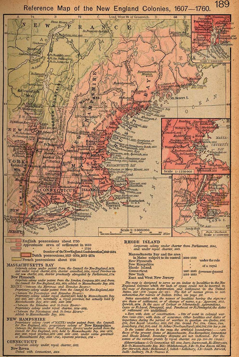
Reference Map of the New England Colonies, 1607-1760 [p.189]
Insets: Rhode Island.
Vicinity
of Boston.
Vicinity
of New York.
●
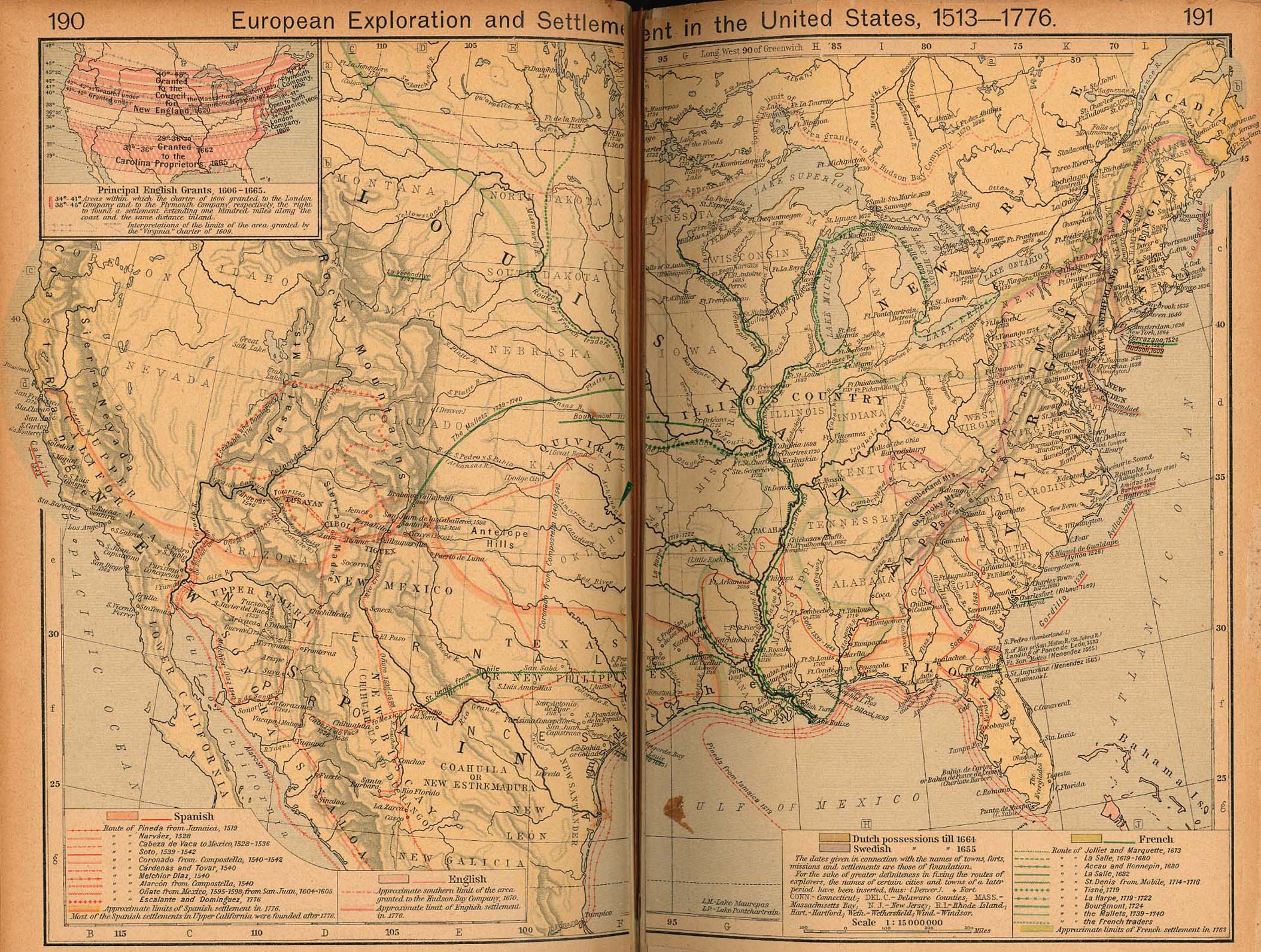
European Exploration and Settlement in the United States, 1513-1776
[p.190-191]
Inset: Principal
English Grants, 1606-1665.
●
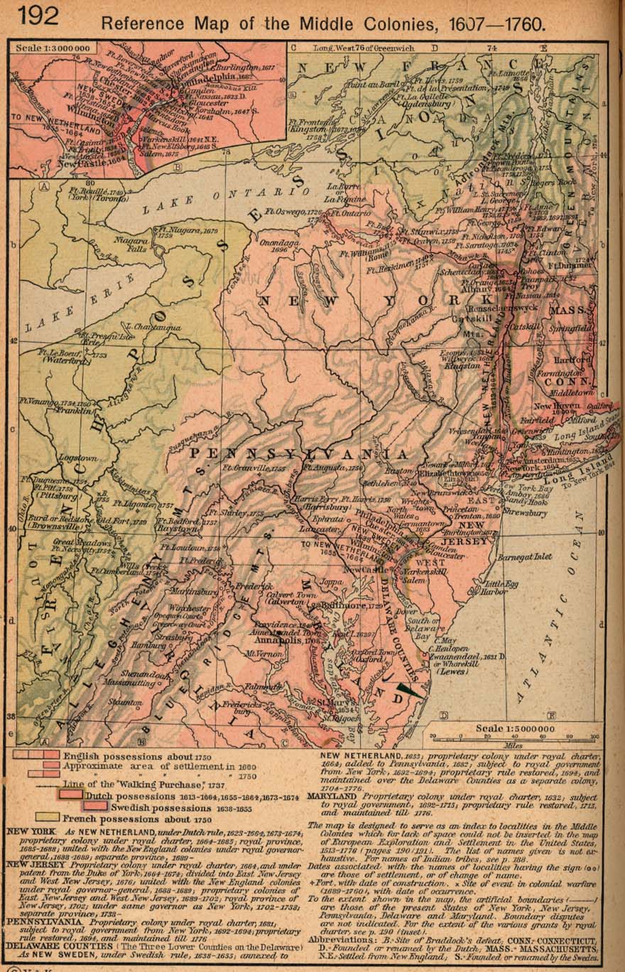
Reference Map of the Middle Colonies, 1607-1760 [p.192]
Inset: Settlements on
the Delaware River.
●
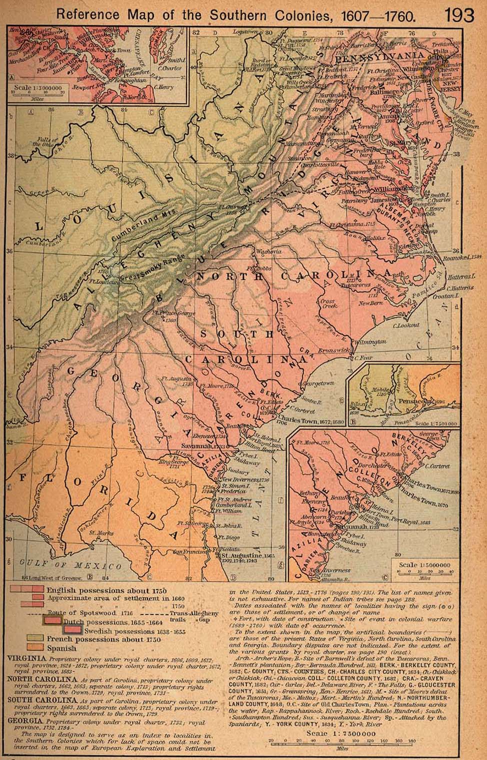
Reference Map of the Southern Colonies, 1607-1760 [p.193]
Insets: Settlements
on the James River.
The
Georgian Coast.
●
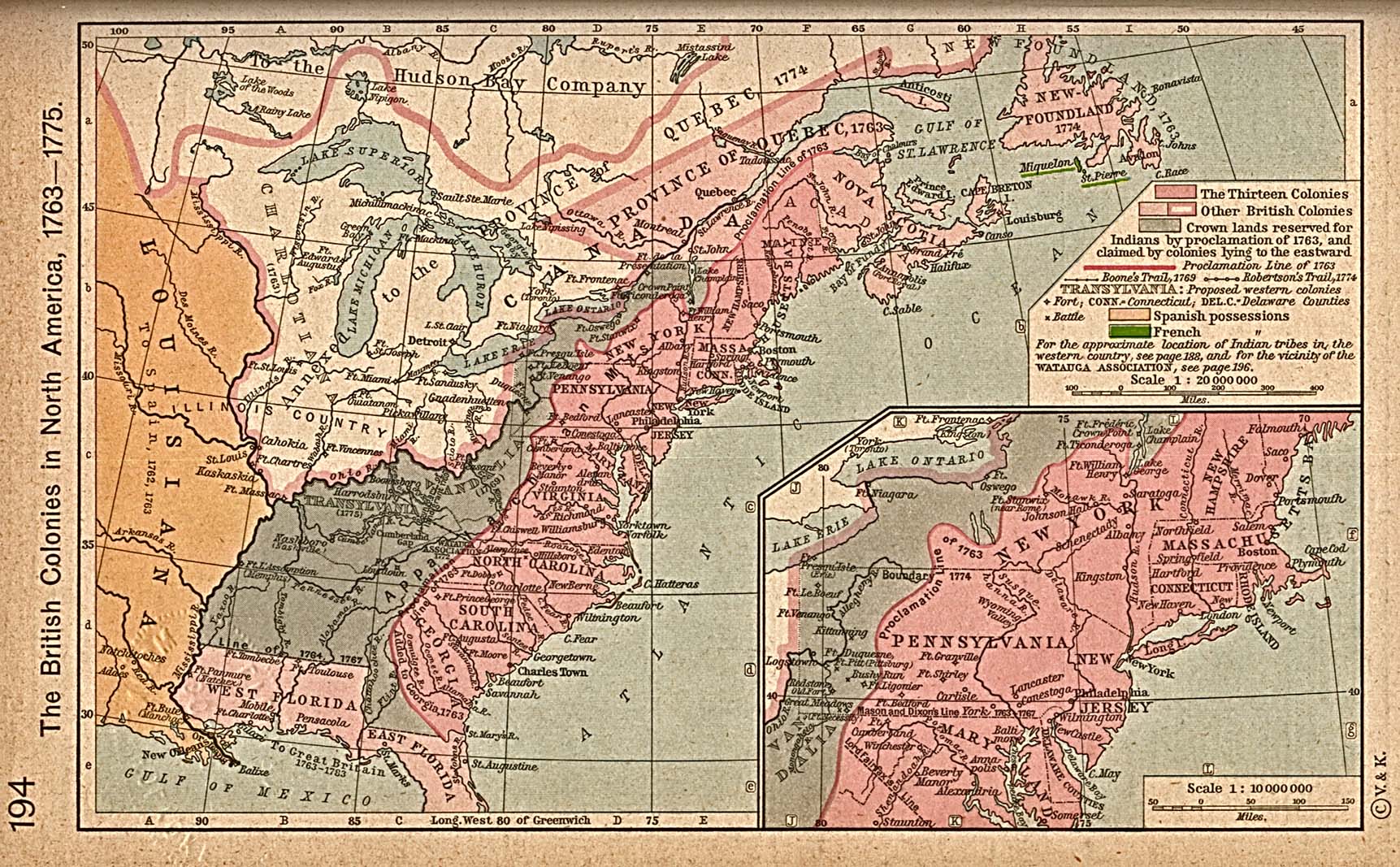
The British Colonies in North America, 1763-1775 [p.194]
Inset: Middle
Colonies.
●
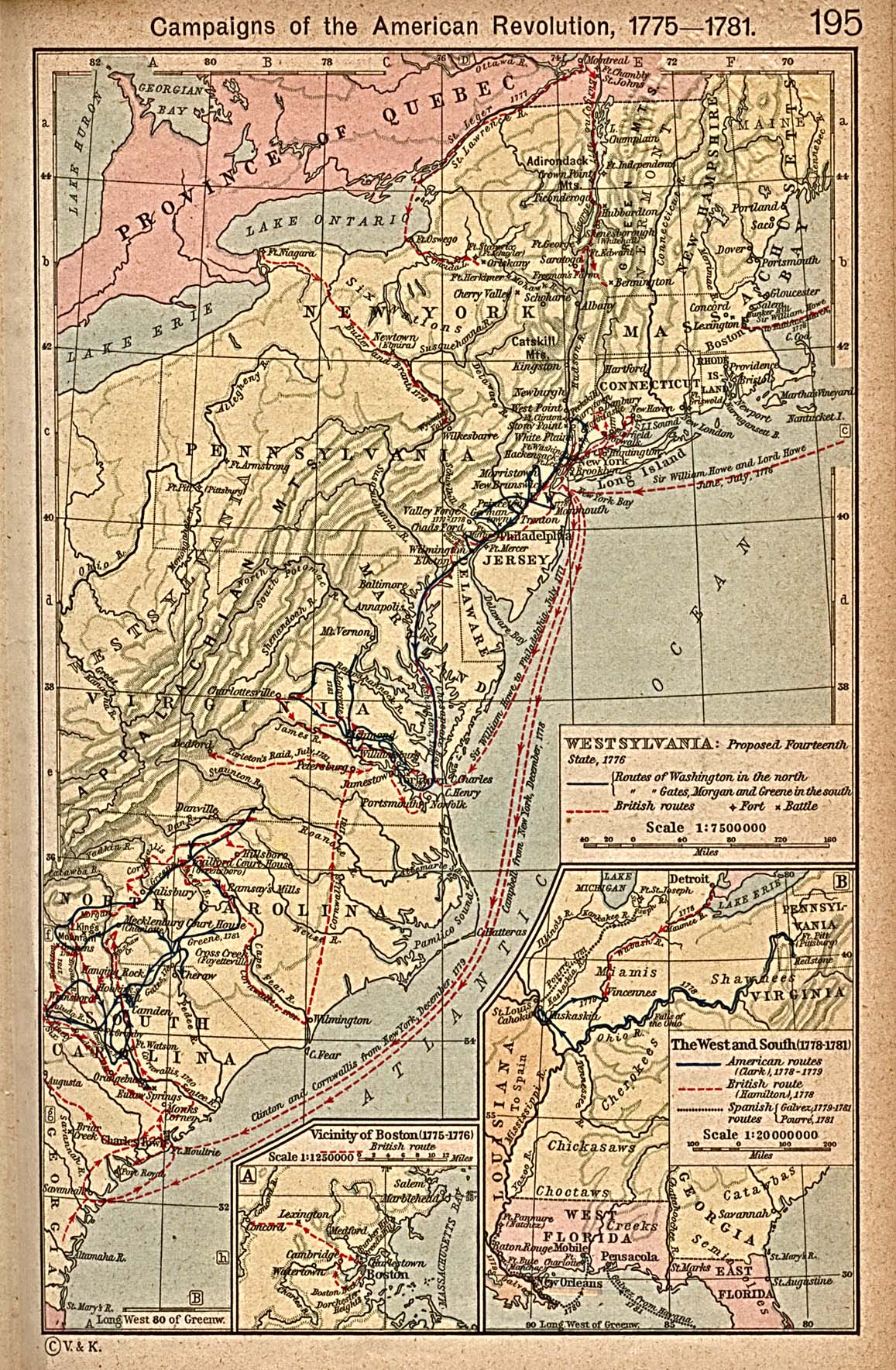
Campaigns of the American Revolution, 1775-1781 [p.195]
Inset: The West and
South, 1778-1781.
●
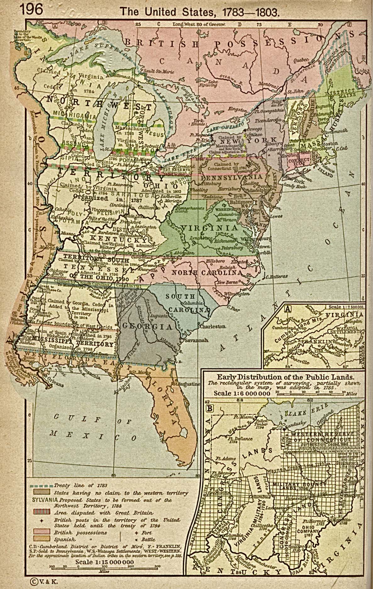
The United States, 1783-1803 [p.196]
Insets: The State of
Franklin, 1784-1788.
Early
distribution of the Public Lands (Ohio).
●
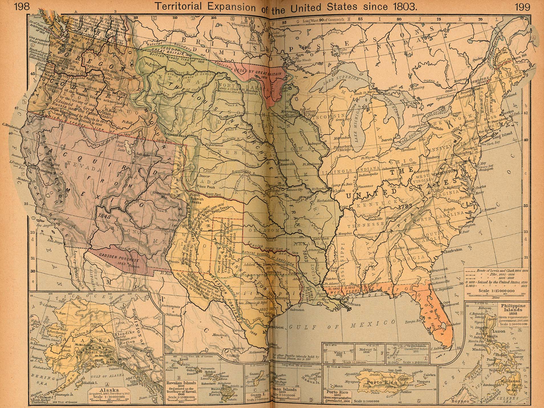
Territorial Expansion of the United States since 1803
[p.198-199]
Insets: Alaska.
Hawaii. Guam. Samoa Islands.
Wake
Island. Midway Island. Porto Rico.
The
Philippine Islands.
●
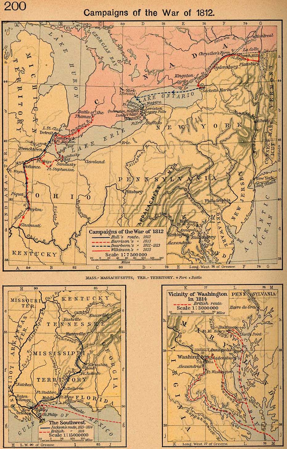
Campaigns of the War of 1812 [p.200]
Campaigns of the War
of 1812.
The Southwest.
Vicinity of
Washington in 1814.
●
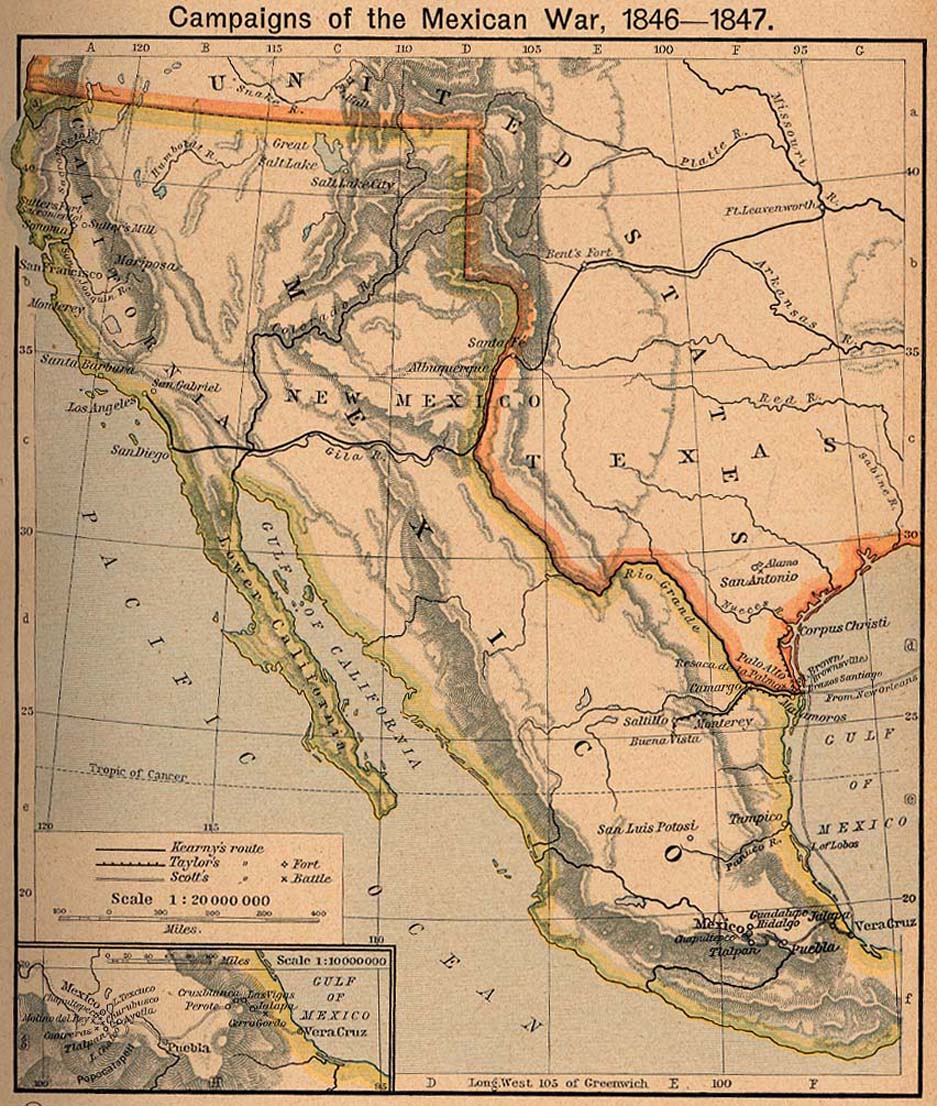
Campaigns of the Mexican War, 1846-1847 [p.201]
Inset: Route from
Vera Cruz to Mexico.
●
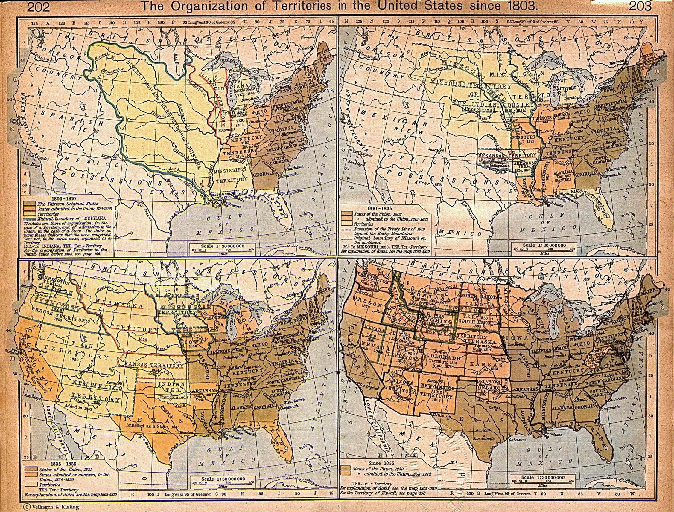
The Organization of Territories in the United States since 1803
(1MB) [p.202-203]
I.1803-1810,
II.1810-1835,
III.1835-1855,
IV. Since
1855.
●
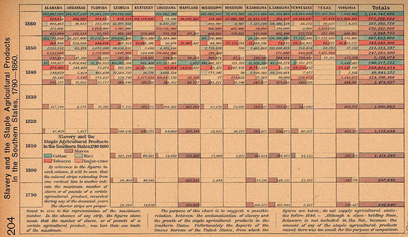
Slavery and the Staple Agricultural Products in the Southern States,
1790-1860 [p.204]
●
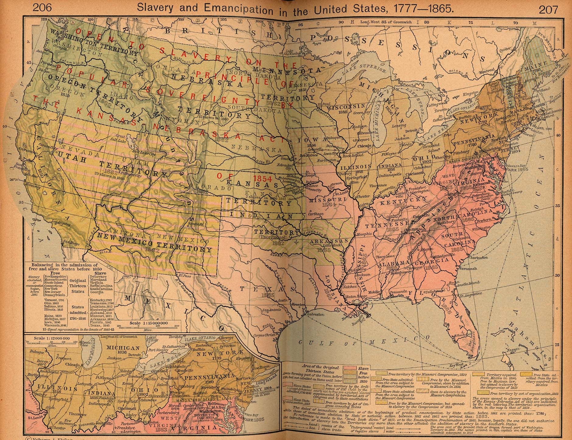
Slavery and Emancipation in the United States, 1777-1865
[p.206-207]
Inset: The Region
South of the Great Lakes.
●
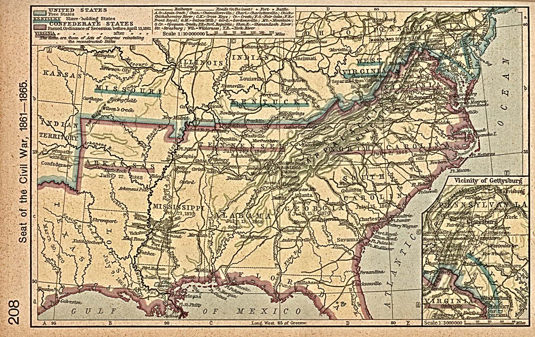
Seat of the Civil War, 1861-1865 [p.208]
Inset: Vicinity of
Gettysburg.
●
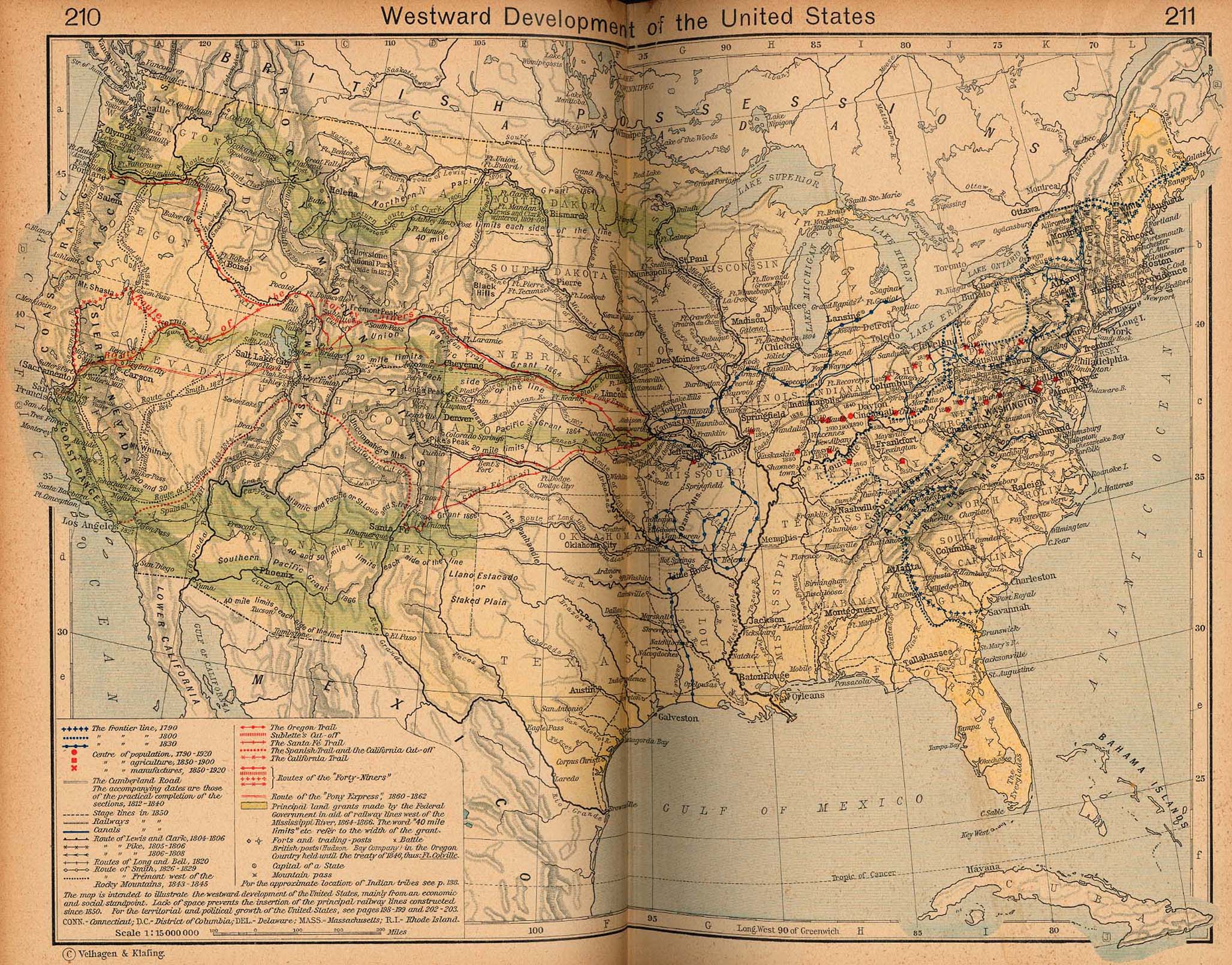
Westward Development of the United States [p.210-211]
●
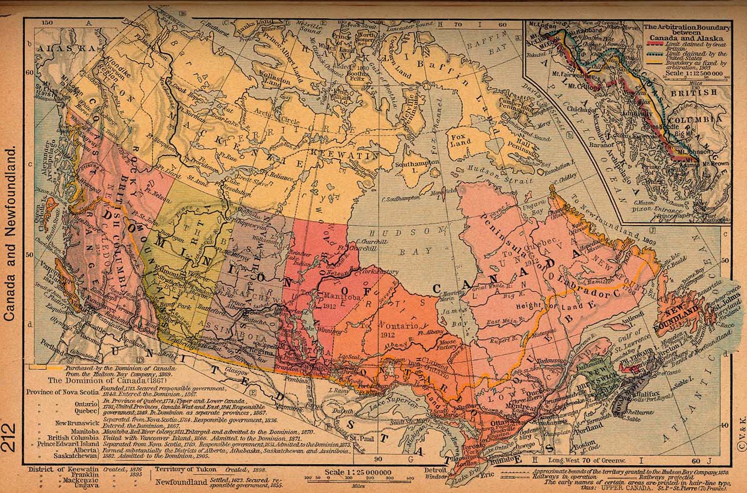
Canada and Newfoundland [p.212]
Inset: The
Arbitration Boundary between Canada and Alaska.
●
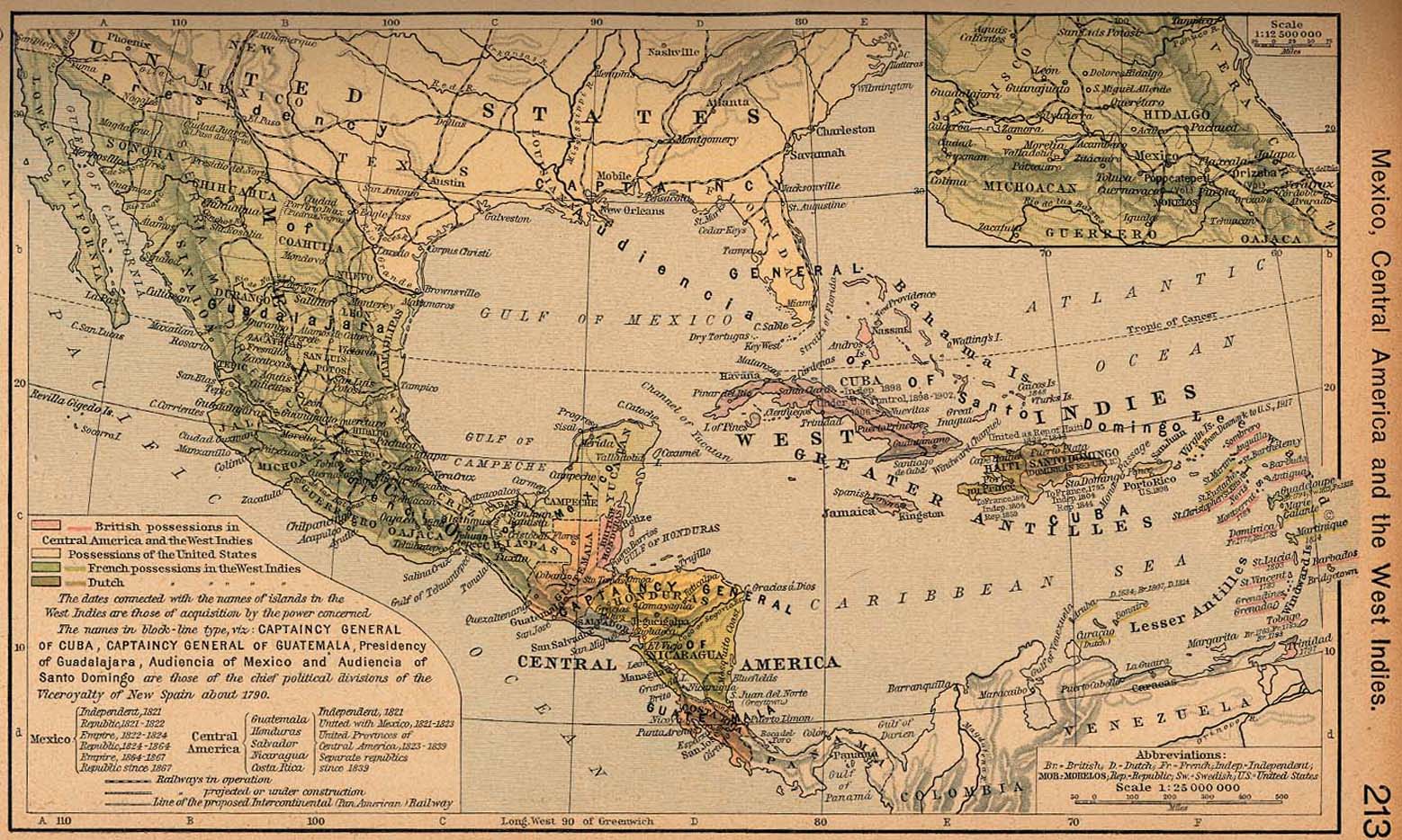
Mexico, Central America and the West Indies [p.213]
Inset: Central
Mexico.
●
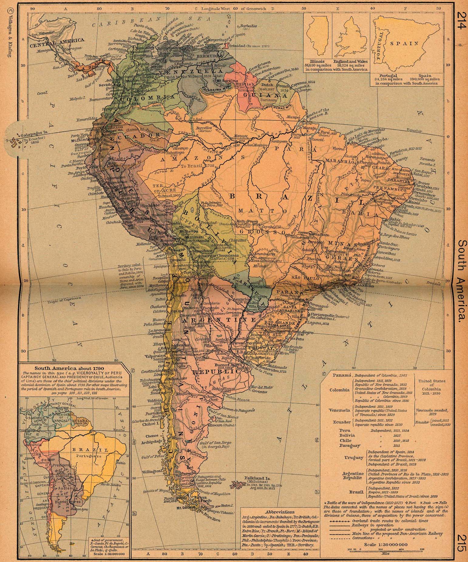
South America [p.214-215]
Inset: South America
about 1790.
●
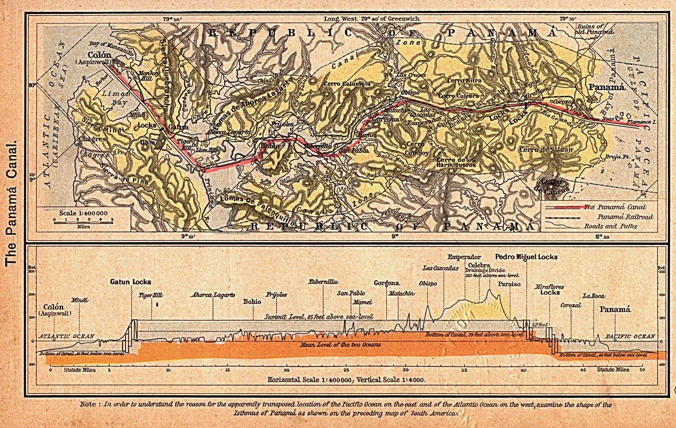
The Panama Canal [p.216]
The Canal
Zone.
Profile of
the Canal.
Download this Table & all Maps in a
77 MB
ZIP or
EXE
file |


 Home
Home What's New
 Bible
Bible Photos
 Hiking
 E-Books
 Genealogy
 Profile
Free Plug-ins You May Need
Profile
Free Plug-ins You May Need
 Get Java
.png) Get Flash
Get Flash Get 7-Zip
 Get Acrobat Reader
 Get TheWORD